
I am increasingly fascinated by not just going ‘off piste’ on the Greek islands, but trying to understand the faint signs of the rich cultural past, trying to tread softly and see the wildlife and the plant life. There is no substitute for trekking the mountains on foot, leaving trails and paths behind is even better. Zooming around on a scooter or quad bike might get you to the beach a quicker but you see nothing. And it is sad when wildlife is pancaked on the road by passing tyres. Frogs, snakes and tortoises are common victims.
One route I have trekked a couple of times recently on Symi has been especially rewarding and stimulating, sparking an enthusiasm to try to find out more.
Starting on one occasion from the harbour, rather than 100 metres higher in the old Horio (village) where I’m staying, gave the opportunity to walk up an old kalderimi (donkey path). They are features of historic engineering genius, as much part of the cultural heritage as the Parthenon, testimony to a lot of hard work by vigorous communities but now shamefully neglected and abused. This one zigzags up to the ridge at the usually friendly gradient, softened by cushions of thyme, now in full flower, and with the distraction of lizards and a large and venerable tortoise.

Looking down the stone-edged kalderimi to the harbour, cushions of thyme growing in the middle

Zooming in on the tiny individual flowers

lizard on thyme catching insects
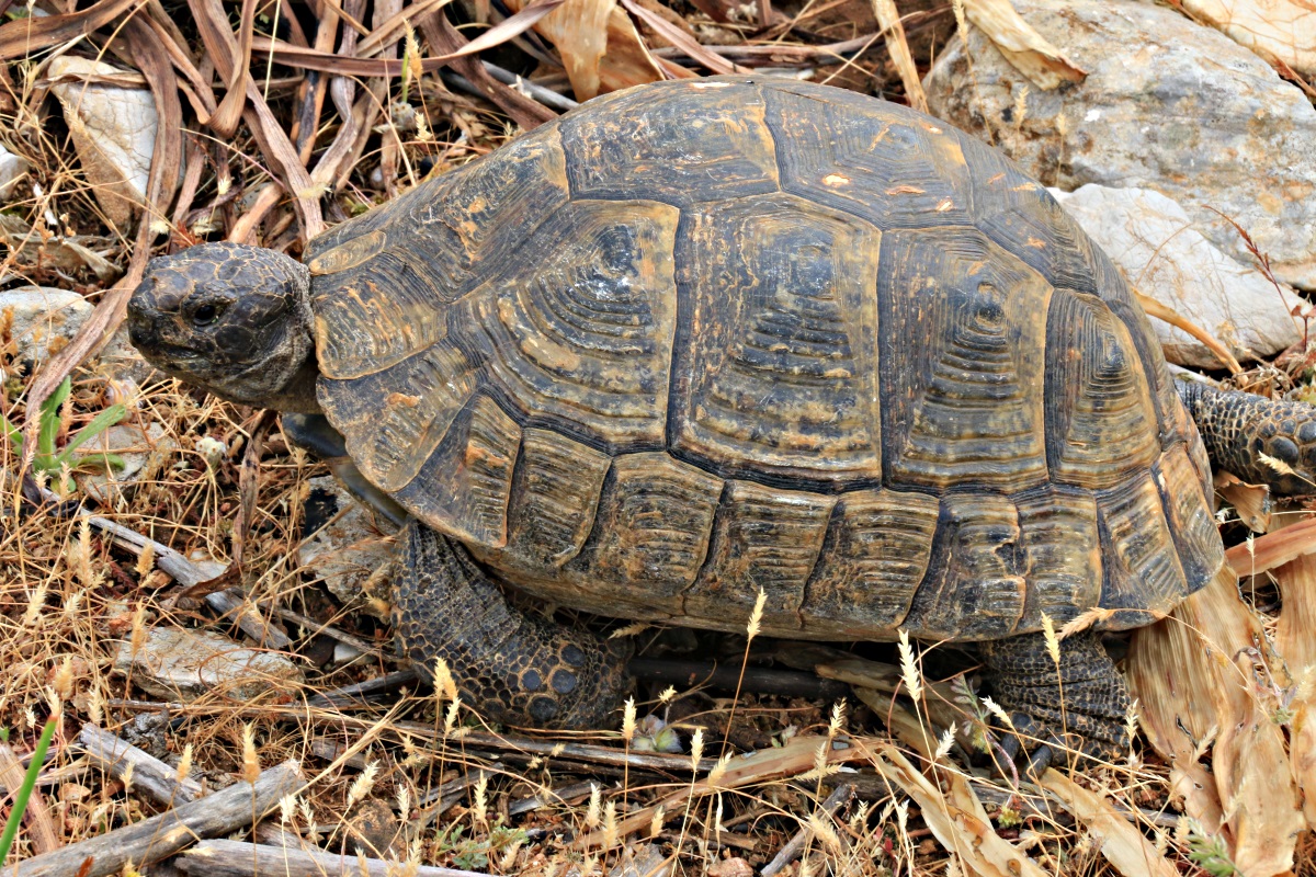
large, dark-shelled tortoise wandering across
From the top of the kalderimi there are a couple of kilometres of road to trudge but the boredom is relieved by taking a diversion to an old windmill and cutting hairpin bends by crossing broken terrain. Cutting one bend means dropping down razor-sharp limestone where inattention could have unpleasant consequences. But it’s great fun. I do it every time. Keeps you switched on.
While climbing up a gulley towards a col I spooked a Little Owl (Athene noctua). Unlike other owls they often perch prominently during the day but don’t like you getting too close. The one I spotted, but not before it spotted me, flew off and perched on top of a fence post made of steel reinforcing rod, just about within photographable distance with the zoom lens on my SLR. Then another flew off to my right and landed on a rock. I have been trying to photograph Little Owls for weeks but got nowhere near close enough, now two within a minute.

Little Owl on a distant post at x200 zoom

using computer software and the high resolution image to zoom in further

its friend flew down and sat on a rock
The next part of the route starts in the col on an old footpath which has been largely destroyed by a dirt-track bulldozed across the mountainside to provide access to what was a secluded beach but is now of the taverna-and-sunbed variety. Apparently the taverna is very good.
Close to the end of the track a path climbs up steeply towards the crags to the right. Very narrow but mostly quite clear, I suspect kept open by migrating goats rather than the occasional passing human. Certainly it isn’t marked in any way at any point, no paint splodges, cairns or stones-on-rocks.
Towards the top it broadens slightly before going steeply into large rocks.

squeeze between and around two large rocks and then climb up a rock outcrop at an easy angle
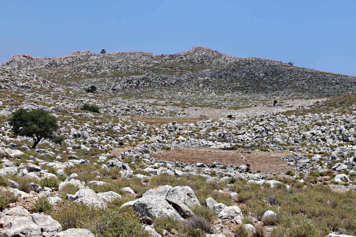
Cresting the low ridge of a col, pick your way carefully across large limestone slabs …. and this is where it begins to make you scratch your head and wonder what is going on. You’re looking along the length of an east-west valley flanked by towering limestone crags. It can’t be seen from anywhere except around its rim. Until you get there you have no idea it exists.
The vegetation is densely growing oregano with the occasional hummock of thyme and a couple of isolated olive trees in the distance. But between the oregano are areas with no vegetation at all, just circular or elliptical areas of bare rock and stones.

Having scrambled up the rocks ,standing on the rim and looking along the length of the hidden valley

At the edge of the largest of the bare patches
The goat path picks a way through the oregano towards the largest of these and, very faintly, crosses it to resume a way through the oregano on the other side.
It then reaches a larger outcrop of low limestone slabs and standing on the edge it is clear that the rocks drop down into an area which is completely flat and totally devoid of vegetation. It is also clear that this area is well below the lowest point of the rim of the valley. It must drain inwards, the water would need to be at least 7 metres deep before it reached a point where it could overflow the edge. The vegetation shows that it is never flooded to that depth.
Dropping down across the rocks rather than following the goat path you pass a vertical fissure, about 4-5 metres deep before it is choked with stones. Looks to me like the entrance of a fault cave which may act as the outlet for water from the valley, a kind of plug hole. Put this together with the areas of bare stones higher up raises the possibility that they might be filled-in sink-holes, any rain draining straight through like a giant sieve. I don’t know anywhere near enough geomorphology to do more than ask questions.
Standing alongside the fissure in the rocks and the ground rises up in all directions save for a couple of metres’ drop to the barren flat area at the lowest point.
Able to see the flat area at the bottom of the valley for the first time

Standing above the large fissure in the rock outcrop

Photographer on the lip of the fissure

Looking across the fissure to the crag on the north side of the valley

Looking across the fissure back the way I came
The low point, so flat that it must have been laid down by sediment settling out of standing water, is surrounded by rocks and large stones which have probably been cleared from it, except for a straight line of stones across it which may be a vestigial field boundary. The surface of the soil is cracked and split in the same way that lakes and ponds crack when they dry up. On the satellite image of Google Earth this and another area nearby look more like ponds than dry land.
There is no sign of there having been habitation in the valley, except for the olive trees, but again close examination of the satellite image shows faint traces of what might have been a small family homestead. I will try to locate it on the ground but am not optimistic of success in the jumble of rocks and oregano..
It’s pure conjecture on my part, no evidence in support of it, but it could be that this a small rift or fault valley which flooded naturally in times of heavier rainfall and people took advantage of the gratuitous irrigation by clearing the lowest points where the water would collect. These would have been Pelagic peoples, not great civilisations like the Dorians or Minoans but small isolated groups struggling for survival.
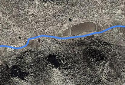
Extract from the tracking software used for the trek, superimposed on satellite image showing the two areas of radically different ground texture and the faint outline of a possible relict settlement (resolution poor because image degraded at source for ‘security’ reasons
Though Symi is not volcanic, unlike nearby Nisyros, there is enough evidence of seismic activity in the area to make the ‘Rift Valley’ theory a possibility.
Crossing the now arid area I spotted another Little Owl in the rocks off to the side. This one wasn’t spooked as easily as the other two I saw earlier in the morning, maybe because it rarely if ever sees a human and was curious. It sat there watching me inquisitively, impassively, as I moved closer with the camera. Then it flew off a few yards and watched me as I drew closer again before finally deciding enough was enough, took off like a Harrier Jump Jet and set down higher on the crag.

Two olive trees: one obviously very ancient and very dead. An indication of long-ago settlement?

Spot the owl

“I’m watching you!”
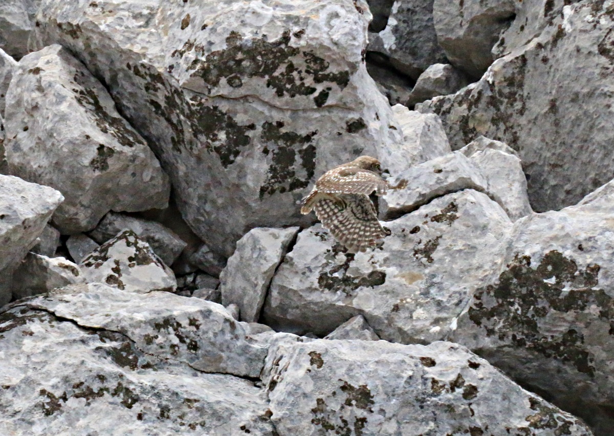
“think I’ll move away a little”

“I can see you creeping up again”

“That’s it! I’m off”
I was pretty elated for the rest of the trek. Markers I had placed last year to guide the tortuous route through the razor-sharp high limestone crags were still in place and when I reached the tiny monastery of Agios Nikolaos Stenou the mulberry tree in the courtyard was laden with ripe fruit.

One of the ‘stone-on-a-rock’ trail markers I left last year
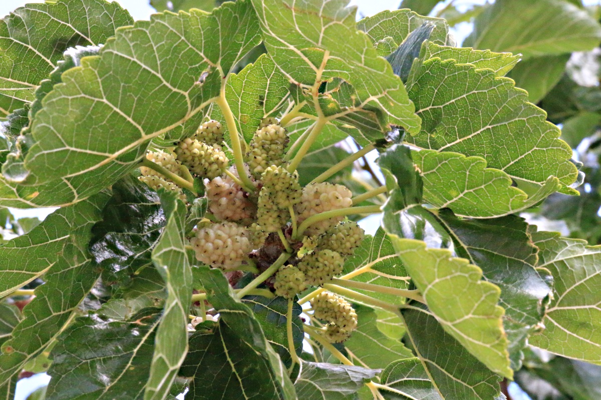
White mulberries
White mulberries with Greek yogurt and honey after my evening meal. Doesn’t get much better.
