Banff, Canada:  The Hoodoos Trail

Though skiing has been the main focus of my visits to the Canadian Rockies since I first came for Christmas 2010 they have always been about more than that.  Especially so since I invested in a pair of ice cleats and a pair of snowshoes.

I love being in the high mountains in hard winter.  My experience of the Rockies is limited to Banff and Whistler.  On the west of the Continental Divide the Whistler/Blackcombe ski area has more snow than Banff on the east side though the snow is wetter and more unpredictable.  But more to the point, Whistler is a winter sport Disneyworld, an artificial creation, whereas Banff is an, admittedly touristified, ‘real’ town.  The nub of why I prefer Banff is that there are winter trails and treks which, as far as I could find out in the two weeks I visited, are completely absent around Whistler.

So, when in Banff I intersperse skiing with trekking winter trails.

After four days skiing my legs were screaming at me. Come Saturday, when hordes of Calgarians could be reliably predicted to descend on Sunshine Village and Lake Louise, orgasmic at the thought of fresh snow which had fallen for the previous four days, I chose to take to the trails on foot rather than queue for ski lifts and then dodge the crazies and incompetents desperate to get to the base to queue again.  A dangerous place to be.

On Friday evening I bought a pair of snowshoes to replace the ones lost along with everything else in the hotel fire in Banff 29 December 2016 and brashly bragged to those who asked me when I carried them back to the hotel that I was going to trek the Hoodoos Trail on Saturday.

Then an email from my daughter alerted me to the fact that a cougar had been seen in Banff the day before. Nevertheless, Saturday morning I togged-up ready for the trek. Maybe a trifle apprehensive, but more with a frisson of excitement at the prospect of encountering natural danger rather than being run over by a bus which would be a really boring end, I set out.  By instinct, habit and former profession I looked for any evidence available so checked it out with staff in the Parks Canada Office on the way along Banff Avenue to the start of the trail which follows the Bow River at the foot of Tunnel Mountain.  They seemed blasé.

Indeed, a cougar had been seen and tracked back into the wildlife corridor …… which I was now about to follow.  I’m told there are four cougars living in the Banff area around Tunnel Mountain.  It’s their habitat.  The day before, I had watched a Siberian Husky attack a snowdrift at the side of the main street in Banff and, resisting the tugging on the lead held by its owner, emerge triumphant with an empty Starbucks take-away cup clamped on its snout.  If a dog could detect that under a foot or more of snow I had no doubt that a cougar would smell me a mile off, though it may be confused by my shower gel and not recognise me as a life-form.

I’m told that the modus operandi of the cougar is to attack from behind.  Weighing as much as a man they hit the back of neck teeth first and it’s all over before you know anything about it.  Doesn’t hold out much prospect for a photo.  As defence, I carry trekking poles on my rucksack, point up behind my neck.

Once out of the town I strained my ears to pick up any sound, stopping periodically to hush the crunch of snow under my feet, and sniffed the air like a dog constantly.  On a previous trek along the ‘Bow Falls – Hoodoos Trail’ I had encountered coyotes but this time I heard and smelled nothing until, approaching the Hoodoos, I picked up raucous laughter behind me and spotted a group of three lads on the same trail.  Until then I had been in complete sensory isolation.  Except for the sound of my feet in the snow and heavy breathing when going uphill there was complete silence.  Not even a whisper of wind in the trees. My guess is that the cougar smelled and spotted me and decided that there wasn’t enough meat on the bones to be worth the bother.

I suspect I was being over-concerned about the cougar.  Few locals have seen one in many years of living around Banff.  Cougar attacks have been few and far between, apparently only 27 attacks and seven fatalities in Canada in a century, the last a fatality in Banff National Park in 2001.  But who wants to become a statistic!

However, it made me more aware of my surroundings which were very impressive.
18Banff08w1329

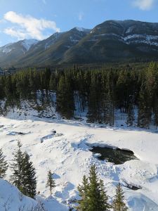
The start of the Trail is along the Bow River to Surprise Corner on the cliffs high above the Bow Falls, en route looking down to the broken ice on the river as it accelerates towards the falls.  Sulphur Mountain behind.
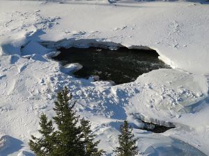
18Banff09w1330

Zooming in on one of the collapses in the icesheet
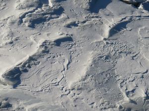
18Banff10w1332

….. and on the snow sculpted by wind across the three-dimensional ice
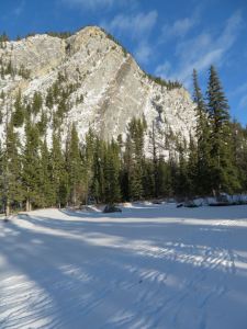
18Banff11w1335

The Bow River forks, the outside bend slower flowing towards the foot of the 1,690 metre (5,544 ft) Tunnel Mountain, frozen solid showing tracks where it was crossed by a herd of elk.
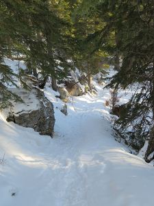
18Banff12w1336

The trail narrows, deep snow to the right, short crags rising to the left, potential cougar ambush site.
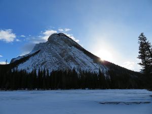
18Banff13w1341

Looking across the snow covered frozen river to Mount Rundle, mid-morning sun just peeking over the side.
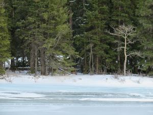
18Banff14w1344

A lone deciduous tree stands starkly pale against the ubiquitous lodgepole pine.
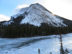
18Banff15w1346

Rising up a short cliff, the view shows the sweep of clear ice delineating  the main flow-channel of the river.
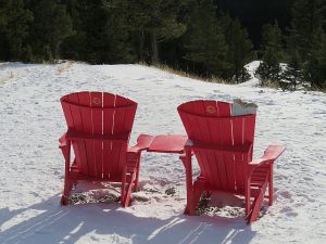
18Banff16w1353

Parks Canada has put pairs of red chairs at key viewpoints throughout the Banff National Park.  These are where the Hoodoos Trail reaches the road and a car park, others are more inaccessible.
18Banff17w1354

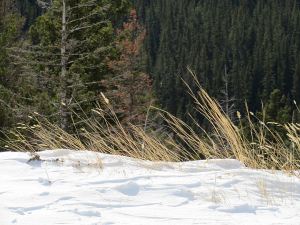
Dry summer grasses survive deep snow and strong winds
18Banff18w1365

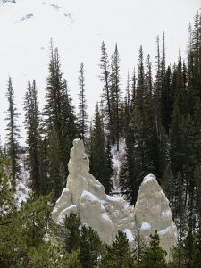
A view of some of the pinnacles of rock which are the Hoodoos.
18Banff19w1379

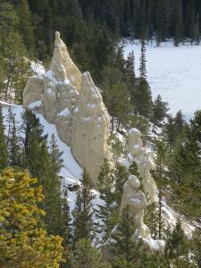
…. and another view


A few days after I did this trek a cougar was seen and photographed in Banff at 03.00 ….. in the street at the side of the hotel I’m staying in.   The RCMP officer who saw it trailed it down Elk Street, past my bedroom window (I was asleep, it was shut and in any case on the first floor) and onto Banff Avenue, the town’s main street. It then ambled past the entrance to our hotel and one of the guests who was outside having a smoke. (I have always said smoking is dangerous!) It went to the entrance of the hotel next door where it triggered the automatic door which opened.  It didn’t go in.  A spokesman for Banff National Park said “it didn’t bump into any attractants”.  Never thought of myself as a potential attractant.  View newspaper report

Posted in Canada, Hiking, Landscape, Mountains, Nature, Photography, Weather, Wildlife, Winter | Tagged , , , , , , , , , | 1 Comment

Banff, Canada: Sunshine Coast

Back in The Canadian Rockies.

It’s great.  Snow piled high along the sides and centre of Banff Avenue, the main street, scraped there early morning by snowploughs, a lot more moved out-of-town on huge trailers.  Still leaves a layer of compacted, very ‘slick’, snow on all roads in the town centre.  Not a problem as everyone drives carefully with consideration for other road users, especially pedestrians.  Quite alien to Grey, very occasionally White, Britain.  People climb over the snow piles to cross the road.

When I arrived temperature had risen to a toasty minus eight.  It was minus thirty for two weeks before I got here so locals think it’s like Spring has come early rather than the end-of-the-world, ‘Extreme Weather Event’ forecasts from the UK Met Office when minus 1 and 5mm of snow are in prospect.

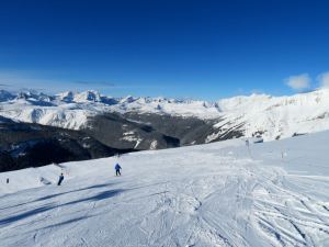
Photos are of Sunshine Coast, a great ‘Blue’ run on Goat’s Eye Mountain, part of the Sunshine Village Ski Resort which boasts the best snow in Canada.  The access road to the base of the gondola is snow covered from the Trans-Canada Highway (the longest metalled road in the world). At 2800 metres (9,200 feet) and close to the Continental Divide the view from the top of Goat’s Eye is straight across to the summits of the many other nearby peaks.

18Banff01w1303

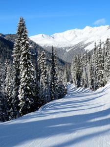
Self-portrait on the level section at the top of the ‘steep’ drop on Banff Avenue, the easy ‘Green’ run introduction to a new season’s skiing, newly groomed fresh snow creating a corduroy surface.  Fabulous!

18Banff02w1309

At the beginning of the long, easy run down from the top of Goat’s Eye, myriad other high peaks in view, not many below 9,000 feet.

18Banff03w1313

Pausing to look at what is just off the side of the run.

18Banff04w1317

Maintain momentum to get to the top of the fun bit on Sunshine Coast but ‘snow good, can’t help stopping to take in the beauty.

18Banff06w1323

Looking back up towards the top of Goat’s Eye

18Banff05w1319

…. and across to Eagle Mountain outside the ski boundary limit.  The only slightly less intimidating ridge to the right is a ‘Freeride Zone’ subject to special restrictions where only ‘experts’ ( a step up on Advanced’) drop of the cliffed edge into Delirium Dive.

18Banff07w1327

For us intermediates on Sunshine Coast there is the steady glide down the ‘cat-track’ to the lift base and back up for another run.  Build up enough speed on the steep section and no need to ‘pole’.  Used to take me 20 minutes per lift/ski cycle, now 15 minutes and knackered legs … and shoulders when you stop to take photos.

07   


Posted in Canada, Grey Britain, Landscape, Mountains, Photography, Winter | Tagged , , , , , , , | 3 Comments

Happy New Year

2017 was not  as eventful for me as 2016, my Annus Horribilis, which included a dislocated shoulder, diagnosis of a heart condition, Easter in a Greek hospital, skin cancer …..  and culminated in an 02.30 evacuation from a hotel fire in Banff and the loss of everything I had.   But it wasn’t great, not least because of the still not successful struggles to get compensation for the losses in the fire.

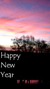
Looking forward to 2018 it’s perhaps as well that I don’t believe in portents.  One recent morning the sky was streaked vivid red, painting the Monmouthshire-Brecon Canal at the end of the garden.   Only lasted a few minutes but it was very impressive.

2018 will hold whatever it does, it’s in God’s hands not some old wives/sailors/shepherds omen.

So,  happy New Year.

2018 New Year w

Posted in Grey Britain, Landscape, Monmouthshire, Nature, Photography, Pontypool, Reflections, Wales, Weather | Tagged , , , , | 4 Comments

Happy Christmas

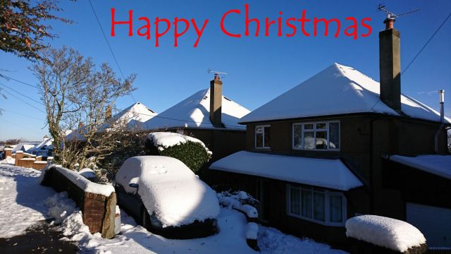
Christmas in Grey Britain this year.  Weather unexciting but a couple of weeks ago we had a good fall of snow at home followed by a few days of blue skies and freezing temperatures.

Looking forward to going to Banff and a Rockies Winter in early January.  In the meantime – Happy Christmas.

2017 Christmas w

Posted in Grey Britain, Pontypool, Weather | Tagged | 4 Comments

Nisyros: beach art

Nisyros has some of the most spectacular scenery and most spectacular treks in the Dodecanese.  But it’s not great for beaches.  If you want a beach holiday, Nisyros is not the island for you.

Not that it doesn’t have beaches, it’s just that they are not the sweeping stretches of golden sand which characterise other islands and there are very few sunbeds and umbrellas.

Though I’m a mountain rather than a beach person I usually pay the odd visit to a beach for a swim and a break from strenuous activity.  This year on Nisyros there was added interest – beach art, or more properly ‘land art’.

Land art, usually made of local natural materials, is often ephemeral, washed away by the tide or blown away by wind.  It’s also often in remote locations so makes it back to an urban audience only in photographs and books.  Typically, it’s not created by artists whose ambition is to make money but by those who reject the commercialisation of creativity and spurn urban living.

After a particularly strenuous few days of trekking on Nisyros in September this year I opted one day for an easier day, following the old route from the caldera rim village of Emborios down the coast near Palloi from where centuries ago local people moved to escape the constant ravages of piracy. With time to spare before the bus back to Mandraki, when I reached the coast I turned west to have a swim at the small beach beyond a great tongue of black lava poking out into the sea.

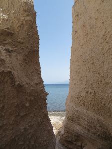
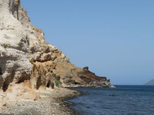
One access to the beach is through a narrow cleft in the high pumice cliffs.  Turn left onto the thin strip of beach and there is a row of shallow sea-cut caves in a line of weakness rising up the layers of pumice.  These have been the summer hang-out of youngsters for a number of summers since I’ve been coming here, strewn with artefacts of simple living, like any typical teenager’s room.  By September the caves are usually deserted as cooler weather sets in and the new academic year begins.

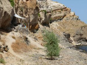
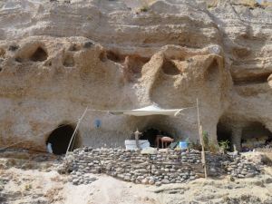
This year there was a radically more sophisticate dwelling.  Not quite the maisons troglodytes of the Loire Valley but with a well-constructed drystone retaining wall to expand the living space, stocked with rudimentary furniture.

At the edge of the terrace were a number of stones carefully balanced on edge and as I walked further along the foreshore there were others balanced on rocks.  Obviously someone with artistic flare and well-honed skill.

The path up to the top of the lava tongue towards Palloi had deteriorated so badly with slippage of the soft pumice cliff that I decided not to risk it. As I retraced my steps along the beach I passed the guy who obviously lived in the cave on his way back from the supermarket with plastic bags of food.  I said that I liked what he had done, for which he thanked me.  Whether he will stay over the winter, or how the retaining wall will survive winter storms I don’t know.  But it was great to see.

17Nisyros053w1066

The narrow cleft through the pumice cliff to the beach

17Nisyros054w1070

Looking along the beginning of the line of shallow caves in the pumice cliffs towards the lava tongue

17Nisyros055w1072

A little further and the ‘improved’ cave dwelling comes into view part way up the cliff

17Nisyros056w1077

Looking directly at it, the well-constructed retaining wall topped by living space under an awning

17Nisyros057w1078

Artwork of balanced stones on the left of the terrace

17Nisyros058w1075

Couldn’t help making my own contribution down on the beach, though showing less skill or artistry, just a calling card to say “I was here”

A week later, another series of hard walks, an early start so an early finish, and another visit to a beach.  This time north-facing Hochlaki Beach just round the headland from Mandraki underneath the cliff-top Enetikon Crusader castle and the Palecastro.  This is a beach of large black pebbles, a ‘dumping’ beach as sea canoeists would say, very steep in profile with large waves dumping heavily rather than rolling in.  In summer the black pebbles absorb the sun’s heat and are too hot to sit on.

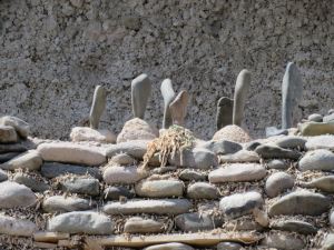
A few days earlier friends had commented on the stone pillars on the beach.  Little did I appreciate how amazing they were.  Turn the corner on the path underneath the overhanging cliff and then look along the length of the beach with small stone columns stretching into the distance.  I didn’t count them but estimate there were well over 100.  Some were just single pebbles standing on end.  Others were several delicately-balanced pebbles high.

The balancing looked so impossible that the temptation was to think that they were glued or pinned.  But not so.  The friends who told me about them said a tripper had taken one apart and found it impossible to put it back together.  I wasn’t about to make the same mistake.

Three things I was sure of.  They were done by the same guy I met at the caves west of Palloi.  They represented many hours of work.  I suspect that they were done just for fun, out of a creative impulse.

The world is a better place for such creativity and love of the environment.

I walked along the beach and around the next small headland and they continued there as well.

I decided that it would be a shame if they had only a very limited audience and were to be lost for ever in the winter storms so I spent the next hour or more grovelling along the beach to try to photograph them.  They were not just impressive individually but comprised a single entity, a large installation occupying the whole length of the beach in the same way as Anthony Gormley’s ‘Another Place’ at Southport in Lancashire. The following photos are a small sample.  I didn’t have the photographic skill to capture the extent and scale of it.

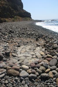
On the further beach there was a different but complementary style of structure.  Hundreds of storm-randomised pebbles had been cleared from one area and a floor of stone slabs laid down.

17Nisyros059w1092

I have seen far less impressive works of art in galleries, including Tate Modern.  Yet this guy may be an unknown making no money from his art.  If he or someone who knows him sees this blog I hope they get in touch.  Or if there is a gallery exhibition of better quality photos of the installation I would love to know.  A check on the internet indicated that there was a land art project on Nisyros between 11 and 25 September this year but I can find no images of this beach installation – or any other land art.  In fact, despite being there for the duration, I saw no indication that there was a land art project on the island.

Posted in Art, Greece, Hiking, Landscape, Photography | Tagged , , , , , , | 2 Comments

The sunshine has gone


17GarnWen01w1181

The warm sunshine of the morning has gone.  Now only pale crepuscular rays filter down through thick cloud driven by strong winds

17GarnWen02w1180

….but today that’s not the focus.  It’s remembering the brightness.

x

Posted in Grey Britain, Landscape, Mountains, Photography, Pontypool, Reflections, Wales, Weather | Tagged , | 1 Comment

Nisyros:  castles in the air

Nisyros has some of the most spectacular scenery and most spectacular treks in the Dodecanese.

I first went there in 2001 on a day trip from Tilos.  We only had a few hours on the island but in that time we were hooked.  First we went by coach into the caldera, the 3-kilometre long ‘hole’ in the middle of the near-circular island, and were overawed by the main crater, hissing and steaming, belching sulphur gas which crystallised in small but intricate formations.  Then, taken back to the harbour and let loose on the town to spend our money in the shops and tavernas, we chose instead to go for a walk and somehow found our way up to the Paleocastro (paleo = ancient) on a hill overlooking the town.

We were blown away by the scale of it, not only its extent but the huge size of the stone blocks from which it is built. Added to and extended over the centuries, the earliest part of the fortifications are reckoned to be Mycenaean, dating back to at least the 12th Century BC.  We visited world-famous Mycenae in the Peloponnese the following year and, with the possible exception of the Lion Gate, were underwhelmed by it having been to the Paleocastro on Nisyros.    I head up to the Palecastro at least once every time I visit the island and it never fails to impress.

17Nisyros054w0518

The extent of the Paleocastro set on the top of a hill above Mandraki

17Nisyros040w0777

Approaching the main entrance

17Nisyros041w0965

Looking back through the entrance, nearly 10 feet high, walls well over a metre thick

17Nisyros042w0969

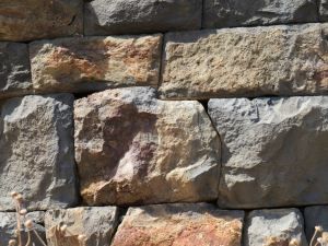
Huge stones are cut to precise shapes to fit tightly together, no mortar or cement used.

17Nisyros043w0971

One of the towers built in later centuries to augment the defences

17Nisyros044w0972

Some of the building blocks collected together to carry on restoration work when funding allows

I think it improbable that it was occupied by the Crusaders who built or re-fortified a number of locations on Nisyros such as the Mycenaen fortress at Stavros.  Two main reasons for thinking this.  First, it is much too big to be defended by the size of force that would have been committed to such a small island with limited strategic value. It seems more likely that it was part of a communication network based on signalling from one island to another, the main fortification being on Rhodes with relatively small forces defending the smaller islands.  Second, the nearby castle of ‘Enetikon’, now partly occupied by the monastery dedicated to the Panagia Spiliani (the Madonna of the Cave), was clearly occupied by Crusaders as evidenced by the escutcheons built into its walls.  Enetikon is a much more appropriate size of defensive site.  The Paleocastro relates in size more to the vast agricultural production from the thousands of terraced fields, supporting and defending a population which must have numbered many thousands.

17Nisyros003w0069

Enetikon, the Crusader castle set on a rocky crag dominating the main town, Mandraki, now partly occupied by the white-painted monastery.

At the other end of the size scale is the fortress of Parletia.  Once on the main route between fortifications at Nikia and Emborios on the caldera rim, now Parletia can only be reached by a rapidly deteriorating path which becomes more challenging every year.  It’s a trek I do at least once every year but, in contrast to the gentle stroll on a stone-paved kalderimi up the Paleocastro, I would hesitate to take others whose abilities I don’t know to Parletia.

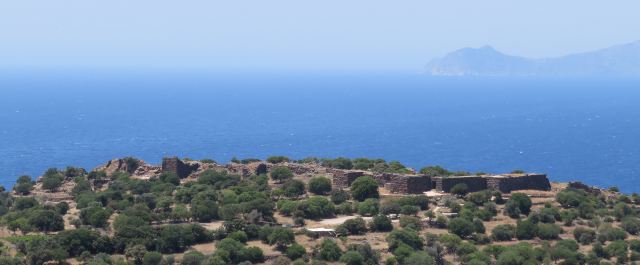
Not only that but to get into the fortification involves modest climbing ability partly on constructed fortification which are increasingly unstable.  Compared to the Paleocastro, Parletia is tiny, built into lave pinnacles with a series of small unconnected stone walls between the natural rock barriers.  More than any other there is a sense of this being a castle in the air.  Standing on the edge looking down to the caldera is breathtaking

I’m not sure what it’s purpose was.  It has no views of the surrounding sea-lanes and so cannot serve as a viewpoint.   It is entirely inward looking, overlooking only the caldera and its rim.   It is in direct line of site of other fortifications at Nikia, Emborios and Stavros all of which have views of the sea approaches as well as the caldera and the mountain passes into it.  But they can all be seen from each other as well so can have direct visual communication with each other without the need for a relay from Parletia.  Maybe its purpose was to defend the routeway.

There is no doubt that it was indeed a fortified site, albeit very limited in extent.  On the east and north sides the crag is virtually unclimbable.  On the west and south sides short sections of wall have been built not to retain soil for agricultural terraces but to augment the natural rock defences.
17Nisyros053w0540

Looking from the floor of the caldera up to the volcanic plug which is Parletia

17Nisyros045w1110

Approaching Parletia on the path from Nikia, short sections of stone walls on the flank
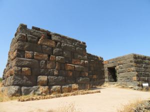
17Nisyros046w1113

The top of the fortification is reached by climbing the rocks and wall

17Nisyros048w1137

Remains of one of the short sections of wall, not built to retain soil in a terraced field but for defensive purposes
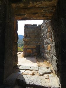
17Nisyros049w1140

Remains of dressed stone wall on one of the platforms at the top of the fortress

17Nisyros047w1123

Old dwelling built under a large overhanging lava slab just below the highest point

17Nisyros050w1144

Establishing beyond doubt the fact that this was an occupied site, the remains of what may be an old altar

17Nisyros051w1134

…….. and a bowl carved out of lava.  I found part of a similar bowl in a limestone-built fortification on Symi

17Nisyros052w1132

Guarding the site, a huge lava dragon, Emborios in the background

x

Posted in Greece, Hiking, History, Landscape, Mountains, Photography | Tagged , , , , , , , , , , , , , , | 1 Comment

Symi:  castles in the air

One of the great things about the smaller Greek islands such as Symi, Nisyros, Tilos, and the smaller villages on the larger islands such as Emborios on Kalymnos, is their peace and tranquillity.  In Greek it’s called ήσυχια.

But it was not always so.

For centuries the islands were plagued by piracy.  The people of the small harbour village of Paloi on Nisyros got so fed up with being raided that they moved up to the crater rim, considering the simmering crater below a safer bet.  An incidental advantage was underfloor heating from volcanic vents.

The Crusades between 1091 and 1295 AD upped the anti big time.  For two centuries the Crusaders successfully defended the Dodecanese islands between Rhodes and Kos from attack.

It’s all very murky and there are many interpretations about what happened and why.  The Knights Templar are now generally considered to be the military arm of the Masons and to have been primarily in pursuit of loot. The Knights Hospitaller, who occupied the Dodecanese islands, seem to have been more about bringing medical aid to pilgrims though they were also a military force.  Medecins sans Frontieres backed by the SAS.

The combined effect of centuries of piracy and warfare left a legacy of fortifications.  Some are extant, like the Paleocastro on Nisyros, the castle above the harbour on Chalki and the fortifications on Rhodes.  Others are mere remnants, some completely obliterated by newer building or lost on abandoned footpaths.

Difficult to work out what went on as layers of culture and settlement sit on top of or replace each other ….. but fascinating to try to piece things together from observation trekking around the mountains.

Last year I wrote about some of the ancient structures on Symi:

https://barrysramblings.com/2016/08/04/symi-rambling-around-the-past/

Still a lot more to check out and think about.  This blog looks at another two fortifications and a possible third.

The mountain-top monastery and church of Archangelos Michail Kokkimidis can be reached by vehicle but I trekked there via an obscure trail up the steep northern flank of the ridge.  Dramatic location and extraordinarily well-preserved frescoes covering the  interior of the church are good reward for the effort.  I have visited several times in recent years.

But this time I looked behind the obvious.  Having been alerted to the fact by a chapter by Michael Heslop in the book “On the margins of Crusading: the Military Orders, the Papacy and the Christian World”1, I went uphill behind the church to look at the remains of fortifications, part of a Crusader stronghold.

At just short of 600 metres above sea level and perched on the edge of vertical cliffs, the views across much of Symi and across the intervening Aegean to the islands of Rhodes, Tilos and Nisyros would have been a crucial part of the inter-connected lines-of-sight of defensive network.  With remnant walls still over two metres high the fortification would also have been easily defended.

17Symi051w0356

Random-stone walls on top of the cliff behind the church of Archangelos Michail Kokkimidis

Some hundred or more metres below the Kokkimidis fortification another smaller but better preserved fortification stands on a small rocky knoll close to the track.  It doesn’t have the same panoramic vantage point but it’s purpose may well have been very different.

There are a number of beach landing points on Symi but few better than Nanou on the east coast facing what is now Turkey.  With a comparatively easy access up the gorge (for a commando-style invasion force) it would have been a good way up to the ridge at the heart of the island.  The castle occupies a strategic location at the top of that gorge.

One thing has perplexed me about the fortifications on Symi.  The 20-foot high walls of the Paleocastro on Nisyros are built entirely of huge ‘ashlar’ blocks of stone to over 6 metres high.  The archaeological reconstruction in recent years has collected together hundreds of others found lying around nearby.  On Symi, the ashlar blocks of the remaining most fortifications rise to no more than 3 courses, just under two metres high at most.  There are large blocks lying around nearby but nowhere near as many as at the Paleocastro, certainly insufficient to make comprehensive walls to a defensible height.

The more intact walls of the fortification at the top of the Nanou gorge may provide the clue.  Large blocks rise to two or three courses with additional height gained by smaller, random stone.  There could be a couple of reasons for this.  The limestone of Symi may be more difficult to work into blocks than the volcanic rock on Nisyros.  Allied to this may be that the defences had to be constructed in more of a hurry under pressure from potential invasion.  Or it could simply be that the original walls were rebuilt post-Crusades for more agrarian purposes, though that doesn’t explain the paucity of other large blocks.

Whatever the reason, it seems a reasonable conclusion that the other fortifications on Symi followed the same pattern, two or three courses of large dressed stone and the rest of random stone.

17Symi052w0364

Looking across to the fortification from the track.  Stone walls below it may have served the dual purpose of providing agricultural terraces and slowing down attack.

17Symi053w0368

Getting closer shows the lower courses of stone are well-cut but above that the stone is random.  A few but not many large cut-blocks lie nearby.

17Symi054w0372

The threshing circle inside the fortification seems unusually well built.  Most are just a circle of narrow stones set on edge.

The third location in this blog post may – or may not- be the remnant of a fortification.  The path from Horio to Agia Marina is one which I have avoided in recent years because it is increasingly impeded by the invasion of alien ‘tree tobacco’.  I carry secateurs and cut it back but it makes for slow progress.

However, at the end of my stay on the island last October I walked the route, going off-piste, as is my wont, and spotted what may be another fortification.  Certainly, on the top of a small knoll on the ridge overlooking both the main harbour and Pedi Bay it is in a location where a fortification might be expected.

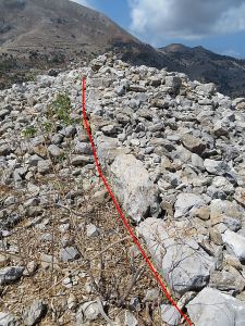
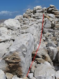
The remnant walls of large blocks of stone are most unlikely to have been for agricultural purposes.  Two lines of such stone are clear, with a few others scattered around, but a lot of clearing of the jumble of rocks would be needed to get a clearer picture.  From its comparatively small size it is unlikely to have been a castle like that above nearby Horio but it may have been an observation point, commanding views of the two main anchorages and the approaches from the mainland.

17Symi057bw0888

The thin red line shows the single course of large-cut blocks above current ground level

17Symi058bw0890

And running to meet it, another culminating in a large jumble of rocks


1 On the Margins of Crusading: The Military Orders, the Papacy and the Christian World    Helen J. Nicholson     Published by Routledge (2016)

ISBN 10: 1138269832 ISBN 13: 9781138269835


Posted in Greece, History, Landscape, Mountains, Photography | Tagged , , , , , , , | 2 Comments

Nisyros: scratching the surface

Sandwiched between spending time on Symi I hopped a little further north in the Dodecanese to spend a couple of weeks on Nisyros.  Google it and you will see lots of photos of ‘The Volcano’ and the Paleocastro, both very dramatic. But there is far more to the island than that.  I have visited many times, in recent years spending a month each trip, each time amazed at how much I hadn’t previously seen.  This year was no exception.

First off, Nisyros doesn’t ‘have a volcano’, it is a volcano. And it’s still active. To be more accurate it is a volcano which is the remnant of a much larger volcano which originally encompassed the western part of Kos, the sea in between once the caldera.

Most people get on the ‘Volcano Bus’ or hire a scooter or a car and zoom around the roads ….. and miss a great deal. Trek around on foot and the island has a wealth of natural and historical interest.  The following is just a brief scratch below the surface, the island from a different perspective.

17Nisyros035w0739

Looking down to the main crater from the caldera rim near Nikia.  Sit here, sip your ouzo and wait for it to blow.

17Nisyros036w0752

Part of the cliffed wall of the main crater from the path around the rim high above

17Nisyros014w0576

One of the active areas away from the main crater looking across to Oros Divatis, highest point on the island.  The fumarole changes all the time as the sulphur gas crystallises and is then washed away in winter rains

17Nisyros011w0561

Sulphur washes down the cliffs

17Nisyros012w0563

….. in places more thickly deposited than others.  Note the caldera-rim village of Nikia high above.

17Nisyros013w0568

From the macro to the micro, a crystal flake on top of a pillar

17Nisyros002w0476

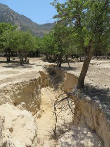
In 2003 seismic activity opened a fissure in the floor of the caldera, in places 20 feet deep and more than that wide.

17Nisyros009w0542

Increasingly the caldera is so hot and arid that many trees cannot survive the drought, especially closer to the main crater.  This one points towards the dramatic lava cone with the Crusader fortification of Parletia on top.

17Nisyros010w0544

Though wooded at the eastern end of the caldera, the western end towards the still-active craters is desert, though even here a few trees still survive.

The whole island is made up of rocks which are without exception volcanic in origin.  Apparently, the magma chamber below the island is comparatively shallow and though there is no sign of lava flowing now, in many places past extrusions are very evident.

17Nisyros019w0607

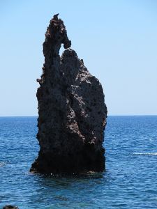
Some of the most dramatic, and least seen, are the lava stacks near the southeast of the island.  Isolated and inaccessible, difficult to reach overland

17Nisyros020w0608

A giant sea horse emerged from the sea and has stood resolute over the centuries

17Nisyros018w0600

On the approach to the coast at this point, gas bursting from large blocks of lava make them look as if they came from space rather than exploding out of the ground

17Nisyros022w0625

Other blocks have contorted multicoloured patterning

17Nisyros025w0648

While further north along the same coast pieces of lava bubble litter the shoreline (the toes give scale)

17Nisyros026w0655

… many variations

17Nisyros027w0651

Some are very different, looking like huge golden nuggets

17Nisyros023w0633

Sea cliffs are very varied, in places layers of different colours and textures.

The fact that Niyros has been volcanically active over many centuries has not deterred settlement, if anything it has encouraged it because of the fertile volcanic soil. The main caldera, a number of smaller, hidden ones, and steeply terraced mountainsides were farmed and extensively populated.  There are large numbers of individual houses, others in small clusters, many under the terraced fields to maximise productive area.  Most are now abandoned, a few still used for agricultural purposes. Of the four main settlements, Mandraki and Palloi are on the coast, Emborios and Nikia on the rim of the main caldera.

17Nisyros003w0069

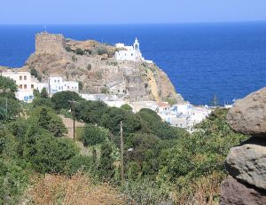
From the flank of the mountain, zooming in on the Crusader castle and the Panagia Spiliani monastery towering over Mandraki

17Nisyros001w0464

Approaching Emborios perched on the eastern end of the caldera rim

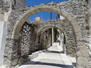
17Nisyros008w0532

Within the village, arches brace the buildings against seismic activity.  Many are long derelict but an increasing number are now being restored, in many cases by incomers to Greece.

17Nisyros033w0733

Perched on the southern rim of the caldera, Nikia has a very photogenic main square at the top of the village

17Nisyros034w0730

One of the many architectural details in the square.

The island has been occupied from prehistoric times probably by a pre-Hellenic Cretan civilisation.  One of the earliest settlements is thought to be Nyfios in a small high-level ‘valley’, really a dormant caldera.  It was clearly settled and farmed but may also had a religious role, the ‘Sanctuary of the Nymphs’.   Though ‘Nyfios’ on the maps, local people still call it ‘Nymfios’.

17Nisyros030w0698

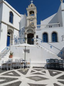
Entering the tiny, completely hidden, settlement of Nifios high in the mountains. The ‘Horns of Consecration’ carved out of the rock indicate a Minoan culture.

17Nisyros032w0704

The main settlement is built into the rock, a single cluster of about eight houses around what is now a church which is still painted, cleaned and candles lit.

17Nisyros029w0692

Looking from the crag across the top of the buildings along the ‘valley’, Oros Diavatis towering above

17Nisyros031w0672

Two of the houses in the cluster.  Note the massive stone lintels above the doorways.

There are also small fortified monastery complexes, most noticeably Armas and Siones.  Both probably started as cave dwellings with other buildings added later including small churches.  Both churches are covered in frescoes, that at Siones is open but the one at Armas is locked.

17Nisyros005w0075

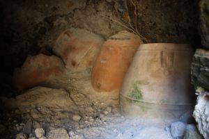
Terracotta storage containers in one of the caves below the Armas compound

17Nisyros015w0580

Part of the fresco-covered interior of the church at Siones

17Nisyros016w0594

Looking back at one of the two caldera leading from Siones, traversed by a now tortuous but once walled and paved footpath

17Nisyros037w0748

One of the many small settlements on the caldera rim below Nikia, remains of a windmill above

These are some of the ‘themes’ on Nisyros but there is much else besides.

17Nisyros006w0521

At the side of an ancient sunken pathway between terraced walls, an ancient oak has grown around a boulder next to a stepped entrance to a building and enclosure with a piece of imported dressed stone incorporated into the wall.

17Nisyros007w0089

Scarce Swallowtails (Iphiclides podalirius) flit everywhere, occasionally settling long enough to photograph

17Nisyros017w0098

A grass snake (Natrix natrix persa) basks in a patch of sun at the bottom of a dry sterna, next to the shadow of my head.  The following day another, about 2 feet long, shot between my sandalled feet as I walked up a narrow rocky path below Emborios.

17Nisyros024w0103

In July the spectacular flowers of capers are much in evidence

17Nisyros028w0679

Selfie.  Reflection in the water at the bottom of a sterna

Nisyros has some of the most dramatic and historically interesting landscapes I know.  This year I spent two and a half weeks on the island, trekking in the mountains every day under cloudless sky in temperatures up to the mid 40s.  Hard going, especially the trek to the lava stacks at the southwest of the island but worth every drop of sweat.  And in the evening, with another route achieved, sit back with a beer and watch the sun go down.

17Nisyros004w0511

In the middle of summer the sun sets into the western end of Kos

Sadly I had returned to Symi by the time of the earthquake on 21 July.  At 6.7 on the Richter scale and aftershocks of 5.4 it woke me up at 01.30 with the house shaking and rattling.  With the epicentre further north the impact on Nisyros must have been greater. It would have been fascinating to visit the caldera and the craters again to see what changes there had been.  Next time.

Posted in Greece, Hiking, History, Landscape, Mountains, Nature, Photography, Reflections, Wildlife | Tagged , , , , , , , , , , , , , , , | 2 Comments

Symi: Spring and early Summer landscapes

I think that is the longest gap between blog posts on Barry’s Ramblings.  Force of a range of circumstances.  I had to return home to sort out some of the issues still unresolved when I flew back to Symi in May.  Then technical issues with the IT kit bought After The Fire which could only cope with temperatures up to 35 degrees and unable to withstand the heatwave raising temperatures in the Greek Islands to the mid-40s.  But hopefully sorted now.  More about Survival Trekking on the Hot Rock soon, but first the Spring Landscapes as promised.

Looking across the bay at Pedi in Spring there is no sign of the gin palaces and sailing boats which flock (or whatever boats do) here in summer and provide entertainment for landlubbers who watch them failing to grasp that the water is very deep and anchors fail to hold.  Just a calm, tranquil bay.

17Symi047w0325

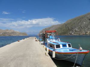
A couple of local boats waiting for the start of the season when they will ferry visitors to Agios Nikolaos beach.  That’s Turkey beyond the end of the jetty and the bay.

Nor is there any sign of the deserted village high above the empty bay.  That’s hidden behind the crag in the centre.

17Symi046w0322

No sign of the deserted village on the mountain, just rocky crags

17Symi035w0299

…. but get up the mountain and the extent of the deserted village is clear, with signs that at least one house and enclosure is being renovated.

17Symi033w0295

….. and to the right more enclosures … and The Pond

It was very pleasing to see that the pond at Gria now had water in it again.  In October before I flew home last year I saw it completely dry for the first time in 16 years. I don’t know about before that. There seemed to be less wildlife than usual but that may be down the parched habitat failing to support the next generation of particular species.  Other ponds on the island are also back to normal levels.
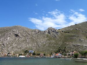
17Symi025w0249

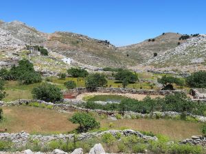
The pond at the deserted village of Gria is remarkable because it is usually completely surrounded by barren rock and parched soil

17Symi055w0380

Elsewhere ponds are surrounded by Spring growth.

Another great walk is up to the top of the ridge on the south side of Pedi Bay.  The path is strenuous, zigzagging over rocks and between trees, and can be difficult to find. So I and others put markers at key points, trying to make it clear that it is a marker and not just a heap of stones. Amazingly even on the very top of the ridge there are indications of ancient habitation when things were very basic.

17Symi050w0335

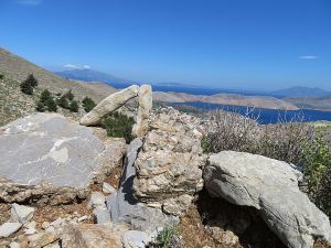
I prefer to use markers with a stone standing on edge – that makes it clear that it hasn’t happened by accident and is easy to spot.

17Symi034w0298a

Right on the ridge-top, a still well-formed threshing circle.  Nothing to thresh now!

17Symi037w0300a

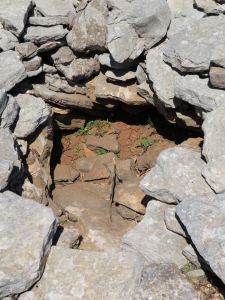
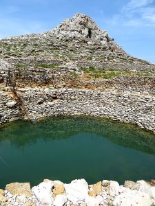
Having passed this way many times I hadn’t previously spotted this water hole, collecting rainwater run-off and presumably with a short lifespan unlike the pond hundreds of feet below at Gria.
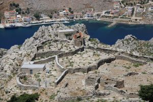
17Symi041w0317

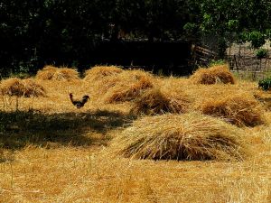
A drop down to Pedi for a swim and then gentle amble back up the valley footpath with rapidly ripened cereal in tiny fields hand-reaped ready for collection.  After the Alpha-male cockerel has had his fill.

Another great walk is to Nimborio and up to the ridge on the East side of the bay.  A very clear if strenuous path leads up to the ridge-top Agios Nikolaos Stenou monastery.  It’s not shown on the ΣΚΑÏ map which purports to be the result of thorough exploration of the island on foot.  My guess is that the ‘cartographers’ were on a jolly, based the map on satellite imagery and filled in other bits in the taverna with locals over a few beers.  It’s a great walk with views across to Turkey (be careful you don’t get hooked in to roaming charges on your mobile phone, Turkey is outside the EU) and the benefit of a swim on a deserted beach when you drop back down to the bay.

17Symi030w0287

Looking across the Nimborio Bay from the cool of the Agios Giorgos Drakounda monastery in its West side, another monastery nestled at the top

17Symi029w0275

Reaching the monastery after a long, hot pull

17Symi027w0270

…. and then a peaceful swim back down at base.

Great stuff!!!

Posted in Greece, Hiking, Landscape, Mountains, Nature, Photography, Spring | Tagged , , , , , , , , | 2 Comments