
There are parts of Symi which are rarely seen but which at one time were hubs of activity. I have long taken an interest on going ‘off-piste’, wandering around away from marked footpaths. In recent years I have taken an interest in the Northwest of the island and find it fascinating. I have put information together in the attached PDF about two derelict fortifications, an agricultural enclosure, and a hidden valley. Because they are near Toli Bay I’ve called it ‘Konda Toli’. The document is a work in progress.
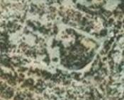
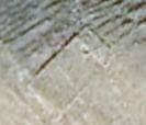
The two fortifications are less than half a kilometre apart, Kato (Lower) Toli close to the sea, Pano (Upper) Toli at the top of the hill. It’s probable that they were built by the same community of people as they are identical in size with the main entrance on the short side to the north. Kato Toli is to some extent hidden behind a small hillock. However, both are difficult to see because they are made of stone from the immediate vicinity so blend in remarkably well. Access is difficult as the ground is loose underfoot and footpaths have all but disappeared through lack of use. Built of large ashlar blocks, some remain in place but others lie around, having fallen or been pushed over. From the amount of fallen dressed masonry it’s not clear how high the walls would have been and it is possible that the large, cut blocks were topped by random stone walls.
The area marked as Louria on the SKAÏ map is a hidden ‘valley’. 280 metres from Pano Toli over very rough ground and XX metres lower, though it is certainly hidden, critically important in some periods of history, it’s not really a valley. The land rises on all sides, so unlike either fluvial or glacial valleys there is no outflow channel for water. My guess is that a seismic tremor caused a localised downwards shift along a fault line. So, instead of a stream bed draining the valley in times of heavy rainfall, there is what can best be described as a geological plug-hole at the lowest point, a cave entrance. The cave is likely a ‘fault’ cave rather than water eroded so may well be blocked by dislodged rocks – but I hope to explore and confirm. Whatever, the valley is certainly well hidden from the sea and so comparatively safe from raiders and has a good-sized area of flat agricultural land.

There may have been little everyday contact between these locations and the final remnant structure, Kato Kokkinhoma, which is a kilometre and a half away over difficult ground and more easily accessed on foot from Nimborio and Agios Nikolaos Stenou or by sea. It is probable that it was inhabited more recently than the other locations, the house having wooden cupboards built into the walls and roof timbers, decaying but still roughly in place. This is reminiscent of houses in Micro Horio on Tilos abandoned in the 1950s. Construction of the walls of random stone rather than dressed ashlar blocks and the enclosure of smaller areas within the perimeter is an indication that it was for agricultural rather than defensive purposes.

As with Kato Toli the principal access would have been by sea, the main entrance being towards the beach. Apart from access by foot to the immediate locality, field terraces and the like, it is probable that movement between settlements was most frequently by sea. For centuries this was the case in Britain, communities having only infrequent contact with each other, focusing on the all-consuming processes of everyday living and in the immediate locality. The sea would have been of primary importance both for communication and trade, but also for fishing, the staple of the economy together with agriculture.
If you haven’t come across what3words it’s a great app for locating places anywhere in the world, identifying 3-metre squares precisely with three random words. Click on any of the links below and it takes you to the location, then click on the Google Earth icon in the bottom right of the screen – and pan in or out from there to see the structures in context. Of particular interest to look out for are the many vestiges of long-abandoned agricultural terraces on the steep hillsides – and the proximity of beaches.
Kato Toli: https://what3words.com/impatient.unresolved.closes
Pano Toli: https://what3words.com/banknote.gardener.remake
Louria A: https://what3words.com/diviner.bottler.recited
Louria B: https://what3words.com/windbreaker.economies.landlords
Louria C: https://what3words.com/roulette.walkway.twinkly
Kato Kokkinohoma: https://what3words.com/recitals.huddled.delegating

Very many thanks for mailing this, Barry – and also for having earlier pointed out so much of the terrain under review as to make your piece that much more readily visualisable! It’s particularly pleasing to have something in the non-fiction department to get one’s teeth into – all the more so since it brings into sharper focus the prospect of a possible Symi re-engagement at some point this year. Whatever else 2021 ushers in, I realise it obviously hasn’t had any immediate impact on some of my default rhythms, viz: weekends are for catching up on correspondence… Not sure, given everything that’s not going on at present, whether it’s (belated) happy new year or tier greetings we should be extending. In that vein, north of the border, I suppose we’ll find our own true ‘level’ soon enough… It would be nice to think, when we all come to look back at this point, that a page had been turned – and not just in a calendrical sense, either… Anyway, our very best wishes for the rest of 2021 – and lechyd da! ron & Donxx PS I don’t think we acknowledged receipt of your very fine Albertan photo earlier – definitely the best Xmas tree doing the rounds last week!
Hi Barry,
Good to see you! I would be grateful for the reference to the book on David Thompson.
All the best,
Mike
Mike, the book is titled ‘Epic Wanderer’ by D’Arcy Jenish. I bought it from Amaz
Many thanks Barry. I look forward to reading this. Have a good visit to Symi. We are off in two or three days, then off to Canada for two months. All the best, Mike