
My jaunt along the Kokkinochoma peninsula ‘Trekking to a time before Greece’ and finding the fortified platform and other stuff, which I think are Pelasgian remains (though with no corroborating expert evidence this is conjecture), set in the top of the crags fired my enthusiasm. So for the past week I have been trying to locate other ‘ruins’ shown on the SKAÏ map. The problem is that as part of the Murdoch Empire its representation of reality is inevitably somewhat approximate and I have had mixed success.
I went first to the col below the fortified platform where ‘Hellenistic Period Ruins’ are shown. And found nothing. The tightly encircling stone walls of the extensive agricultural enclosure below the crags may incorporate earlier structures but I couldn’t go wandering around inside to look as, amazingly, it is still occupied and farmed and there was no-one around.
I climbed up the surrounding razor-limestone crags to get a bird’s eye view, which was fun, but though I saw a Painted Dragon lizard torn between curiosity and caution, spotted nothing which I could identify as a significant hint at anything archaeological. It may be that despite the claim to first-hand research in drafting the map that someone in a taverna one evening after several beers waved a finger generally over the area and said “There may be Hellenistic ruins in there somewhere. Unfortunately the guy you should ask died last year. But he really knew his stuff.”
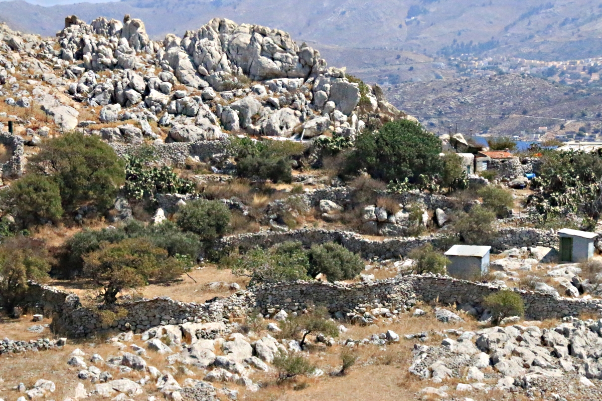
Looking down on the old enclosure from a crag above
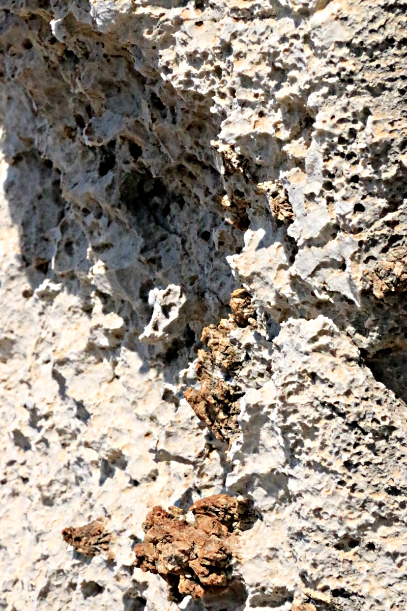
Flesh-ripping limestone

Torn between curiosity and caution
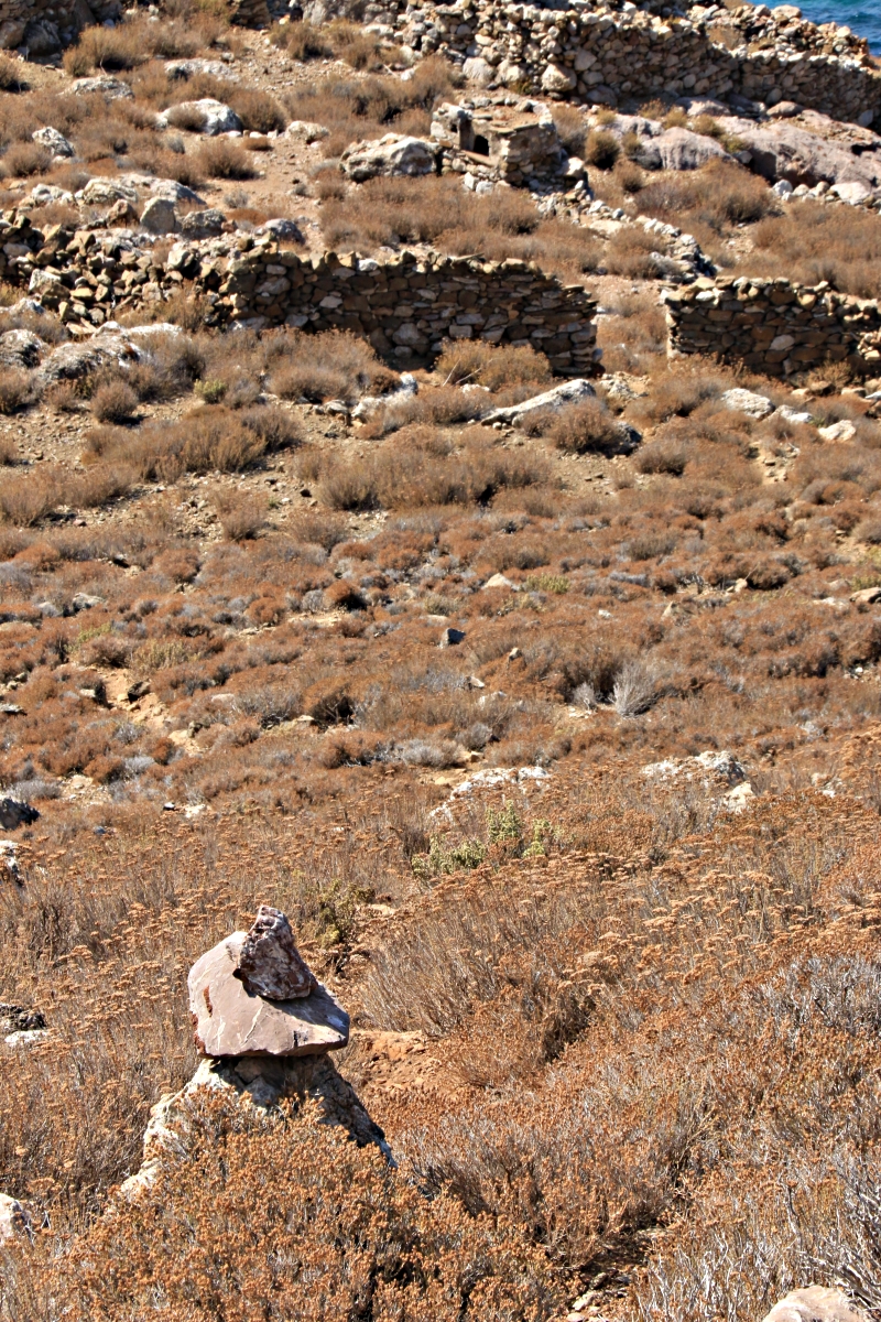
On the way to the col I had spotted far below on a small spur of a headland what looked like stone-walled enclosures and buildings. Nothing was marked on the take-it-with-a-good-pinch-of-salt SKAÏ map.
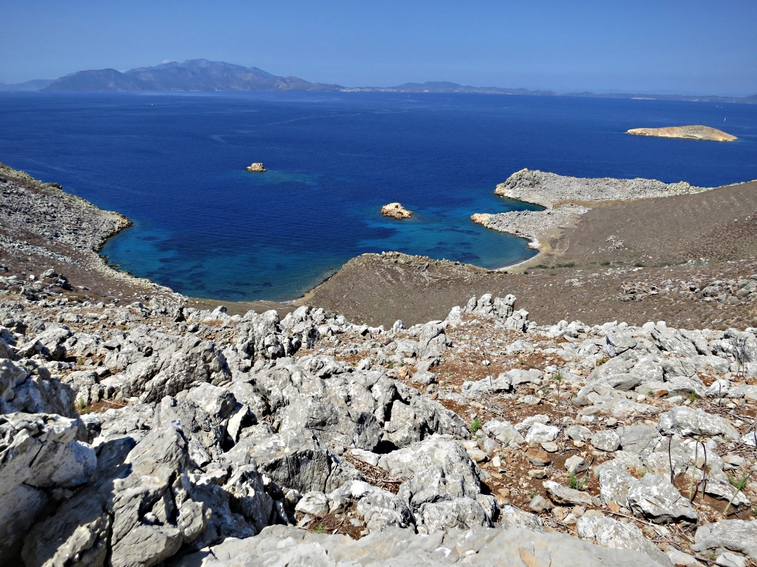
Looking down across the boulder-field to the short spur of a peninsula far below, Turkey across the water
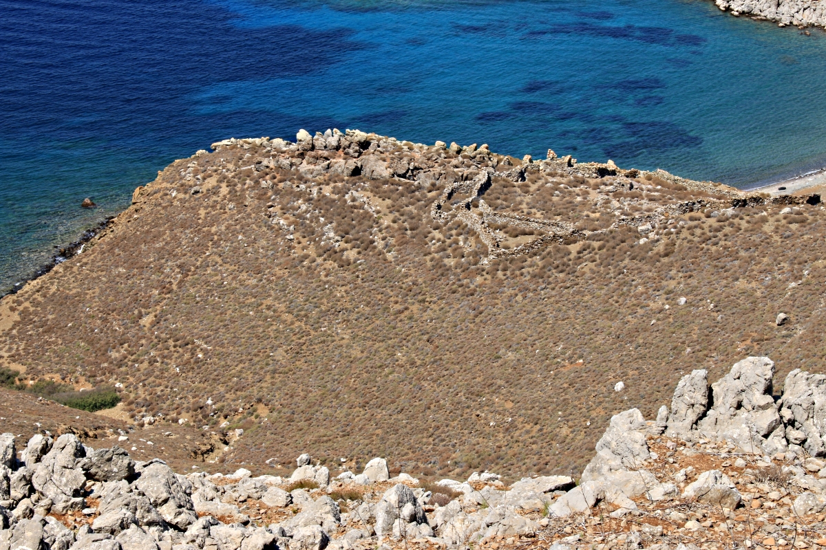
Zooming in on the stone construction
So I set off down through the boulder-field towards it. I love walking that stuff. Get it wrong and it will skin your shin or slice flesh. It keeps you focused. After a while I noticed a few ‘stone-on-a-rock’ markers used by local farmers leading towards a faint path through the dense prickly-thyme on the lower slope. It turned into a well trodden if very narrow path though the only prints in the fine-powder dry surface were those of goat hooves. No-one had walked this way for a while but passage of feet, maybe for generations, had obviously compacted the soil.
Stone-on-a-rock marker on the thin path down to the entrance to the site
It led meanderingly but inexorably down to a gateway in the outer stone wall of the enclosure.
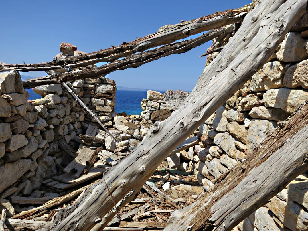
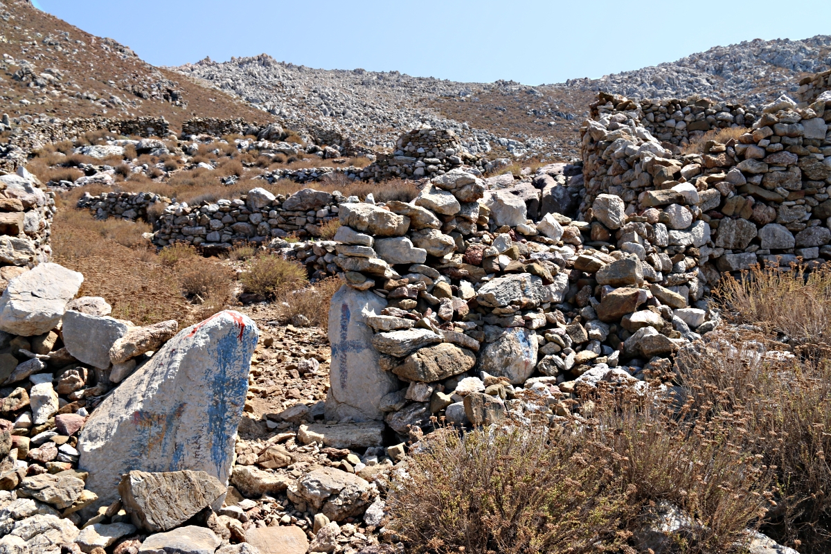
By now it was clear that there were extensive remains of stone construction but that most of it was walled enclosures rather than buildings. In the centre of the large main enclosure was a bread-oven on a plinth, still largely intact including a floor made of what I think were blocks of refractory clay. It stood apart from the only building on the site, a house.
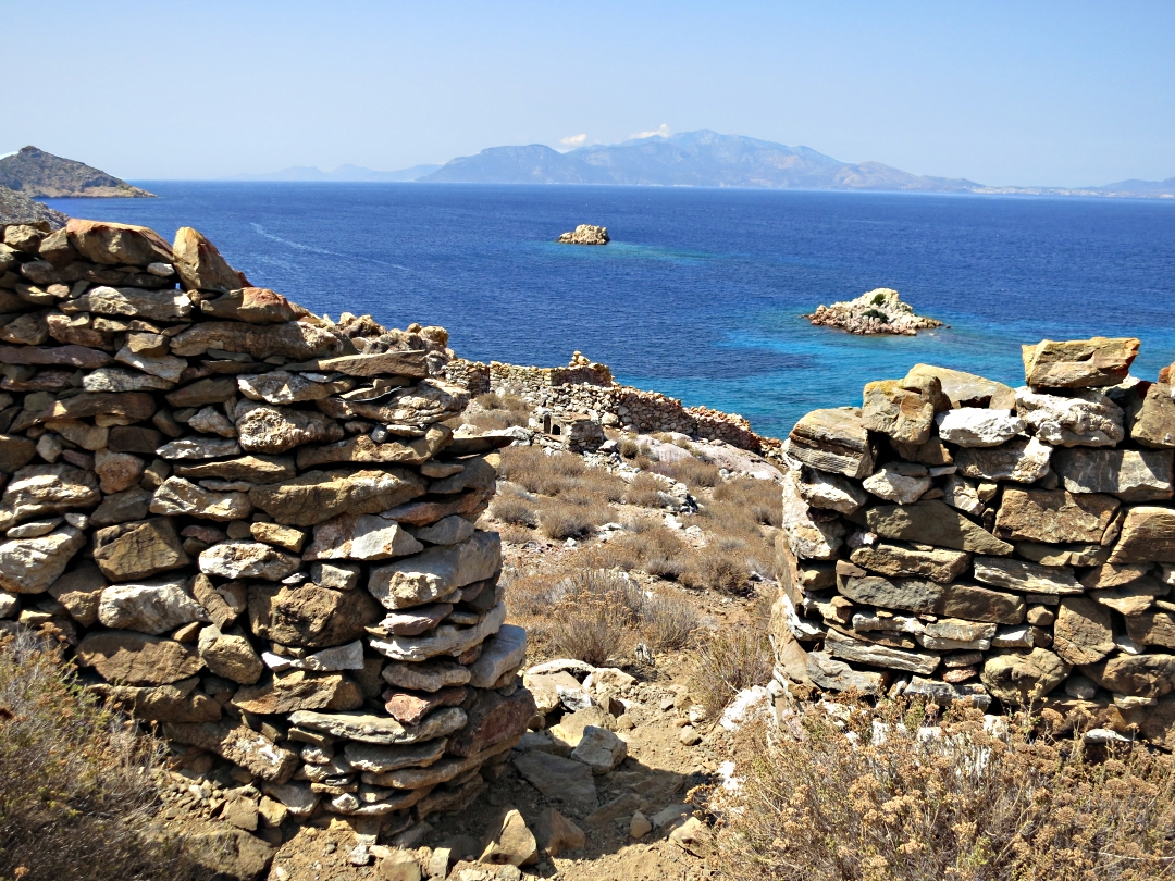
Reaching the gateway
Looking across the main enclosure, bread-oven on the right, house on the left
The construction of the house was very rough, random stonework, pieces picked up and used with no dressing or shaping, a multiplicity of colours and types of rock. With only the one house within the enclosure it implied that one family, albeit probably an extended family had lived here.
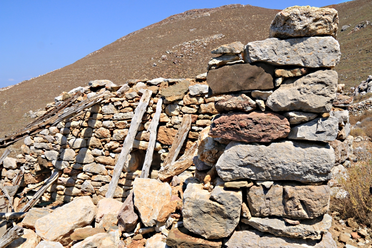
Random stone in the corner wall
The pine roof timbers had rotted and collapsed, leaning against one wall or the other. Two of the walls were intact, the end wall with a built-in wooden cupboard with shelves. The other end wall with a window facing the sea had largely collapsed, shutters lying on the ground outside. A door with a simple latch lay on the ground inside.
Looking towards the window and collapsed wall
I have no idea how old the building was but to me, no expert, it seemed that it may have been built a long time ago but lived in, altered, added to until fairly modern times. The ironwork on door and shutters, the wooden cupboard would all have been fairly recent. More obvious tell-tales of recent occupation were patchy use of cement rendering, a piece of plywood amongst the collapsed timbers on the floor, and a white Pyrex coffee cup.

The built-in cupboard
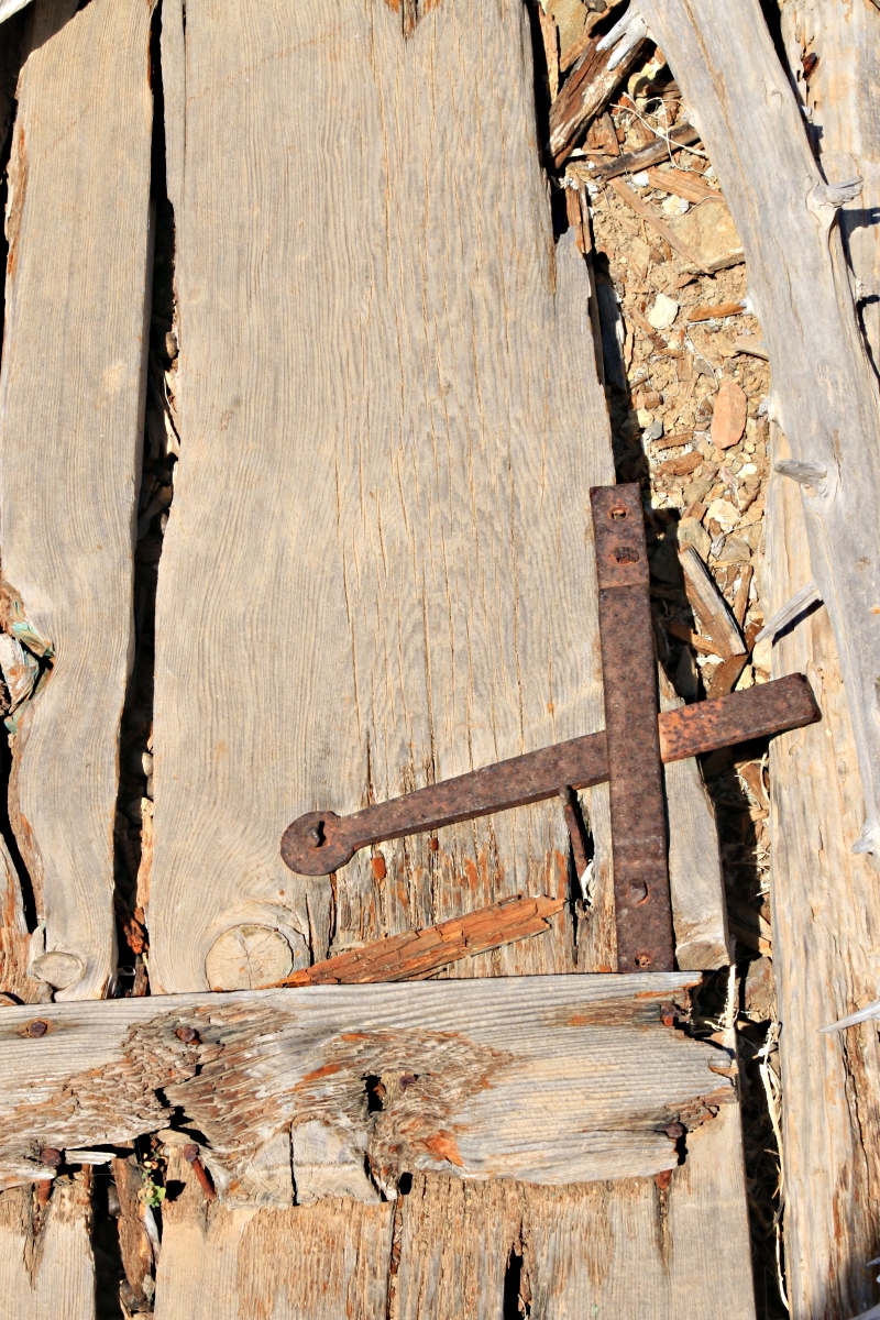
Simple iron latch
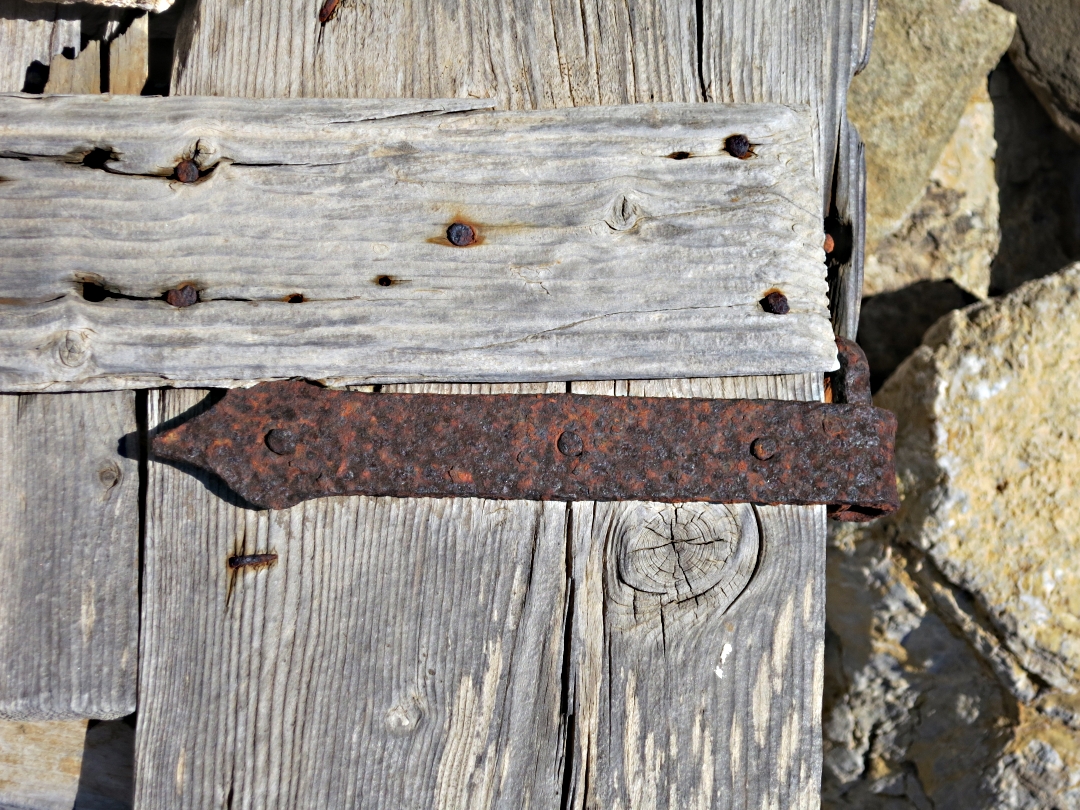
Surprisingly ornate hinge on shutter

Finely cut timber jointing
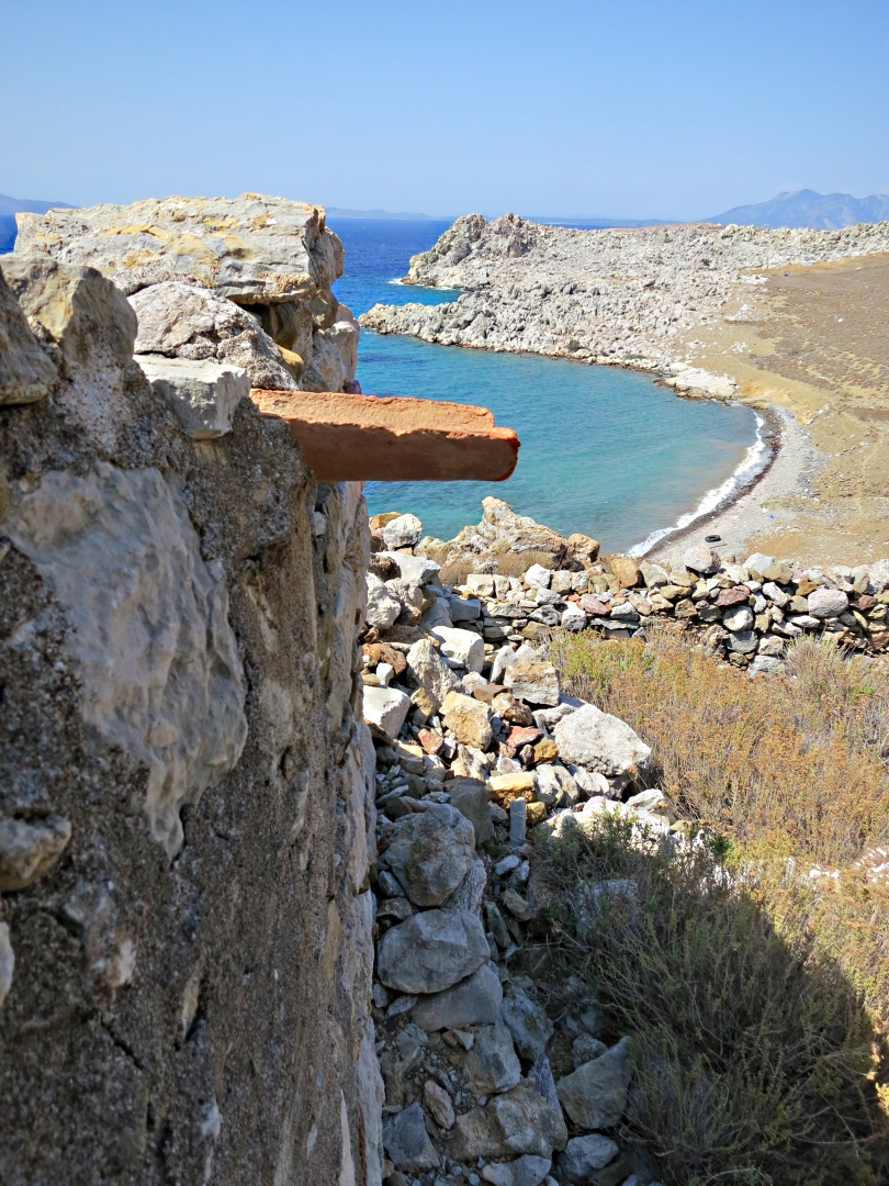
Tile to drain the roof cemented in place
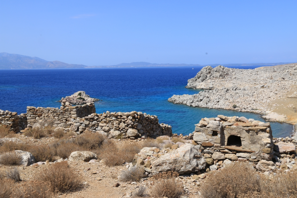
A little disappointing that there was no evidence of antiquity here but exploring the extensive enclosures outside was more productive.
At the lowest point of the large enclosure, at the top of a path down to the water’s edge, was another gateway but this one had cornerstones of dressed white marble indicating that it was The Main Entrance to the site. Clearly at the time it was built access by sea would have been more important than overland.
Dressed marble blocks at the seaward entrance to the enclosure
Looking around the other smaller enclosures to the side of the central area and I came on the strongest link to considerably older development, a piece of dressed, finely shaped marble which was obviously part of something larger. It had been used as one of the many random stones in the rough construction but was such a fine piece it stood out like a sore thumb. Maybe the painted letters and numbers on it indicate that it has previously been located, identified and catalogued by someone who knows what they are doing rather than a rank amateur like me.
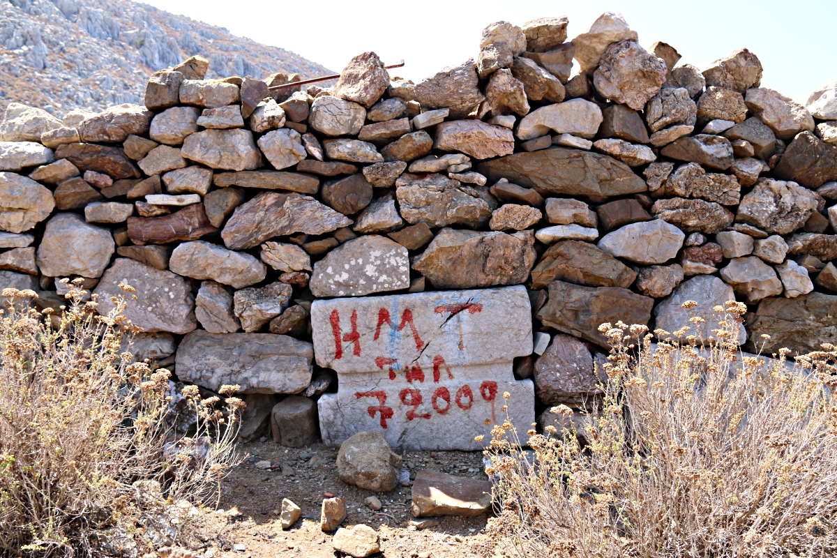
Rather more refined than the average random stone block
The trek back up to the ridge was hot work in the afternoon sun but the glow was satisfaction at having found another old pathway and trekked down to an old settlement with possible evidence of antiquity. None of it shown on the map.
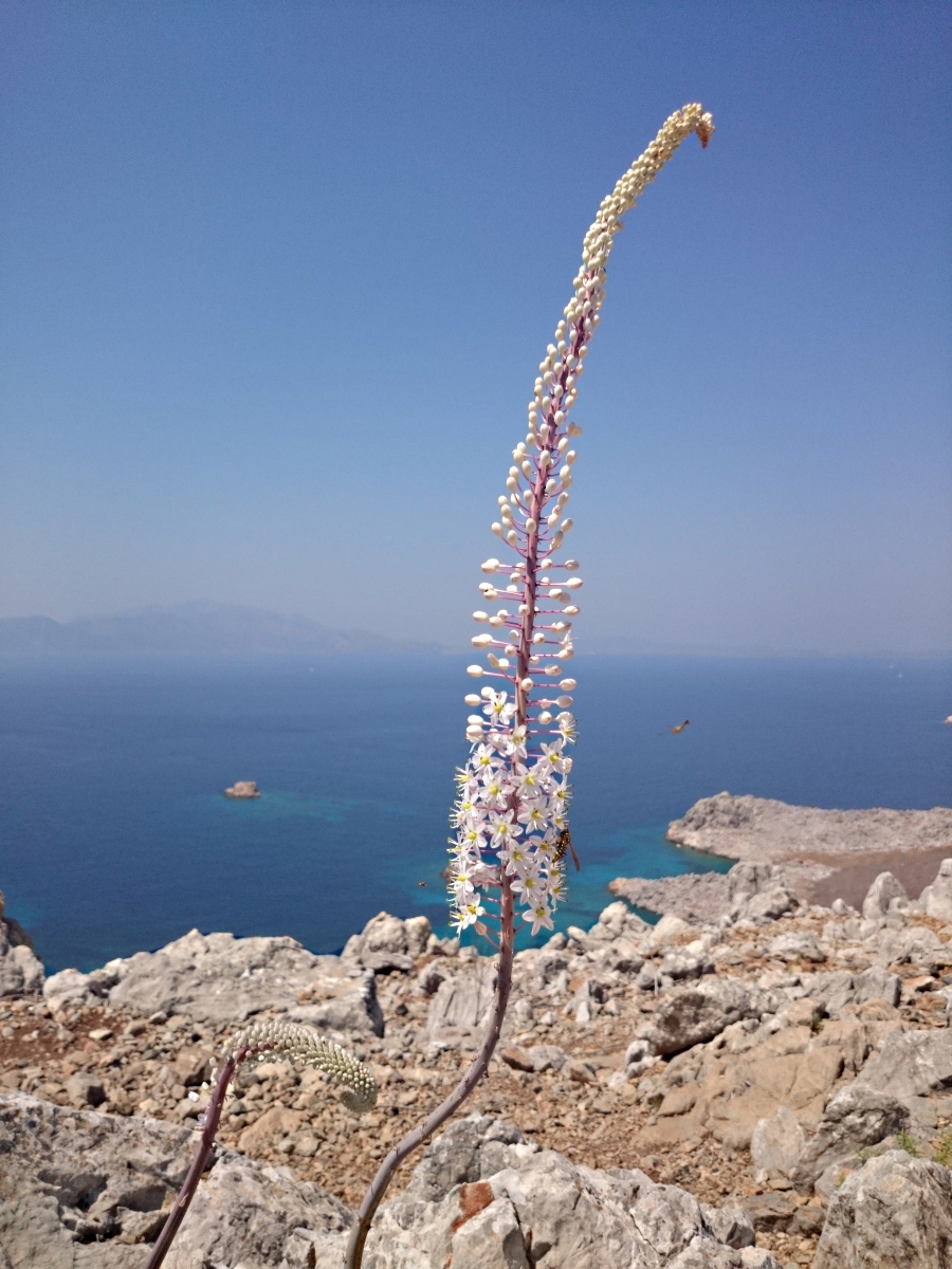
Squill bursting from the ground
x

Bravo Barry!
It’s amazing what you find in the back corners of these islands. Tilos is full of such things, relics of an incredible history that make wandering off the beaten track a fascinating (and rewarding) experience.
Also loved the pic of the sea squill. How I used to enjoy seeing those coming out as summer wound down.
All the best,
Ian