
I had walked to Nanou Beach a few times, a long trek up to ‘The Tarmac’, the road along the top of the ridge which is the main spine of the island, and then a 2½ kilometre drop down a steep path to the beach. I never enjoyed the latter and so hadn’t visited it for a number of years but one day recently I had arranged to meet friends there who travelled by taxi boat from the main harbour.
The trek starts in the narrow alleys of Horio and then out of the village up an old kalderimi to ‘The Viewpoint’ with its spectacular panorama of the main harbour, over the intervening ridge to Nimborio Bay with the coast of Turkey beyond that, and down the valley to Pedi Bay.
The kalderimi, rough-stone paved and at an easy gradient for laden donkeys, is broken up but still easy walking. Through the gate, which in theory keeps the goats out of the village though heads peering from the houses above shows that it fails to do so, and onto the open mountain. Not shown on the dubiously accurate SKAÏ map, the kalderimi here splits and, new in the last couple of weeks, a hand-painted sign on a wooden plank points to Agios Vasilios to the right, the path I take frequently, and left to Panormitis, the large monastery at the far end of the island. I go left, the kalderimi on its zigzagging stone supporting walls climbing up to The Tarmac at 300 metres. It’s a long pull up in the heat but most of the height-gain for the walk is made on this one stretch.
Close to the top the kalderimi, a masterpiece of engineering in its day and deserving of but not receiving protection as part of Greek folk heritage, is interrupted by a bulldozed track going nowhere and serving no purpose. However, also in the last couple of weeks waymarking paint splodges on the opposite side of the track guide onward progress on the kalderimi, overgrown and strewn with construction rubble from The Tarmac just above. Unfortunately there is no alternative but to finally give up on the now destroyed kalderimi and slither and scramble up the loose rock and soil to the road.
A short walk on the road to a hairpin bend and the kalderimi resumes, The Tarmac forgotten for a good while. Climbing at a more gentle gradient, the always-locked enclosure to the Agia Ekaterina monastery is soon reached with views across the upper reaches of the Vasilios Gorge and the settlement of Ksissos to the extensive ridge-top monastery of Panagia Mirtiottisa (the Virgin of the Myrtles). A short step on a concrete road to the much humbler monastery of Panagia Stylou (the Virgin of Support or Guidance ???)and the real fun trail across the mountain begins.
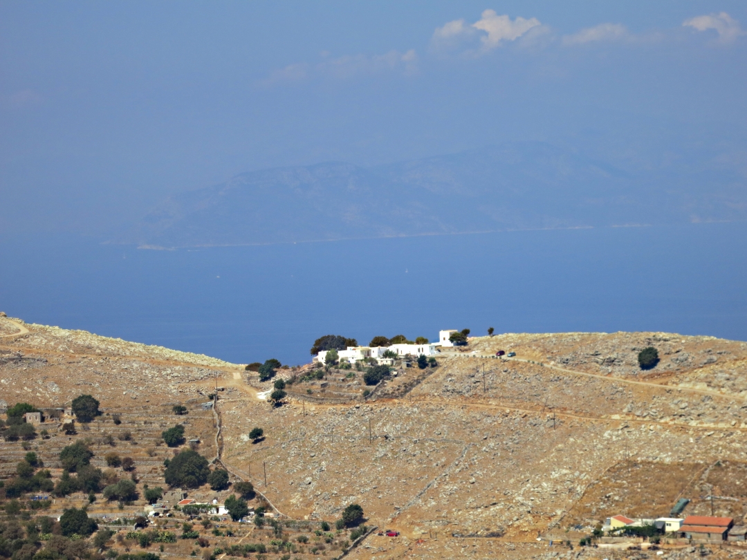
Looking across the the ridge-top monastery of Panagia Mirtiotissa far below
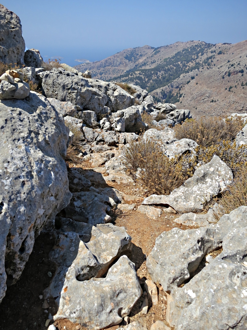
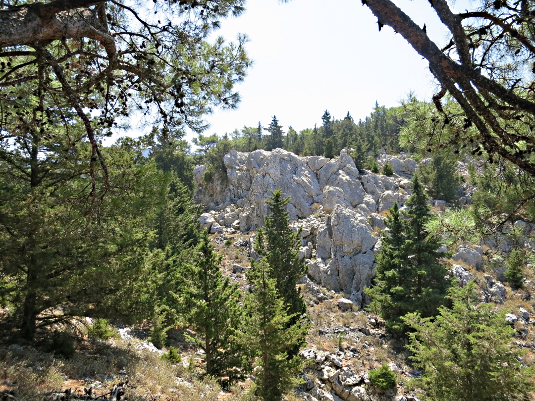
In places the trail is obvious on trodden ground, in others it picks a way through rocks. One section is squeezed between cypress trees and I was pleased to see that the way I cleared by judicious pruning with secateurs last year, though narrowing again, is still open. Onward over more angular rock, easier to hop on the top of than pick a way between, and then crossing the top of a small gorge draining, on the odd occasion it has water, into Lapathos Bay.
Walking over a path of angular rock, easier in good quality walking sandals than boots because multi-directional ankle joints take less of a beating than predominantly two-directional knees and hips, eventually gives way to cypress and pine forest carpeted in needles.

Clear, well trodden path
…. squeezes between large roaks
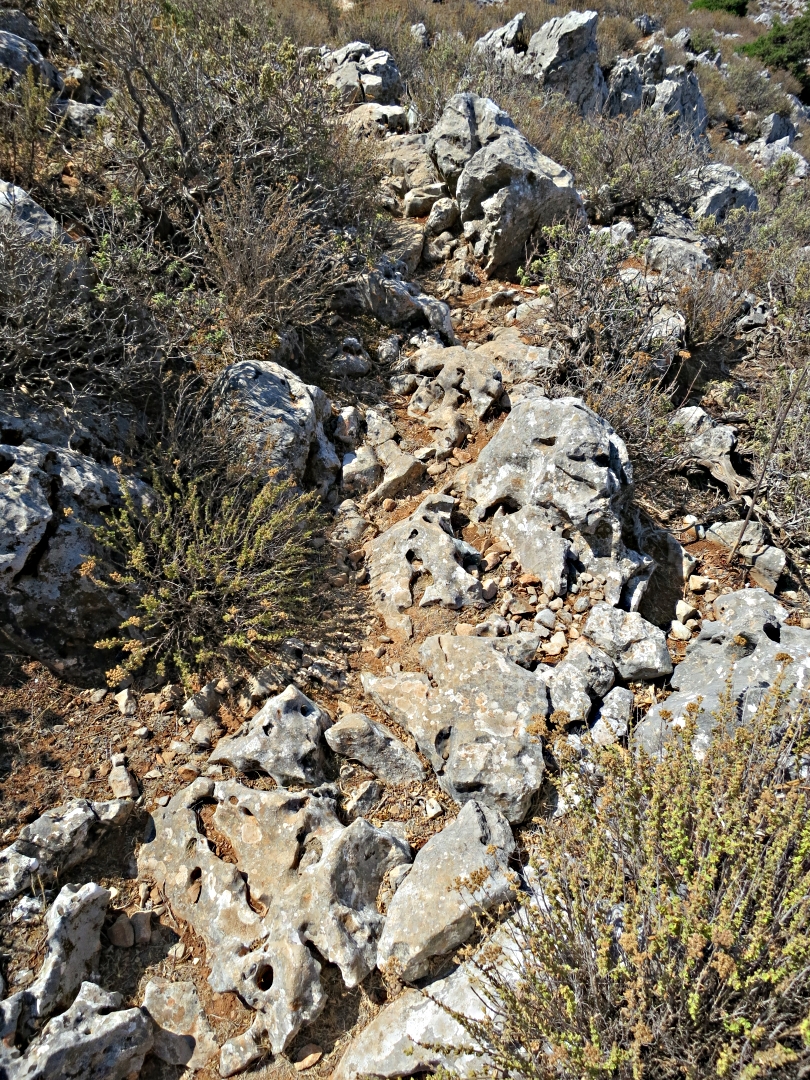
Best way is to hop from rock to rock

Pick a way through that lot!
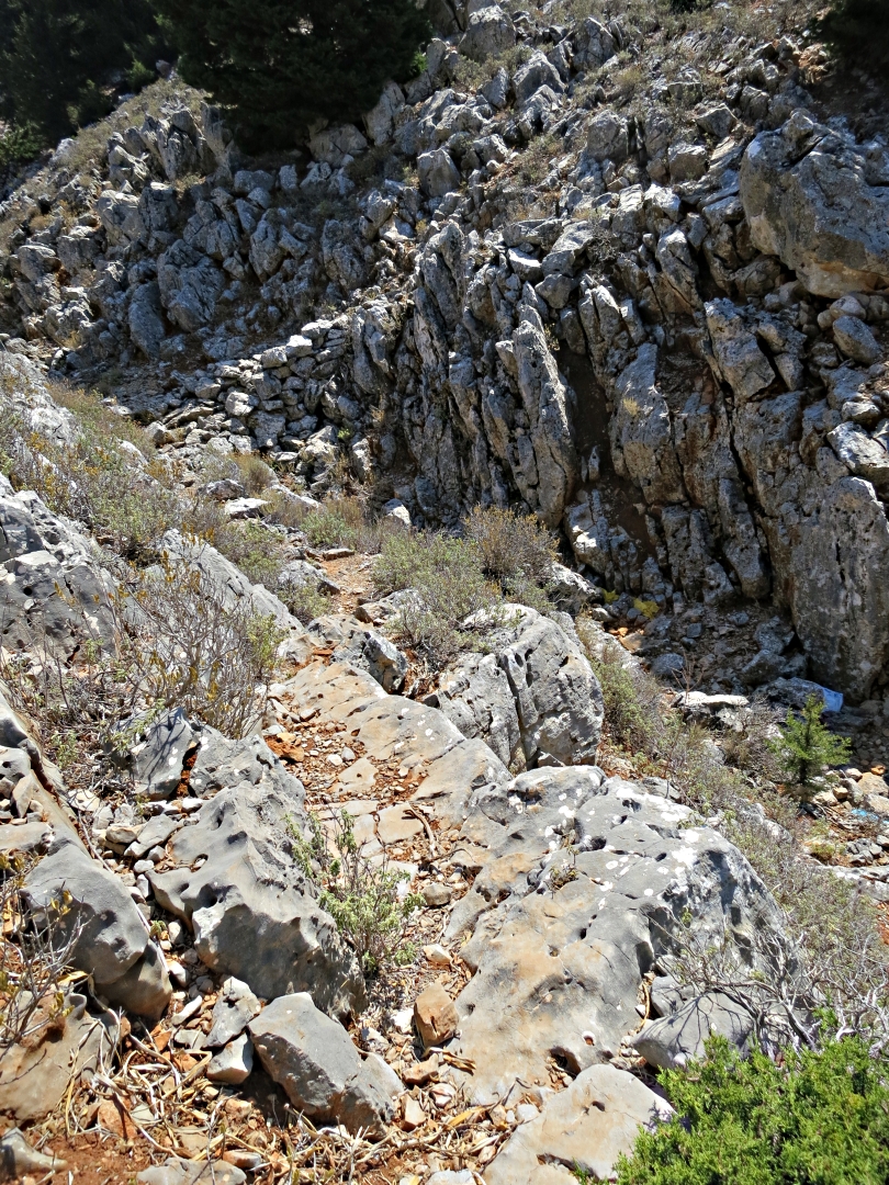
Dropping down sloping slab into the top of the gorge to cross to the other side
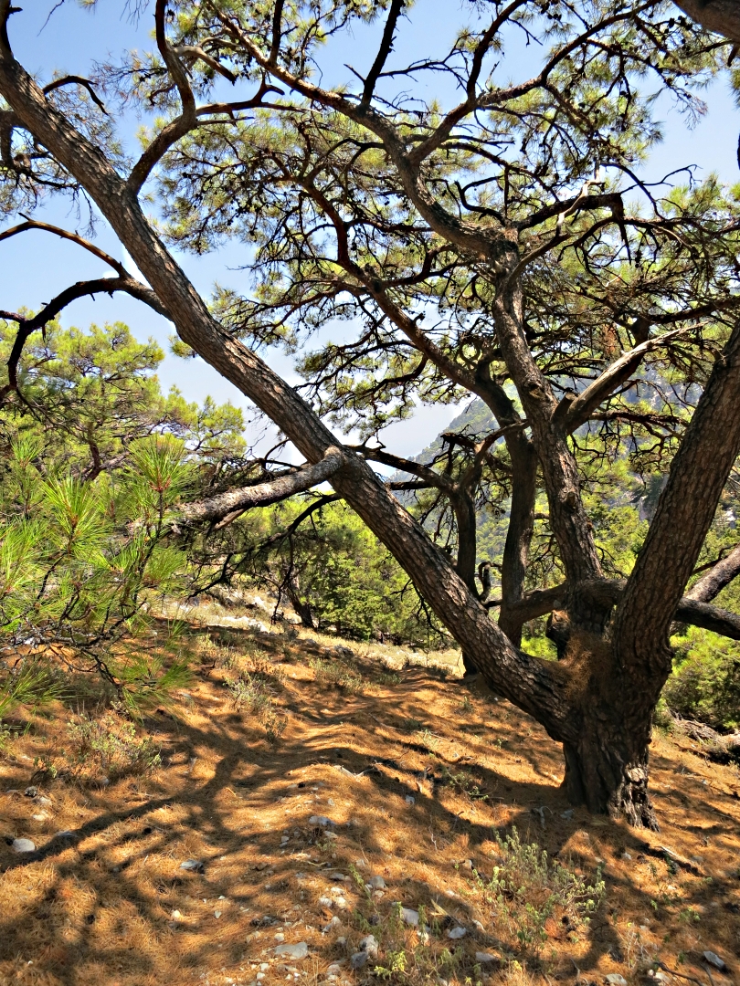
With no shade for an hour or more the trail through the woodland is refreshingly cool, with, counter-intuitively to north European eyes, fresh, cool green foliage on Scots Pine (or a close relative).
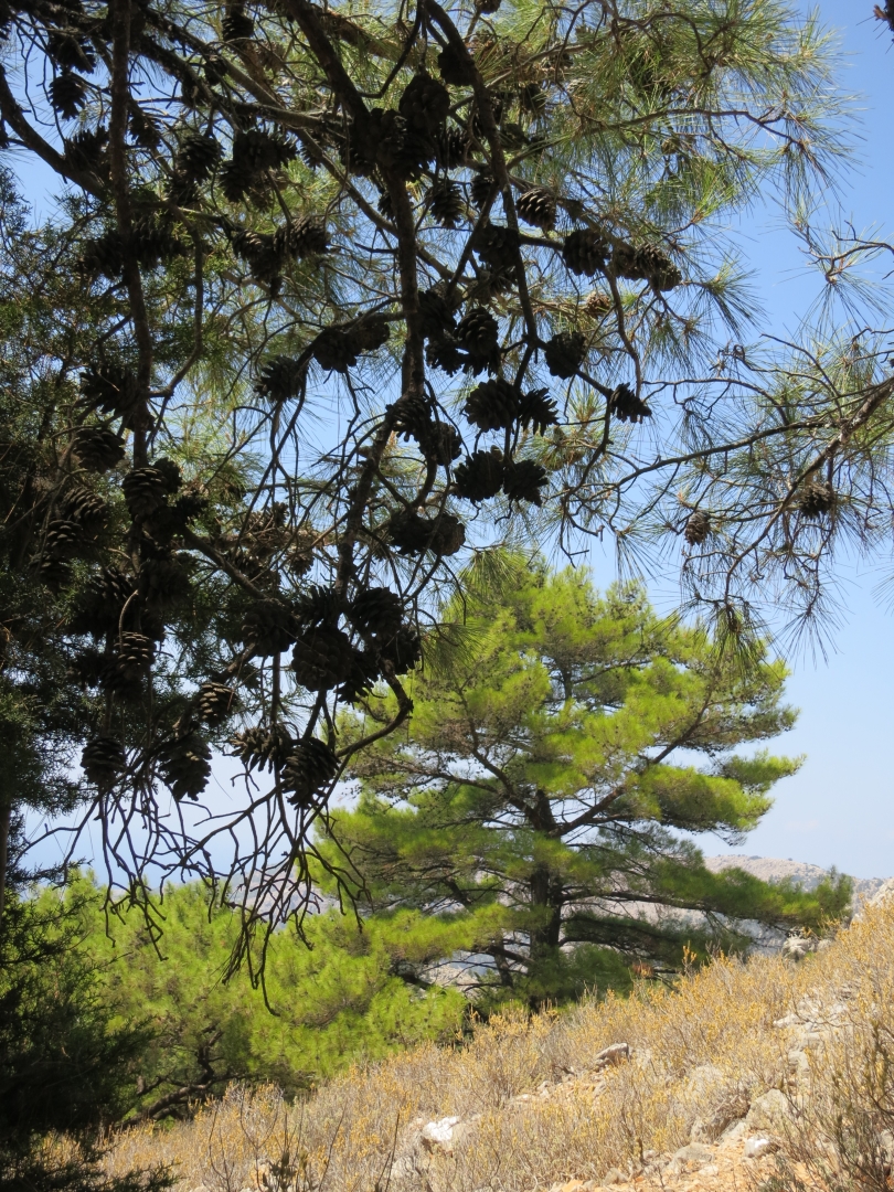
Fresh green of new growth on Scots Pine
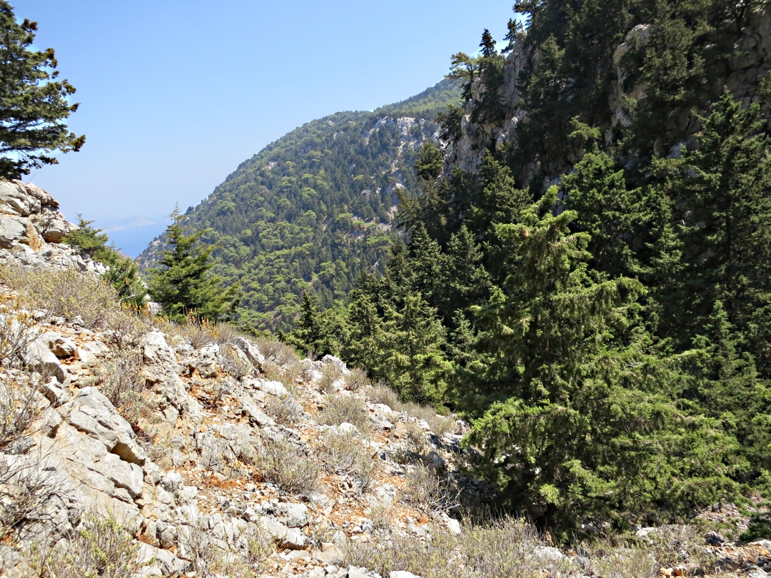
Looking across to a crag on the other side of the gorge
Reaching the small monastery of Agios Prokopios the opportunity for a pause under a shade tree is again thwarted by a locked gate and high fence. But at least the trail is now back on the map, a dirt track leading back up to The Tarmac. Thankfully it’s only a nodding acquaintance with the road as a parallel path leads through the trees to the roadside monastery of Panagia Strateri.
From here it’s straight across the road to the top of yet more road construction rubble which obliterates the start of the path. With minimum effort and negligible cost continued access to ancient pathways could be provided during road construction. Other municipal councils in Greece do it, why not on Symi? Indeed because these roads are invariably built with EU funding why doesn’t’ that gargantuan bureaucratic machine require protection of such pathways, part of the national heritage, as a condition of the grant?
Last year people asked me where the path to Nanou began but failed to find it. Now I can understand why. Slithering and sliding down loose bulldozed rubble, even though I knew roughly the line it took, I had to look very carefully until I found the small but well placed cairns marking the tight zigzags into the top of the gorge.

Firts slither down the road rubble at the start of the path
….. then try and locate the path
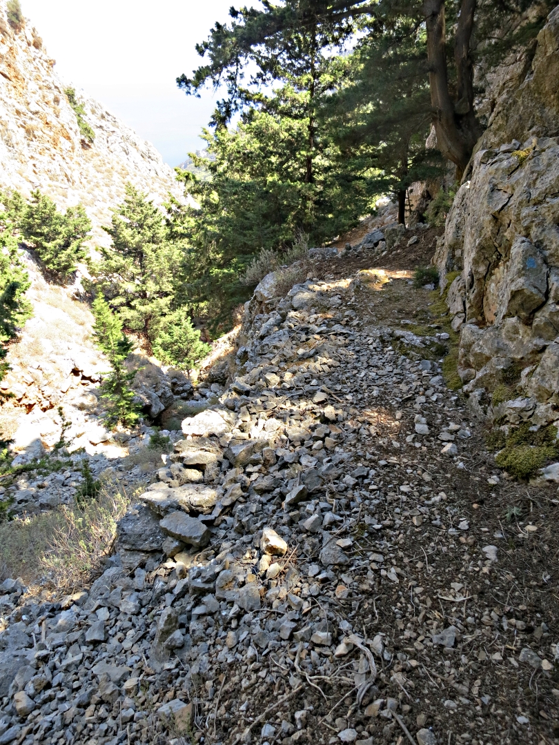
The trail negotiates dry waterfalls and then keeps well above the river bed, a loose, stony path dropping steeply under pine and cypress trees with a carpet of smooth needles reinforcing the need to take short steps to maintain balance and avoid landing uncomfortably on one’s dignity.

The path bypasses a 20 foot waterfall
A broad, easy section
Pine-needle carpet through the trees
Rounding a bend and the path passes the entrance to a cave. On previous visits I had poked around inside but with only the light from the entrance could see little of the interior which had been disappointing. This time I had come prepared and packed a head-torch in the rucksack. With that it was clear that the cave was far more extensive with more vertical development than I had expected. Large deposits of calcite decorated significant areas, water still dripping slowly from straws hanging from the ceiling.
‘Early man’ often lived in caves such as this. It was certainly large enough with a broad level floor and there was evidence of blackening on the ceiling which may have been from fires long ago. My guess is that others have had the same thought as there are small rectangular trenches dug in the floor which weren’t there last time I was here. I know that in Wales caves of this size have been found to contain dinosaur bones and on the Dodecanese island of Tilos to the west were famously found the bones of pigmy elephant, the last of its kind in Europe. Who knows what lies under this floor.
I hadn’t packed my bump cap nor the romper suit which I wear when crawling around in caves over here, without which I didn’t fancy climbing up into the higher corners of the cave. I couldn’t detect any draft which would have indicated longer passages but I would still have liked to explore further. Next time.
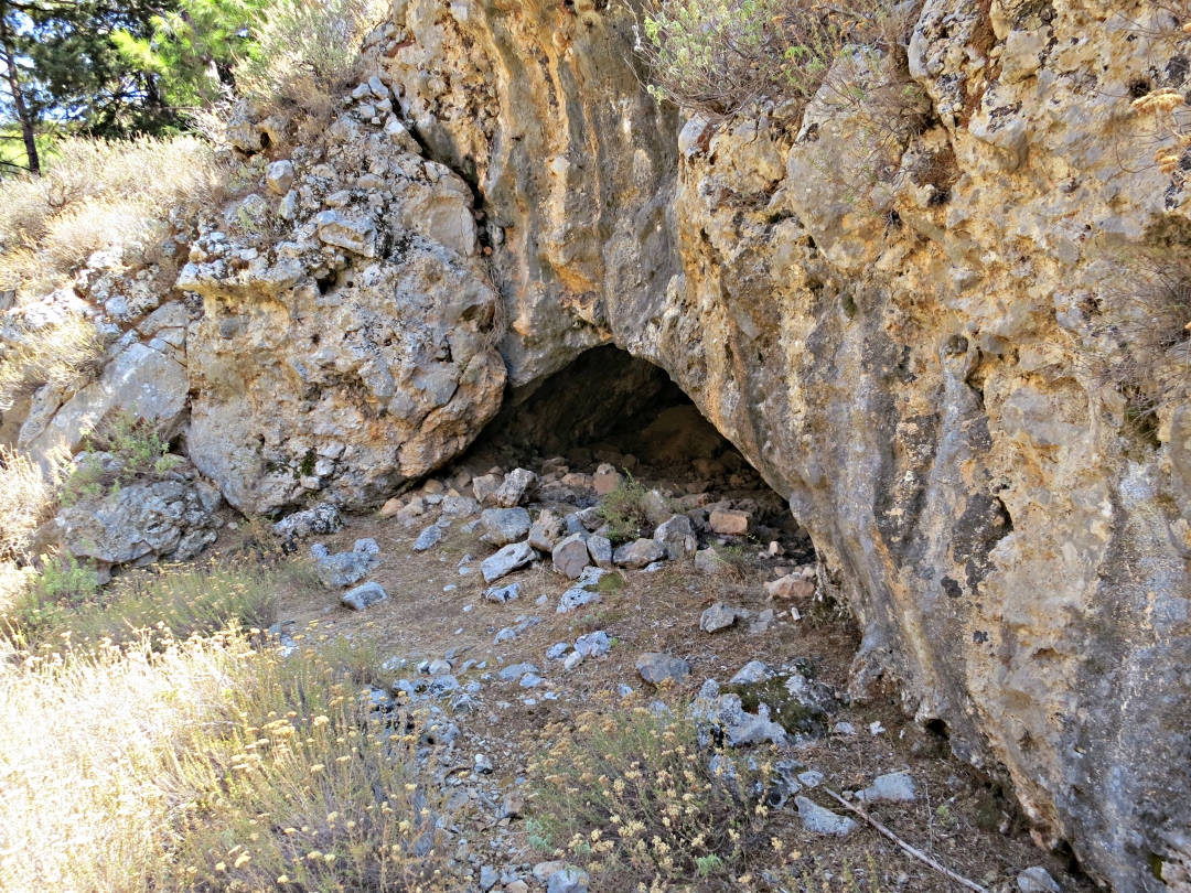
The entrance to Skordelos Cave
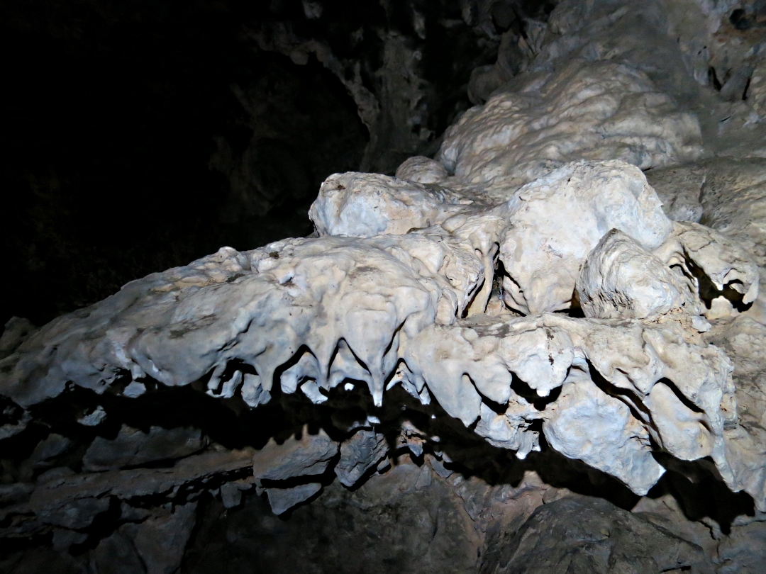
Clam-shaped calcite deposit

Calcite veining on the ceiling

Groups of stalactites like multiple udders

Knife-like calcite curtain

On the way out
Eventually I made it down to the beach, located my friends relaxing on sunbeds outside the taverna, and had a very refreshing swim to wash off the perspiration and the grime of the cave. Then a return with the taxi boat.
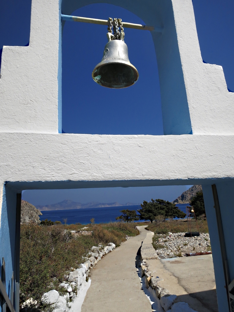
Reaching the chapel behind the beach
Altogether just over 5 ½ miles, a taxing but very enjoyable trek.
I have started writing up the route as a walking guide to both Nanou and the mountain-top monastery of Agios Stavros Polemou. The guide isn’t yet finished but you can check it out if you want to try the route.
