
It started out as a simple amble across the island to check out the site of more ruins shown on the SKAÏ map but turned into a really good-value-for–money trek.
Finding the Pelasgian Platform (‘Trekking to a time before Greece’) may have fired my enthusiasm but neither that nor the abortive trip along the Kokkinochoma peninsula to look for the ‘Hellenistic Period Ruins’ increased my faith in the accuracy of the map. Nor did finding ruins which were not marked on the map (‘Wandering the mountains in a search for the past’).
Maybe the ruins marked on headlands overlooking Toli Bay further to south along the island’s west coast would prove to be more than fictional.
The first part of the walk is to the ridge-top road, once again on an old kalderimi not shown on the map. Climbing at a good donkey-friendly gradient to 240 metres it has the advantage for me that I start in the alleyways of Horio at just over 100 metres ASL so don’t have to lose and then regain height.
Trudging along the road for the next part of the route means I can pick up speed but is boring so I decided to go off-piste and try to by-pass the road section. A major problem with doing this is that increasingly landowners are fencing off tracts of mountain with 2 metre high chain link fence supported on steel rods driven into the ground. I had already started to cut off bends in the road by crossing rough ground and was looking to do more.
At the point where the kalderimi meets the tarmac there is a small rise which looked promising in that it isn’t fenced off. It also held out the prospect of being a good viewpoint looking over much of the northern part of the island. Unfortunately, as I broached the top I stopped watching my foot placement so carefully, trod on the edge of flat stone which flipped up and took a layer of skin off my shin. Again. Only superficial but the claret flowed freely and needed staunching and dressing.
It was a great place to sit on a rock, deploy the relevant part of my emergency kit … and eat a banana. As I tilted back my head to take a swig from my water bottle my eye was caught by a flicker of movement high in the sky. I’m no ornithologist but I do know a kestrel when I see it, partly because of its unique ability to hover in one position by rapid adjustment of the angle of attack of aerodynamic wings. One of the smaller birds of prey, I have watched them many times at home, even flown with them on my paraglider, but have found them difficult to photograph. However, as I watched, this one drew closer, obviously with its eyes fixed on potential prey, paying no heed to me. I managed a couple of shots with maximum zoom (x200) on the rapidly deployed SLR before it folded its wings and dived very rapidly to ground, hopefully having caught its dinner.
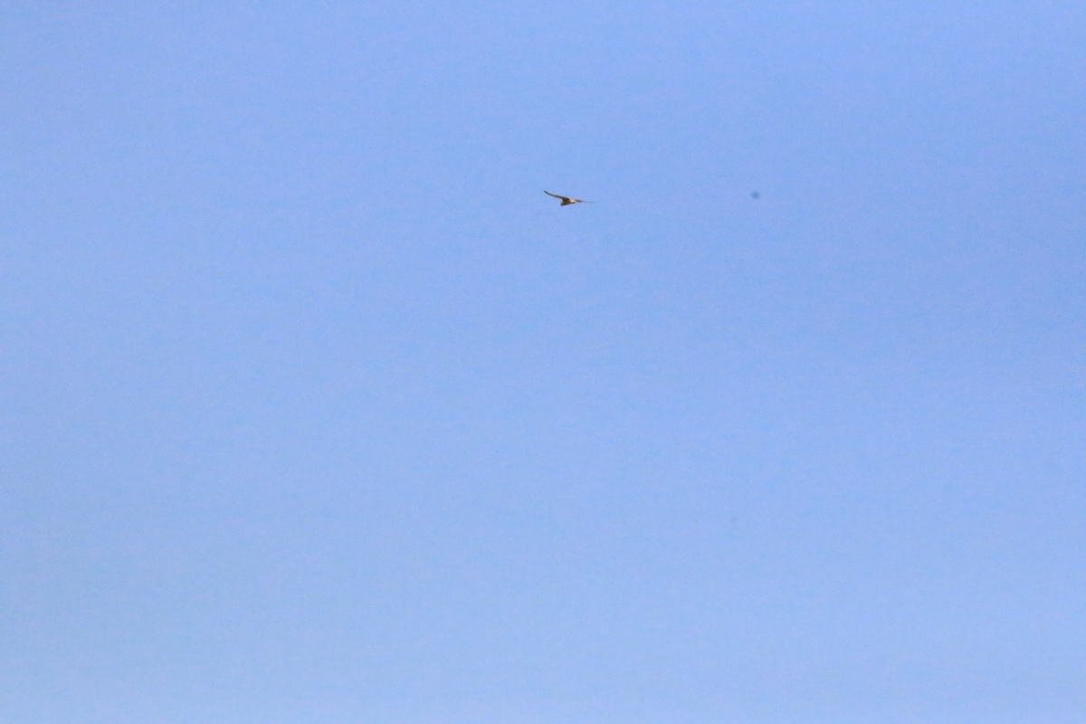
Kestrel high in the sky,it’s the one against the blue background

…. soaring a little closer

…. just before it folded its wings and dived on its prey
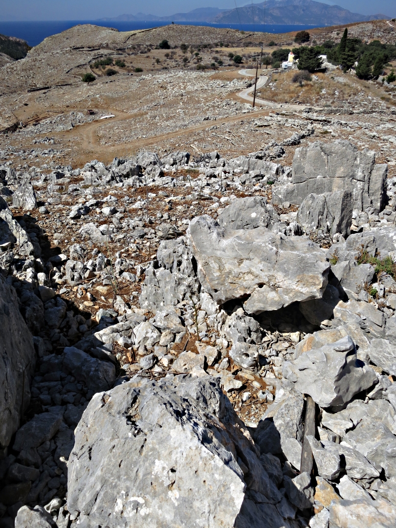
I managed to reduce the amount of tarmac I had to walk by a good amount and then came to the top of the remnant of path overlooking my objectives, ‘Classical Period Ruins’ on a small spur of a headland and non-specific ‘Ruins’ on a limestone headland beyond and high above Toli Bay. For once the map showed their location accurately.
Looking down the rocky outcrop to cut off a bend in the road

Ribs of rock, great fun to walk along

Looking from the col across the area to be exploredd
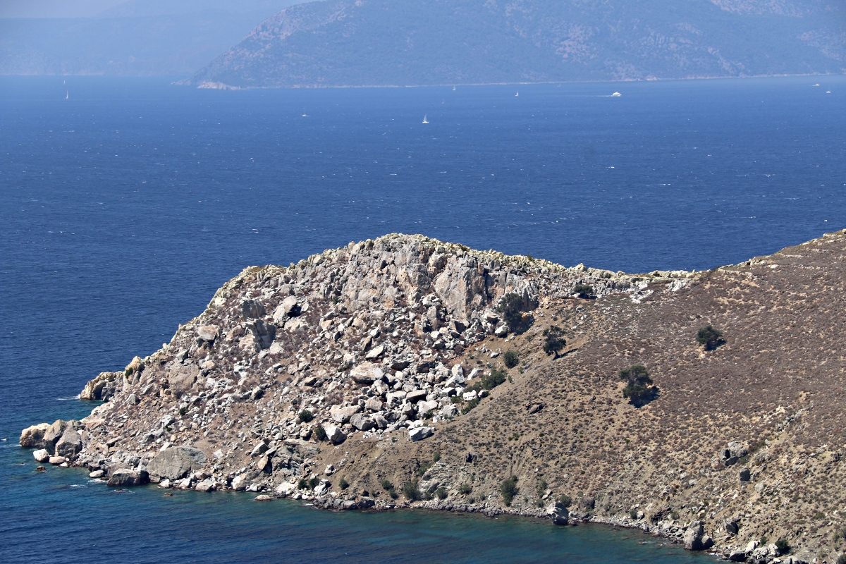
Zooming in on the Classical Period Ruins on the small spur of headland
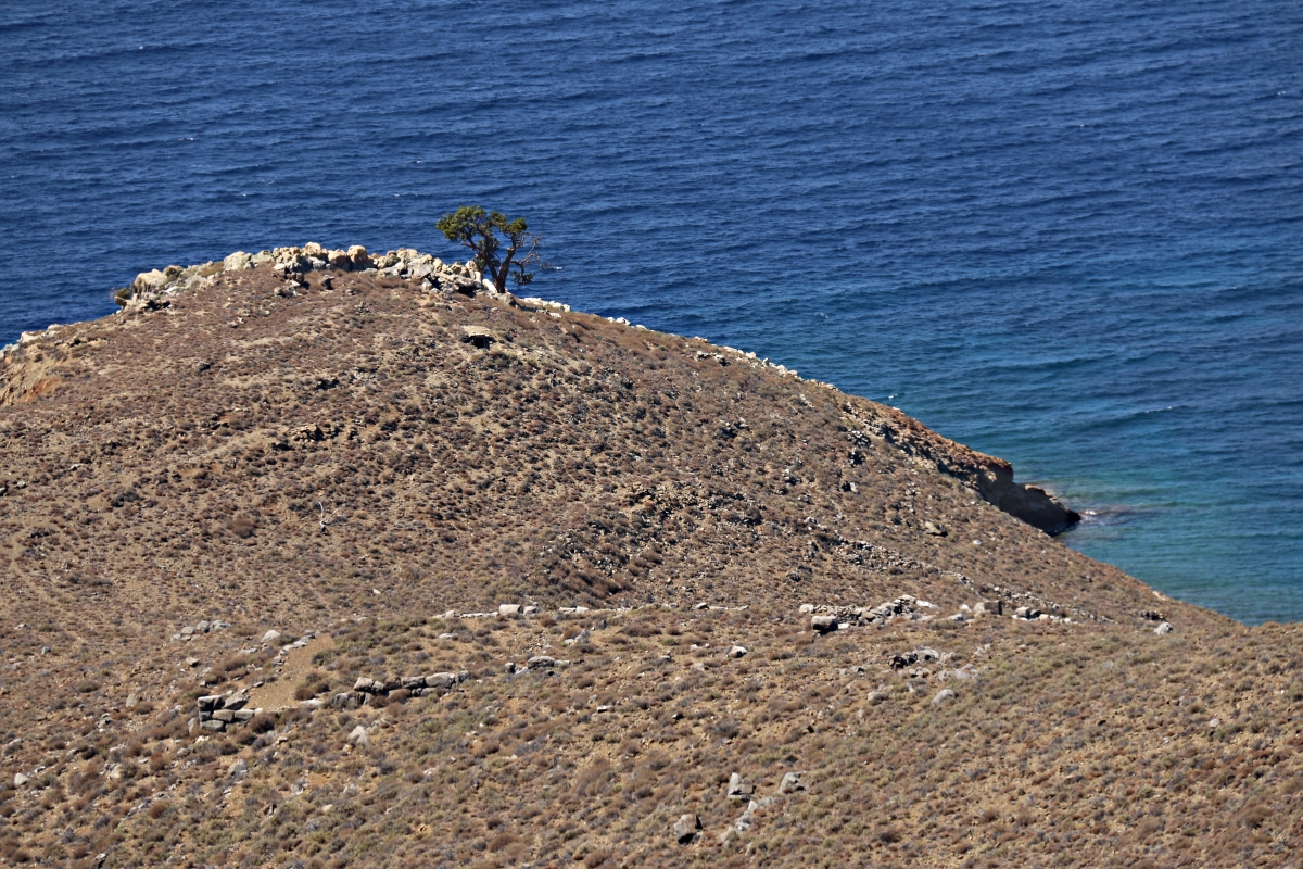
Zooming in on the further headland with ruins at the junction of two geologies
First to the far side of the bay. Disrupted by the bulldozed track to the new taverna at Toli Beach, none of the paths in this area are shown on the map but casting around can still be located. Once found the path I needed was clear and well trodden with a couple of distinctive landmarks, maintaining a steady height around to the col at the junction of two distinctive geologies.

If you don’t stop moaning I’ll turn you onto a tree! Distinctive landmark along the unmarked path
Even more distinctive landmark. Ho ho ho!
The ruins are in plain sight, a house, a threshing circle and various agricultural terraces but I have no idea how old they might be. By contrast to the remains I found further north east along the coast, the walls are all of grey–white limestone rather than a myriad of rock types but none of the stones are dressed, simply rough-built walls of ‘found’ rocks. Presumably the site is noted on the map as ’ruins’ because the advisors to the cartographers had no idea of age either. Another example of evening research in a taverna perhaps? Wish I could get signed up to that little number.

Threshing circle with well preserved terrace wall behind

Ruins of house with ornamental oil drums

Photographer on the edge at the ruins

Old agricultural terraces marching up the mountainside
Back along the footpath, now following it to the point of its interruption by the bulldozer, and soon a scramble down the unconsolidated rubble bank towards the ‘Classic Period Ruins’. No sign of a path this time, just picking a way carefully through the prickly-thyme. I would not like to be here when bees are harvesting the pollen!!
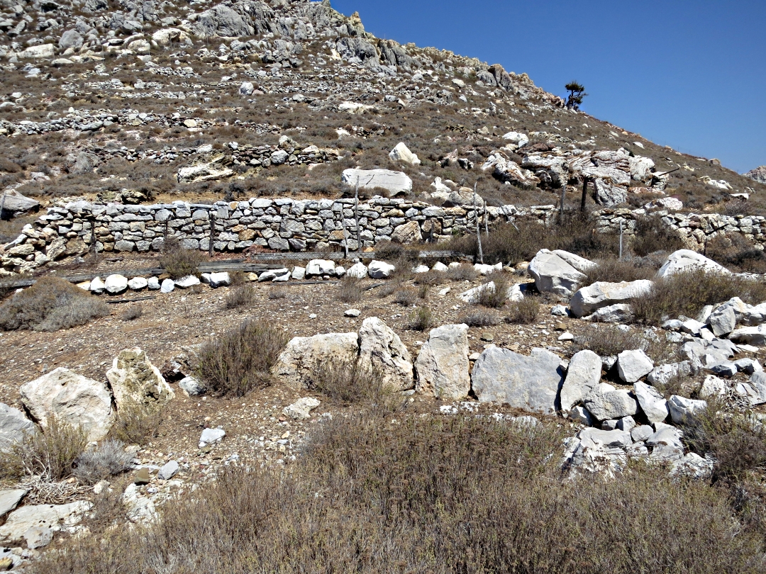
The walls of large, dressed stone visible from the col are now only 3 or 4 blocks high but extensive. The blocks are nowhere near as massive as those in the Paleocastro on Nisyros nor are they ‘nibbed and grooved’, or whatever the technical term is, but are nonetheless impressive. A few are significantly larger, at roughly 1½ metres, about 2 courses, high, one particularly large one marking what was probably the main entrance to the site.
I walked around the whole site, the corners and 95% of the base of the wall intact and at a rough estimate about 100 metres by 75. It seems to have been a well defended community with agricultural terraces marching up the mountainside, now long collapsed and colonised by arid vegetation. The short ‘Classical Period’, a mere two centuries until the death of Alexander the Great in 323 BC is famous for a flowering of Greek culture, art and philosophy and remembered for the wars with Persia and between coalitions led by Athens and Sparta. What the role of a lonely outpost on Symi was I don’t know. Nor do I know how the ruins of the fortified area on Symi are linked to that period in Greek history, nor how the style of construction fits in with more famous buildings from that period. But the ruins are still there after nearly two and a half millennia or, for those preferring numbers, 2,500 years. That’s impressive.
I recognised no evidence of either a link to a more ancient past nor sign of more ‘modern’ occupation, unlike the palimpsest of ruins on the flank of the Kokkinochoma peninsula to the north. It seemed that this people were there and then gone, no adaptation to changing environmental conditions or econo-political circumstances.

Wide entrance through the walls on landward side

Large dressed-stone block marking an entrance to the site
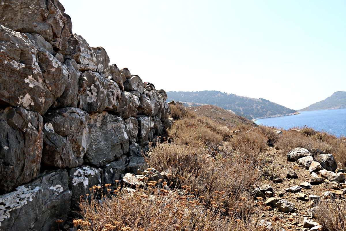
Long wall along seaward edge

One of the internal walls
Towards the end of beating the bounds I sat down on one of the inner walls for another swig of water and spotted yet another dragonfly on a stick. Different to any I have seen previously (the dragonfly, not the stick). Fascinating to try to photograph as it didn’t seem to be spooked by me just sitting there..

Familiar top-of-stick poistion, unfamiliar colouring

Getting a little closer
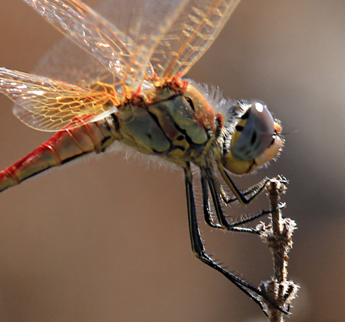
more detail
A last look around and then the climb up through the densely thyme-covered hillside, to the col and a steady drop down a thin path to the beach at Nimborio and a swim. Great day!

Dropping down towards Nimborio
x

Hi Barry, glad to see you’re still tramping the Island. It always amazes me when you think you’re in a really inhospitable place out in the wilds in Greece, there’s always signs of previous lives lived, threshing floors and cisterns, not to mention really ancient ruins. Lovely to have an encounter with a kestrel (possibly a lesser kestrel?) and a magnificent dragonfly. We’ve had a fantastic September here, to make up for the rubbish August and now there’s a touch of autumn in the air but all is soft and twittery. Take care, Sarah
Beautiful dragonfly photos!
Fabulous photos! That huge wall looks worth the walk…