
A few more walks after the Kamikaze Trail and I decided to have an easy day and head to a beach for a laze and swim. Apart from the pebbled town beach, over a mile long and just a quick stagger across the pedestrianised seafront road from hotels, apartments and tavernas, there are a number of very good options on Tilos requiring only a relatively short walk from Livadia:
Red Beach, small but a favourite with many because it’s a short distance along a good cliff path and has a name familiar to English tongues;
Lethra further along the same cliff path with a couple of options for shade;
Thollos on the other sided of the island with a dramatic drop down a small gorge to affine-shingle bay;
Stavros also on the other side of the island with an even more dramatic gorge-path through fiercely folded red rock.
The treks to these beaches, short as they are, thankfully deter the majority people so there is no affront to quietness or modesty.
This time I opted instead for the beach at Despoti To Nero, nothing to do with autocratic Roman emperors, in Greek it means something like ‘Lord of the Water’, an indication of the quality of the freshwater spring which emerges into a trough behind the beach.
The first 1½ miles is a saunter around the coast road to the tiny harbour of Agios Stephanos on the opposite side of the wide bay from the main harbour. In keeping with my intention to be lazy I called in the taverna there and sat with a frappé under the bougainvillea canopy watching life drift slowly by. Or not.

Looking across the bay on the way to Agios Staphanos harbour
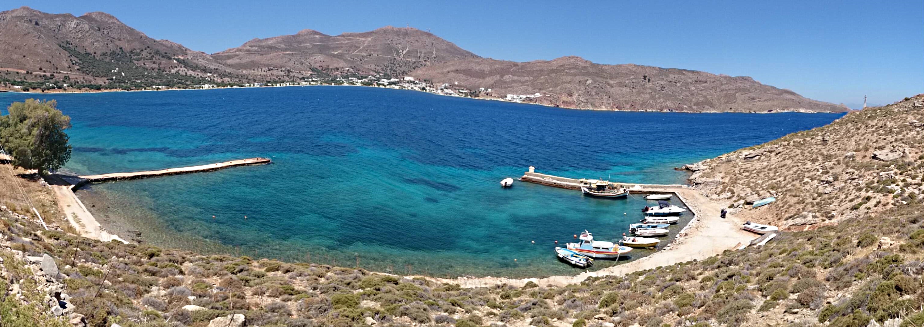
Looking across the Agios Stephanos harbour with its complement of small fishing boats
Then I girded my loins (or the equivalent when you’re wearing shorts) and climbed up the rough track to the tiny chapel of Agios Ioannis and sat under the shade tree swigging cold water from a ½ litre bottle. It was very hot with temperatures forecast to push up towards 400C by the afternoon and no breeze so as well as the ‘neraki’ I had a 1½ litre bottle of iced water in an insulated sleeve and, knowing there was sweet water at the spring, I was not stinting myself. Some years ago I had a urinary infection on Tilos from becoming dehydrated and didn’t want the same to happen again.
After the chapel the route is on a very good, easy cliff path with views 150 metres down to the sea shading from turquoise to dark blue as it deepens and a rocky shoreline interspersed with small shingle beaches. Turning left at a fork in the path and I’m looking straight ahead to 500 metre high Oros (Mount) Koutsoubas on the opposite side of the bay. It’s still not yet the end of the morning, I’m feeling refreshed from a couple of stops, caffeine intake and plenty of water, I’m walking strongly ….. and I can’t face killing time on a beach for an afternoon, only another half an hour away at most.
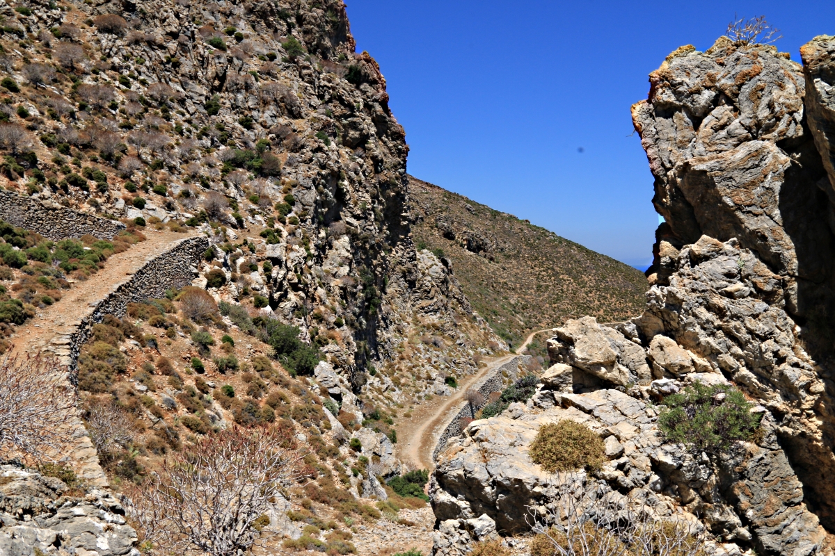
The cliff-path zigzags when it meets rock crags
The path forks at the centre of the shot, the cliff path goes left, the alternative continues up the valley to the crag at the top
Looking back down the path after forking left
On a whim I change my plan. I’m going to climb Koutsoubas. I’ve done it a few times before so I know I’m letting myself in for something a lot more taxing than originally intended but I’m feeling strong and have more than usual water.
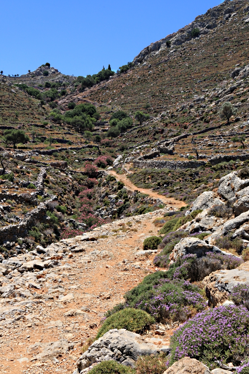
I pass the fork down to the beach at Despoti To Nero, vainly look for ripe figs on a couple of path-side trees, and come to the deserted village of Ghera where the good path ends.
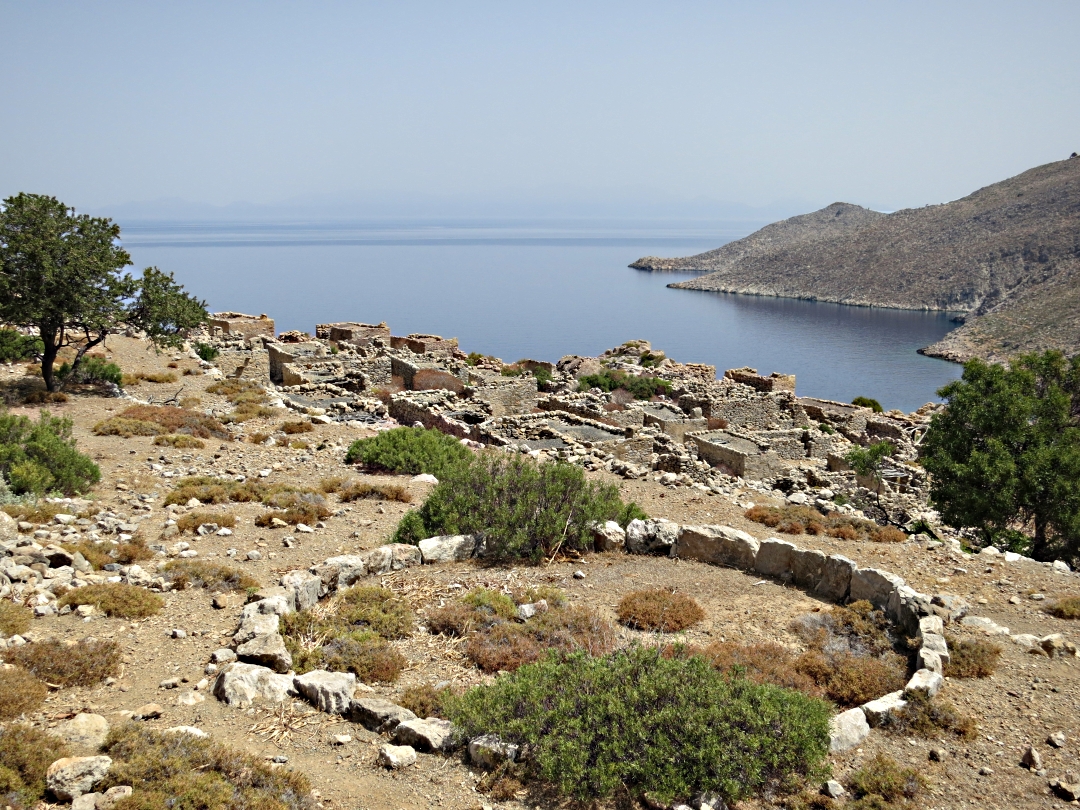
Looking across the deserted village of Ghera, the end of the good path
From here it is a difficult to find the mountain path, first tracing across thorn-covered abandoned agricultural terraces, through a clump of pink oleander in a dry stream bed and then down into a gulley before crossing onto the flank of the mountain. The path was created many years ago when donkeys would have carried all the building materials and supplies up to the telecom station on the top but now, like the telecom station, the path is abandoned and falling into disrepair, helped on its way by goats excavating for roots and by marauding plants.
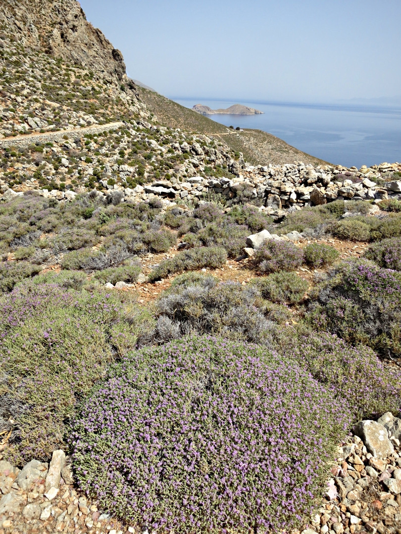
However, while the telecom station remains highly visible for miles around the path has all but disappeared. Not shown at all on the dubiously accurate SKAï map it zigzags up the mountain, marked in places by small cairns of the ‘stone on a rock’ variety. Part of the reason for the frequent changes of direction is to maintain an easier gradient for loaded donkeys but it is also to avoid what the Cornish call a ‘zawn’, a steep sided gulley running down to the sea. On previous occasions I have failed to spot a change in direction and once lost it is very difficult to find. The best option when that happens is to go straight up (or down on the descent) until the path is intersected again. Or not. It can mean navigating up very large, very sharp limestone boulders. Great fun but energy-sapping.

The mountain path crosses the top of the zawn
This time I was determined to find and follow the path properly all the way up and down. It had once been a well trodden donkey path so when the way ahead didn’t look right and I found myself trying to read the ground I knew that I had missed something. On several occasions I stopped to look around and there was another line going up at an angle behind me.
I didn’t hurry, partly to make sure I was on the path, partly to reinforce a few of the ‘stone–on-a-rock’ markers for coming back down and for others going up, partly to make sure I perspired as little as possible and so conserve water.
Perspire I certainly did. Any hope that there would be more breeze higher up was ill-founded. It was flat calm so nothing to dry the perspiration which sat on my arms, rivuletted own my front and back. In places the route is across sharp-edged rocks and I was finding it increasingly uncomfortable underfoot but that was just another distraction so I ignored it.

A snake used the rough edges of the rock in the path to help slough its skin

First glimpse of the deserted telecom station

…. getting closer
I was glad to reach the top and find a patch of shade behind the old accommodation block, bed frames piled up inside, now used only by goats and sheep. The smell was so bad in the heat that I would have passed out had I gone inside. The goats and sheep, getting out of the sun, panicked when they saw or heard me and ran out kicking up clouds of dried, powdered droppings which clogged the throat.
I found a bit of shade to eat a banana and nut bar and for a short siesta,. By now I knew it was important to conserve water and resisted the urge to swig it back, however refreshing it would have been. Temperatures measured and forecast are those in the shade over an open area of grass. By mid afternoon I had no doubt that in my patch of shade it was over 400C, the limestone rock and concrete slabs radiating stored heat. There was no breeze, only the occasional slightest of zephyrs. Once out in the sun again the it seemed like being hit by a hammer but the body quickly readjusts.
After a few photos to prove that I had been on top I headed back down.
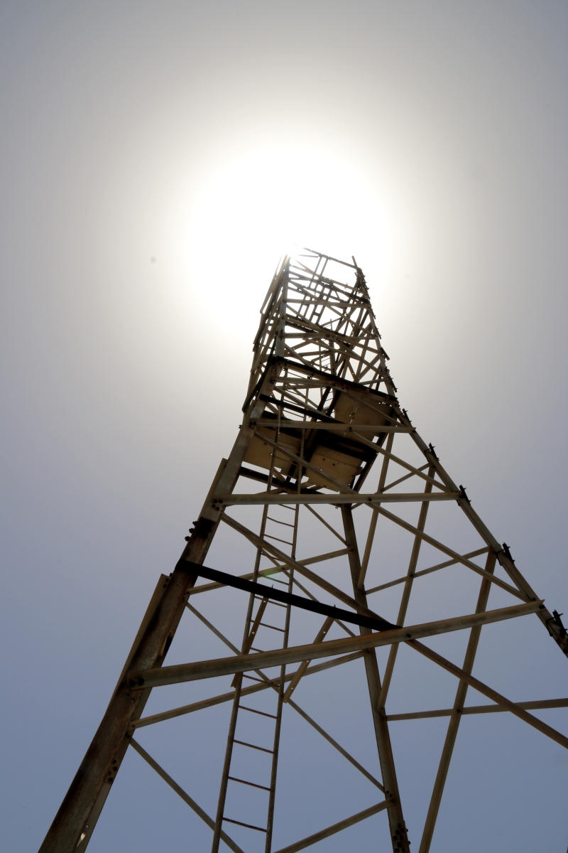
The telecom mast is still in place

Zooming in on the beach at Despoti To Nero, my original destination and now a very tempting prospect

Photographer on the edge: 500 metres straight down to cool blue sea
Going downhill with the pressure moving onto the front of the foot, I was more aware of discomfort especially on stony sections of path. Normally I prefer walking on rock because it is more certain underfoot than soil, sharp-edged rock giving good grip especially when going downhill. But it became more uncomfortable and the descent seemed to take longer than I expected.
I was glad to reach the shade of trees back at Ghera with the prospect of a good path the rest of the way. The ice in the water had all now melted but it had done its job and what was left was still refreshingly cold. Then I took off my sandals to empty out bits of grit and found the reason for the discomfort. Though there was still plenty of tread, the footbeds had collapsed and one had a 3cm split across the ball of the foot. No wonder it felt like walking in the moccasins I wear in the house in winter.
The sandals were new when I came out in April and have done less than 10 weeks of trekking in the mountain. As with car tyres there is a trade-off between good grip and hard-wearing qualities and I have always chosen good grip because of what I do, sandals soled with ‘spider rubber’, the same rubber as used on rock boots. However, I do expect more than 10 weeks’ wear from them. An issue to take up with the manufacturer. I may need to change my brand. And my avatar!!!!!
They are not completely dead but I can’t trust them now on extreme terrain and they would damage my feet on a long walk. It wasn’t this one trek which killed them. I’ve been walking sharp limestone trails since April and it must have been a gradual process But it was this inconsequential looking mountain which finally did for them.

Looking back across from the cliff path to Koutsoubas
The walk back from Ghera was uncomfortable but no problem, a relief to get back to shade at Agios Ioannis and drain the last drops of water before the final drop down to a cold beer in the taverna at Agios Stephanos.

A relief to be approaching shade at Agios Ioannis
x

Hi Barry, I find I have the same problem with sandals – they’re not built to last reasonable hard ground walking. The material they use is too soft. It looks nice on the shop shelf, but doesn’t stand up to good use! If you find a better brand, do let me know!
Thanks for your blog posts – I enjoy looking through them!
All the best, Stu
Hi Stu, Good to hear from you. I keep up with what’s happening with you and Jen through your newsletter.
The problem with sandals, like car tyres, is the trade-off between grip and durability. I go for good grip because of the sort of walking I do, plus the fact that I periodically climb stuff, and have worn the same brand and model for a number of years. I generally just about get one season’s walking out of a pair so less than 10 weeks is a bit of poser. Has the specification been reduced to cut cost? Am I doing harder walks? Is gravity getting stronger? I’m currently taking the issue up with the manufacturer and will be researching alternatives when I get back to the UK – only flip-flops and fashion sandals on offer on a small Greek island. I’ll keep you posted if I come up with anything.
Best wishes
Barry