
We were taught in school to prepare for exam questions of the type ‘Compare and contrast’ …. ‘The Hundred Years War and the Blitzkrieg’, ‘The East Coast of England and a South Sea Atoll’, ‘the character of Jane Austen’s Emma and Desperate Dan in the Beano’, ‘Human Reproduction and that of beans and other legumes’. The pairs were not as disparate as the above but they were designed to make you think and analyse rather than simply to describe things. An invaluable skill.
I’m back home in Wales for a short time and one day went for a walk with friends along a section of the 15 mile Glamorgan Heritage Coast. I couldn’t help but draw comparisons with the previous 4 months on Symi.
One very stark contrast was the weather. At this time of year on Symi cloudless sky is the norm. No need to look at weather forecasts, it will be sunny and hot every day. For two weeks before I left, afternoon temperatures had been over 40oC. Thankfully my strategy of going trekking in the mountains in the middle of the day from when I arrived on the island in early April meant that I had thoroughly acclimatised to the heat. My metabolism had changed, blood thinned and other physiological adjustments completed (check the science of it).
It has been a cold summer in the UK, in the North and West anyway, and because of the acclimatisation to Greek heat I have been cold since I arrived back. Though providentially we had one of the rare sunny days of the summer for the trip, with temperatures only slightly above 20oC I was just about comfortable as long as I kept moving. On the odd occasion when temperatures had been higher it was grey and humid. The insipient arthritis in my hip ached for Symi sun.
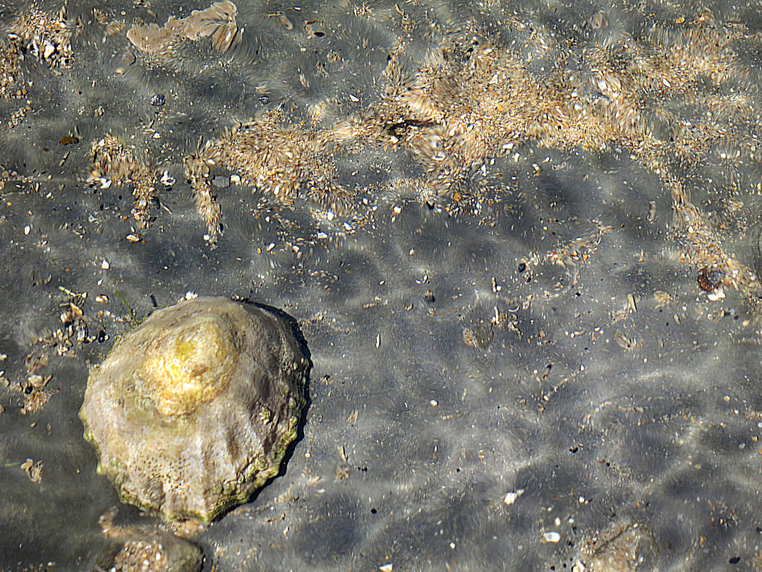
Another sharp contrast is the tidal range. On Symi, as in the rest of the Aegean, you can dump your stuff at the water’s edge and go for a swim or climb the cliffs and be confident it will still be there and dry when you get back. In most places there is no discernible variation in water level. Indeed sailors class the whole of the Aegean as ‘Non-Tidal’. Exceptionally, walk from Pedi to Agios Nikolaos beach and for the first few hundred metres you are aware of the 6 inch tidal variation because sometimes you have to balance on the rocks to stay dry-shod.
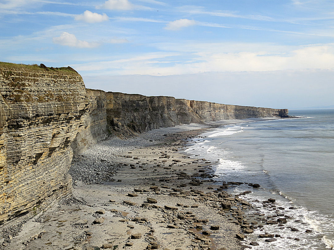
Not so the Severn Estuary which has the second highest tidal range in the world (up to 15 metres) after the Bay of Fundy between New Brunswick and Nova Scotia (max 16.3 metres). This has a number of major consequences.
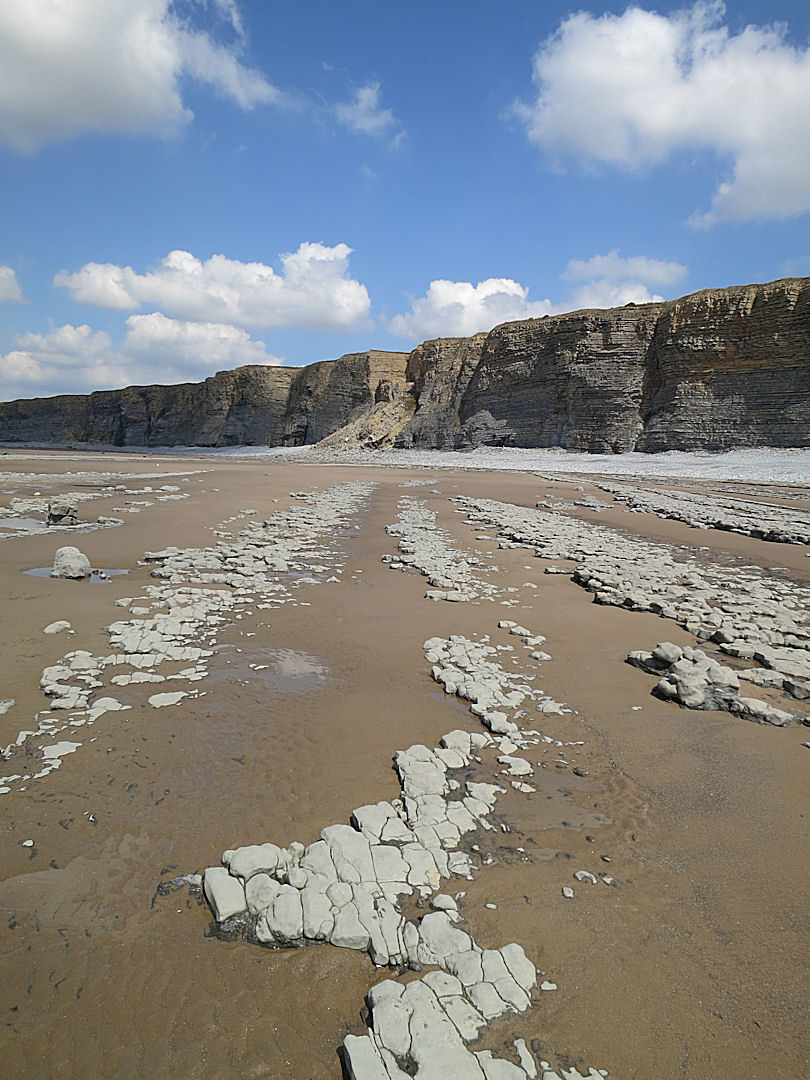
First, in sharp contrast to Symi where variations in sea level can be ignored, it is essential to check the times of tides before you commit to walking along the spectacular foreshore of the Glamorgan coast. On the day, a low tide at 12.15 gave us plenty of time to get around the promontory south of Macross (a village, not a Greek island), meander leisurely westward over the rocky and deeply fissured wave-cut platforms and expanses of sand to the next promontory south of Monksnash.

Rounding the promontory, cliffs curving westwards to the next headland, wide expanse of rock and sand exposed at low water.

Setting out on the fissured wave-cut platform

Playing with the rounded pebbles

Sequence of dipping rock strata, pebbles and sand curving towards the cliffs
Pointing towards a major instability in the cliff

The centre of the curving bay is a broad expanse of sand, empty apart from us and a large flock of herring gulls
In the centre of the foreshore between Macross and Monksnash, sand backed by pebbles of storm beach

Approaching the Monksnash headland

Writhing at low tide
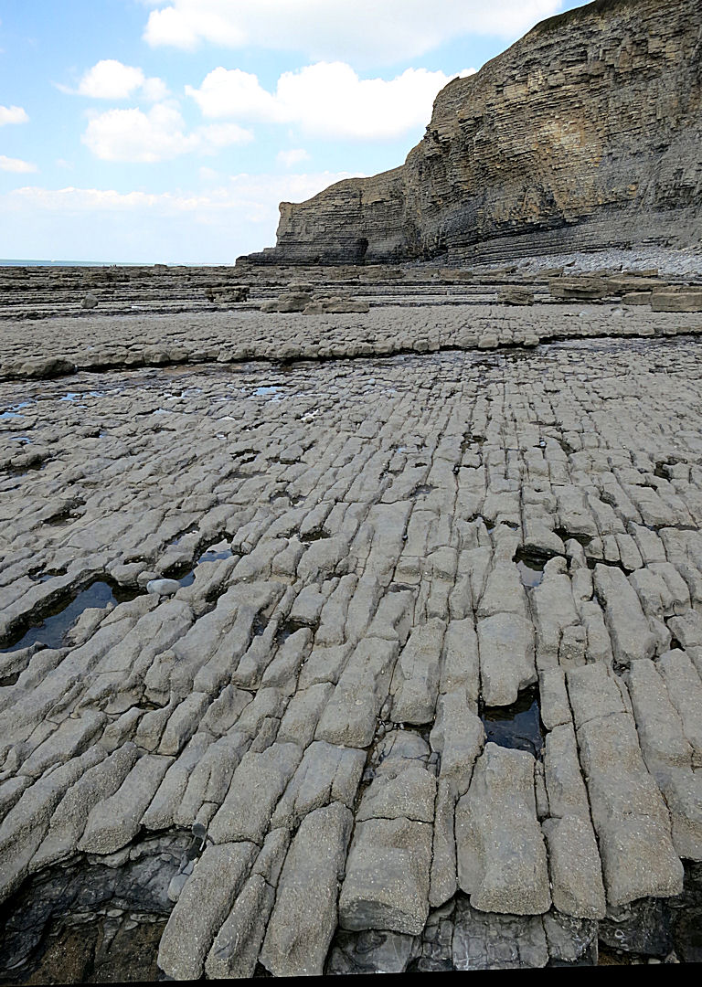
In places the fissuring is so symmetrical it looks like a paved surface (apologies for the lack of contrast, the sun went behind a cloud)

Though not known as a shipwreck coast, ships still come to grief here
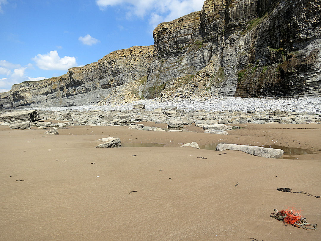
As planned, once there, we walked up the short valley to the village and had a very enjoyable lunch in the garden of the acclaimed Plough and Harrow pub. However, dawdling over my tuna-mayo baguette meant that when we got back to the foot of the cliff for the return journey the tide had swept in covering most of the area we had previously walked.
We could still have fairly easily traversed around the base of the cliff at Monksnash. By staying on the steep pebble storm beach we could also get along the whole length of the shallow crescent-shaped bay at the foot of the cliffs though it would have been slow going, I reckoned at least 1½ hours without photo stops. But I knew from previous experience that it would be foolhardy to assume we would be able to round the cliff at the far end. I had checked the tidal range for the day which at this point along the coast would be about 36 feet. Applying the ‘Rule of Twelfths’, a rule of thumb for estimating the variable flow of tides, I knew that in the middle two hours between high and low water the level would rise by 18 feet. We were now into the first hour of that maximum rise. I didn’t fancy waiting on the storm beach until towards midnight for the falling water to clear the headland again.
Looking back towards the Macross headland, all of the sand and much of the wave-cut platform now underwater.
No problem, we took the cliff path. Not as dramatic but a safer option and when an hour later we arrived back at the start point it was clear that we would not have made it back before the tide was tight against the base of the precarious cliff.
Another effect of a large tidal range is that though the water sweeps in rapidly and out again just as fast, refreshing the beach every 6½ hours, it leaves behind rock-pools which in places add to the water seeping from springs in the cliff and drain back to the sea slowly, eroding channels in the sand. It’s a simple rule: no tide, no rock-pools.

Some of the rock-pools are formed against an edge of rock with a sandy bottom
….others are rock-floored

Patterns in the water draining back to the sea

Pools are formed in depressions in the sand as water flowing around rocks scours a hollow
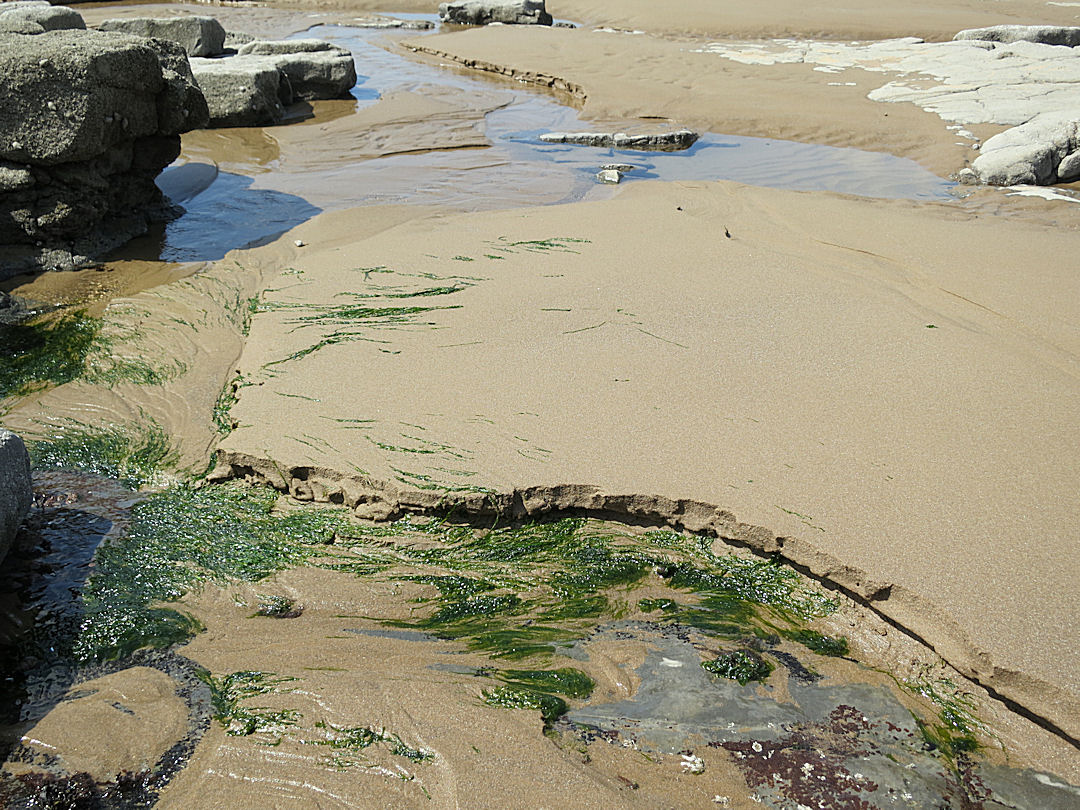
In places where water draining from pools joins with spring water from the cliffs semi-permanent streams are formed, scouring channels in the freshly deposited sand after every high tide
Superficially, one similarity between the coastline of Symi and that of the Glamorgan Heritage Coast is that on both the cliffs are limestone. But the limestones are very different. On Symi it is ‘massive’, jagged and sharp edged, sculpted mainly by solution erosion, in most places very stable. On the Glamorgan coast the limestone is bedded, interleaved with narrow bands of weakness making the cliffs highly unstable and suicidal to attempt to climb. Signs at the access points warn of the danger of even getting close to them. The many large rectangular slabs of rock at their foot and on the sandy beach are testament to this instability and the inherent danger.
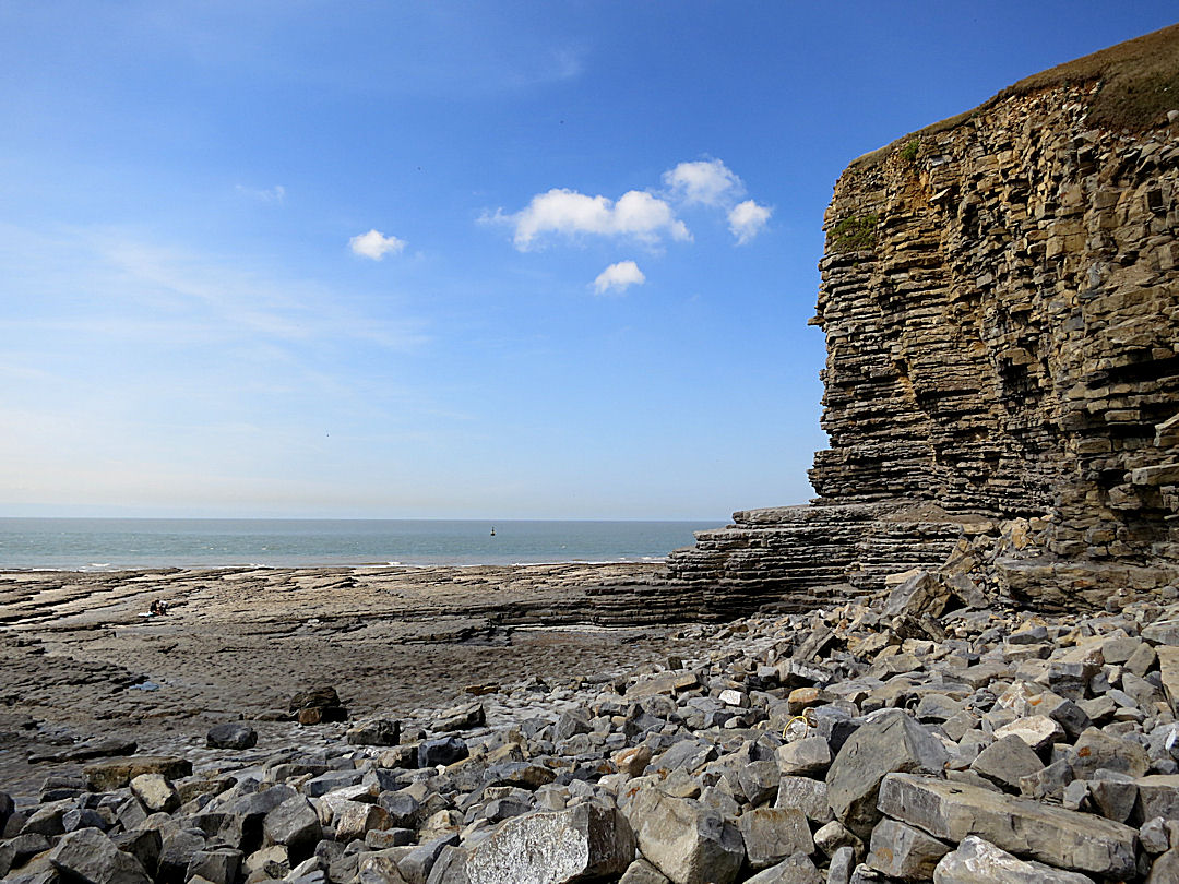
Large rectangular blocks on the foreshore, an indication of the instability of the cliffs at the beginning of the walk near Macross

Giant Jenga …. just don’t be there when it collapses
I’ll be back in Greece soon but this time on the volcano that is the Dodecanese island of Nisyros with probably some of the most spectacular treks in the Aegean.
For more images of the Glamorgan Heritage Coast see my ‘aartworld’ web site:
http://www.aartworld.com/Glamorgan.htm

re read the Glamorgan coast story this morning ‘marvellous– The changing scenes. Mark 13.31 thankfully one thing that never changes. adieu Rich and Pad
I really hope you mean au revoir and not adieu !!!!!!!!!