
But one day at a time they say
And if you’re knowing where you’re going
You’ll be finding your way.
‘Long Way Back’ from ‘Freedom Run’ by The Rifles, 2011
Some years ago, more than I care to remember or commit to words, friends and I did the Four Peaks Walk in the Lake District (that’s ‘The’ Lake District in England, the proper one). The peaks, Skiddaw, Scafell, Scafell Pike and Helvellyn, are those above 3,000 feet and, starting and finishing at the Moot Hall in Keswick, the challenge is to cover the 50 miles and 7,000 feet of ascent inside 24 hours.
After 30 miles and having completed the first three, it started to hurt. We then had a long trek across rough terrain to Helvellyn, climb it, then drop back down and return to Keswick in the dark. On the way down a scree slope on the flank of the mountain in deep moon-shadow, my foot came out to the side of my left boot, the uppers split from the sole. It began to hurt even more.
The finish was along the road and, much as I hate walking on tarmac, at this stage in the trek I was glad of a level surface. Grit your teeth, one foot in front of the other, keep up the pace, and think of anything except the pain.
Into our stride, minds elsewhere, a car stopped alongside us at about 02.00 and the driver, a doctor on the way back from a call-out, offered us a lift the remaining miles into Keswick. The surviving member of the group and I looked at each and, with profuse thanks, declined. We were too close to the finish after such a long time – over 22 hours – to capitulate now. We finished in 23½ hours, determined never to do it again.
Recollection of this sprang to mind towards the end of a trek which I committed myself to full of energy and enthusiasm one morning on Symi, with an early start (09.30 – early for me) and a long walk taking me through the mid-day July heat.
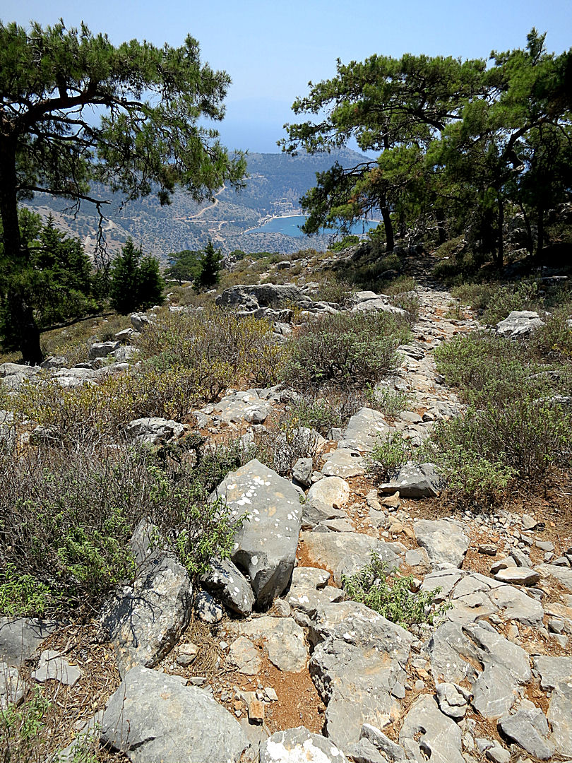
As so often, first up to The Viewpoint (Walk 1 on the Greek Island Walks page) and then a steep and sustained zigzag climb on an old kalderimi (mule path) up to The Tarmac, the ridge-top road to Panormitis Monastery at the other end of the island. About 1,000 feet above the town but no problem, I was by now acclimatised to the heat and the early start gave a relatively cool 30-35oC, afternoon temperatures going above 40. A short section on the road which has destroyed the old routeway by bulldozing rubble down onto it. Back onto the kalderimi where the road can’t sustain the gradient and hairpins back to gain height, followed by a very rocky, tortuous and satisfying path, crossing the top of the Vasilios Gorge before going into cypress and pine woodland and climbing up a limestone crag to the mountain-top Agios Stavros Polemou monastery with spectacular views all round.
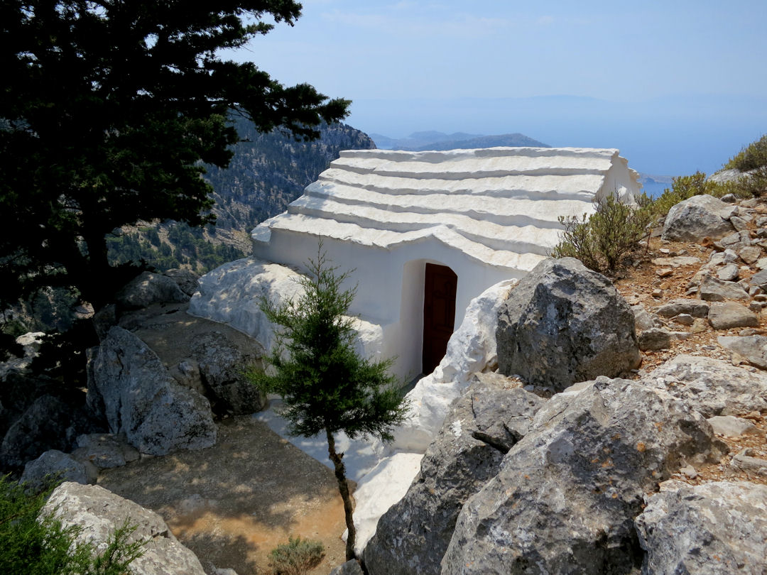
The tiny, very simple church of Agoio Anargiri at the entrance to the Stavros Polemou monastery
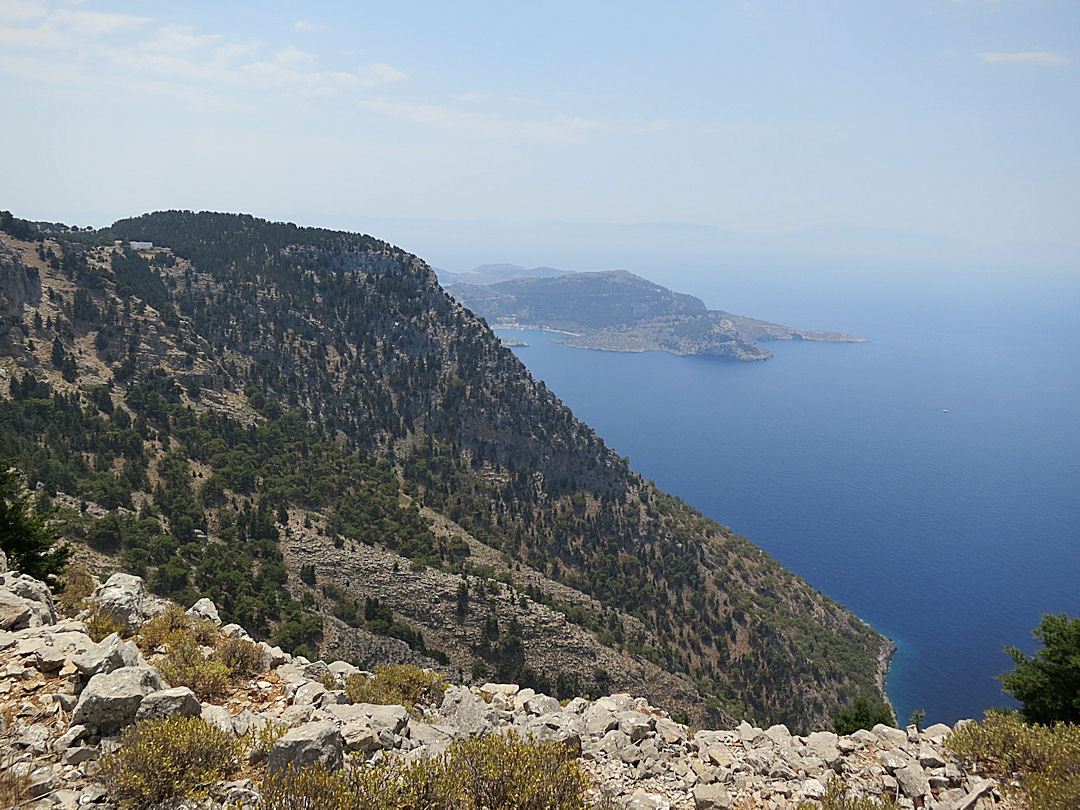
View from the compound of Stavros Polemou with Megalos Sotoris further along the cliffs and Panormitis with its large bay in the distance
Dropping down the crag to the Panagia Panaiidi monastery at its foot I can never resist going into the peaceful, shady courtyard to take a look at the hochlakos (black and white pebble mosaic) floor and 17th Century frescoes covering the inside of the old church.
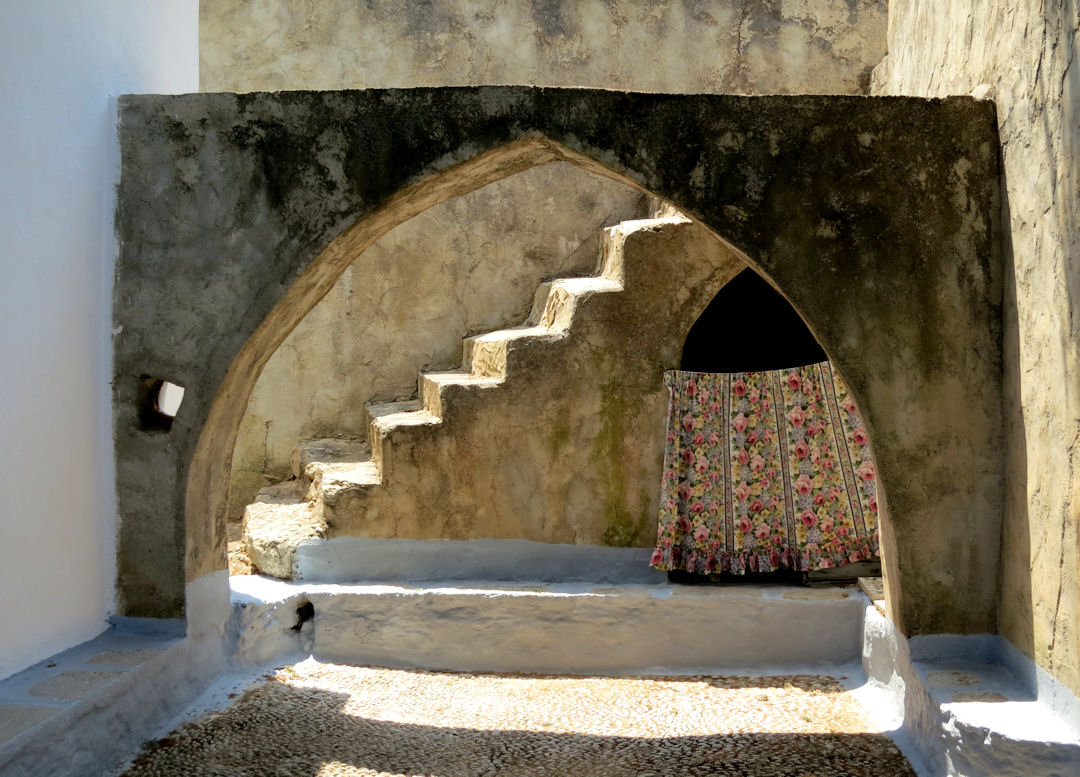
The shady courtyard of Panagia Panaiidi
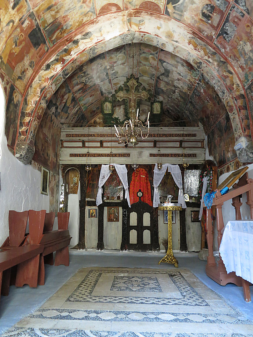
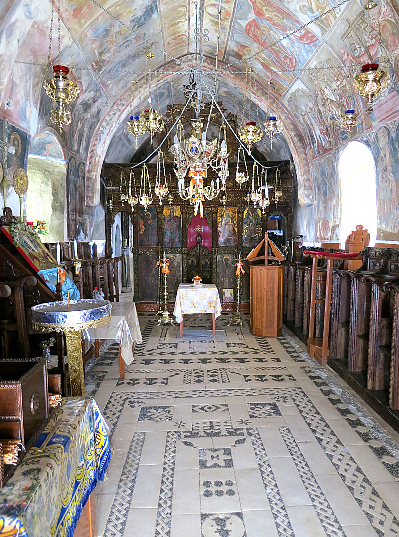
The hochlakos floor and frescoed walls of Panagia Panaiidi
More rough path leading to another monastery at the side of The Tarmac (the walk this far is described in the as yet incomplete Walk 4 on the Greek Island Walks page). From here the route goes onto a section of undisturbed old kalderimi paralleling and above the road before The Tarmac cuts through it. A short drop down and then road walking for a few hundred metres to Agios Dimitrios chapel …. and the island’s polar bear, a wonderful bit of funky art.

An undisturbed section of kalderimi above The Tarmac
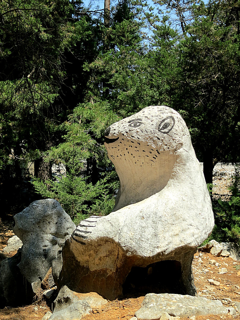
The Symi polar bear at the Agios Dimitris chapel
Another few hundred metres of road to reach the high walls of the fortified Agios Megalos Sotiros monastery. Usually locked up, on the day it was open for cleaning and maintenance work, well worth a look inside with a cool hochlakos courtyard and impressive and well preserved frescoes in the church. As I have done before, I made a small diversion to go up the bank at the side of the monastery to the edge of the cliff which drops about 1,500 feet to Fakounda Bay with views of the curving string of small Diavetes Islands, across back to Stavros Polemou and down to the extensive monastery complex of Panormitis and its sheltered anchorage.

The courtyard of Agios Megalos Sotiros
Inside the church
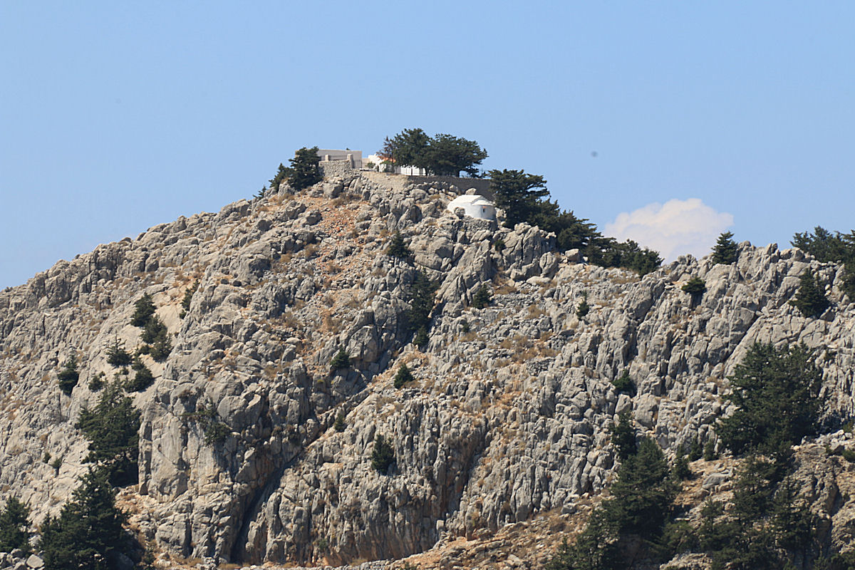
Zooming in on the Stavros Polemou Monastery from the cliff top behind Megalos Sotiros
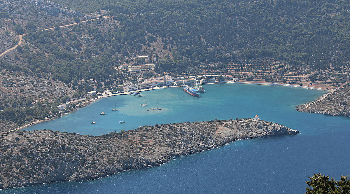
….. and looking the other way to zoom in on Panormitis bay and the monastery complex
Opposite Megalos Sotiros is a concreted track with a path off to the right after a few metres which winds through the cypress woodland to the Byzantine Stone Wine presses, ten of which have been restored by the efforts of local historian Kritikos Sarantis (described in a small booklet obtainable from his bookshop opposite the Meraklys restaurant behind the head of the harbour). The first of the restored winepresses is alongside the path but the others involve another short diversion up to the right.
The path towards the Byzantine stone wine presses

The first of the restored wine presses alongside the path

Looking down on two of the others

… detail of one of them
Returning to the path and continuing along it soon reaches yet another small monastery with a huge shade tree, a good spot for a banana-break ….. but not this trip, too much ground still to cover.
I had trekked to this point a few times in the past but I had decided before setting out that today I would continue further. Into the unknown. The onward path, like so many others, is not marked on the SKAÏ map despite the claim by the cartographers “to explore every inch of the area we are mapping” and to “walk each and every one of those trails”. The trail was clearly a very old routeway, passing a permanent pond and a farmstead, marked periodically by red paint splodges and heading towards Panormitis monastery. It zigzagged down at donkey friendly gradient to emerge from the woodland on the mountainside overlooking Panormitis Bay at the top of the series of hairpin bends which drop the tarmac road to sea level.
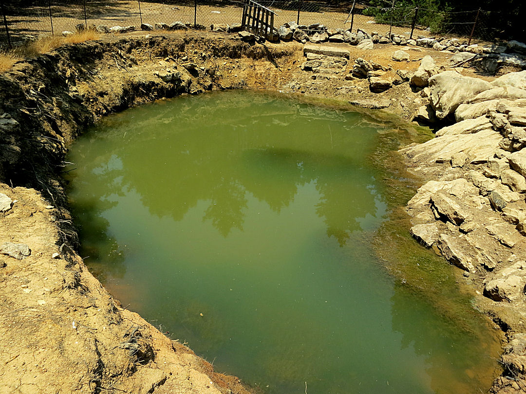
The permanent pond alongside the old pathway
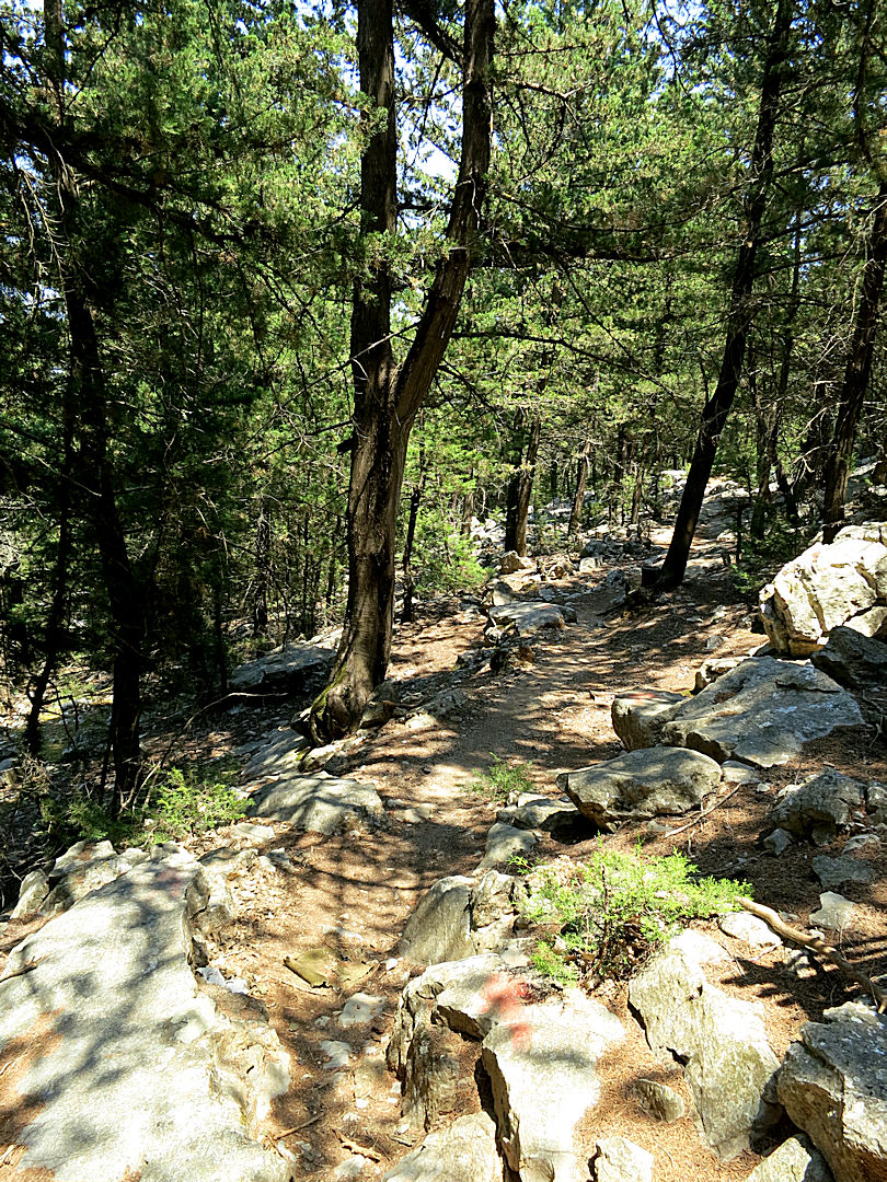
The pathway through the woodland

…. emerging at the top of the hairpin bends in The Tarmac, Panormitis about 1,300 feet below
Enquiries of others had warned that the construction of The Tarmac had obliterated the old route and the only way from here was to take to the road. I declined to do so. Five miles of tarmac held no appeal for me.
Instead I set out to walk back to Horio by a different route. Significantly further and still involving sections of road but by no means the tedious tarmac trudge of continuing to Panormitis. Until the bulldozer intervened the line I was following had been an ancient routeway, the road now connects the sections which it hasn’t destroyed. In places the remaining kalderimi was magnificent. I blanked my mind on the road linking the interesting bits, or drooled at the thought of the cold beer just out of reach ahead of me. So there were fewer diversions to look at stuff on the return. I was focused.
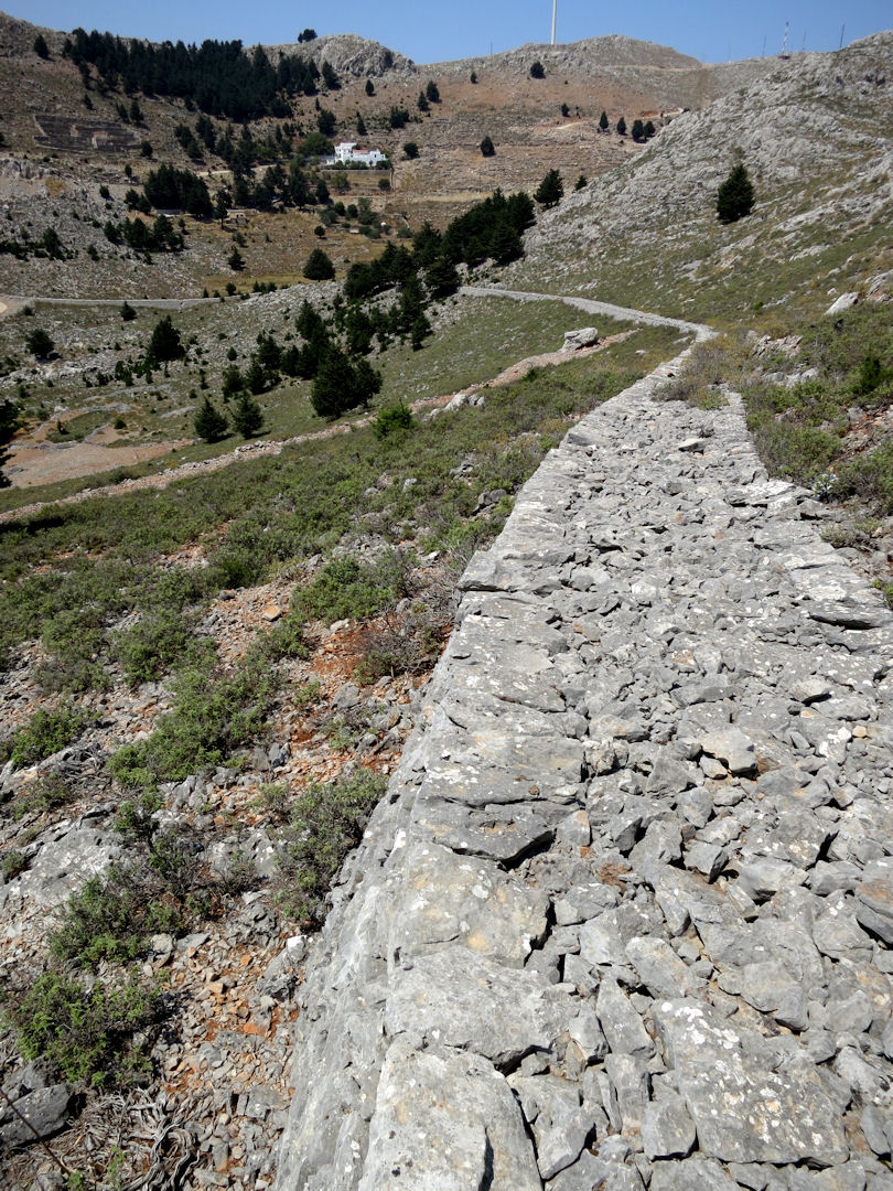
The sweeping curve of a section of exceptionally well preserved kalderimi
Not as long as the outward route but, wilting slightly in the heat of the afternoon, it was a long walk back. After 9 miles and walking without a stop for 5 hours, I was on the penultimate linking section of road and just approaching the next and most dramatic bit of path when a farmer stopped his pick-up, piled high with foliage from trees and shrubs cut to feed the goats, and offered me a lift back to Horio. Not as difficult a decision as that on the way into Keswick all those years before, I declined with thanks.
