
As I recounted in the blog, in July I trekked via many distractions to the ridge-top Lappatoniou Castle on the western-most peninsula on Symi. Then in early in October I went back with friends who, after trial and error and the judicious wielding of secateurs, had found an old footpath which they had been told about between there and the monastery of Agios Ioannis Theologos on a path at a lower level on the ridge. The path to the monastery was very indistinct so I went back again a few days later on my own, partly to reinforce it in the little grey cells but also to explore an old settlement on the ridge-top. I’m increasingly fascinated by reminders that communities once subsisted on small rocky islands like Symi and several times this summer I have set out to try to find out more. In many cases it is a matter of trying to interpret the fragmentary remains of what in their day were probably significant communities.
The trek to the castle was just as interesting as previously though this time in order to make more rapid progress I ignored the many distractions en route. The barren rocky mountainside under blue skies seems all the more appealing now I’m home and surrounded by a green but increasingly soggy trudge to the top of the ridge behind the house.
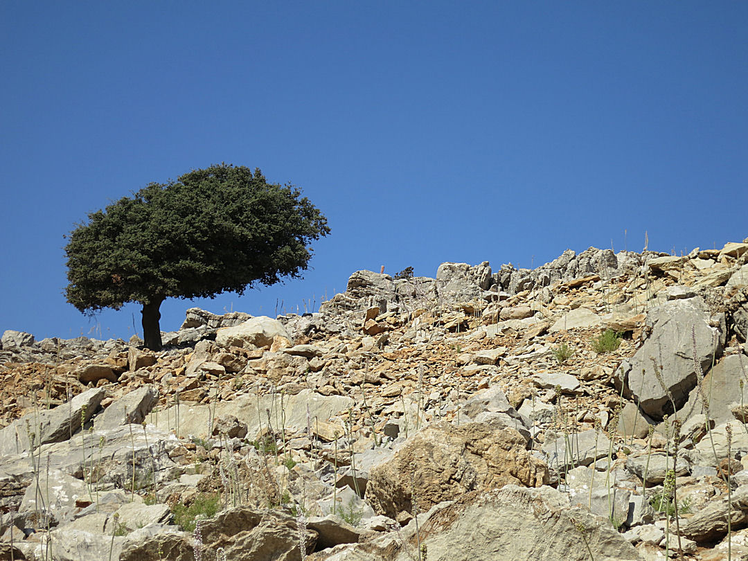
A lone cypress tree skylined on a barren rocky mountainside
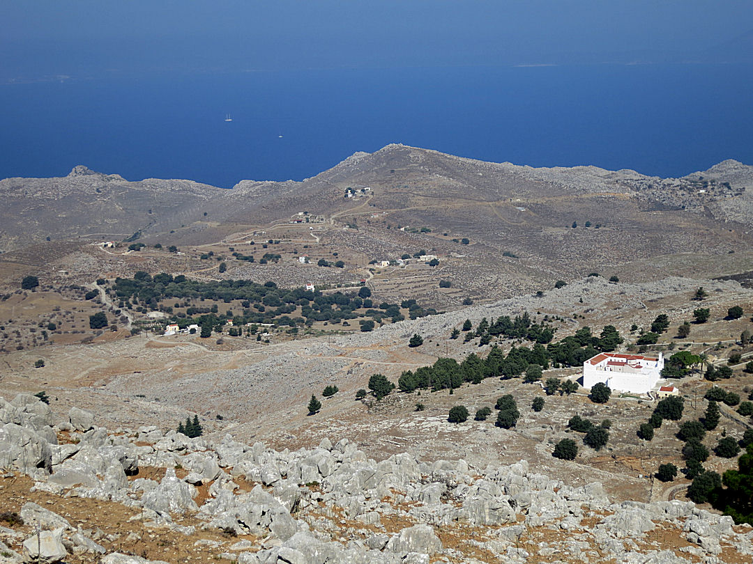
Looking across the mid-level plateau and the fortress-like Roukouniotis monastery

The rocky approach to the ridge-top castle
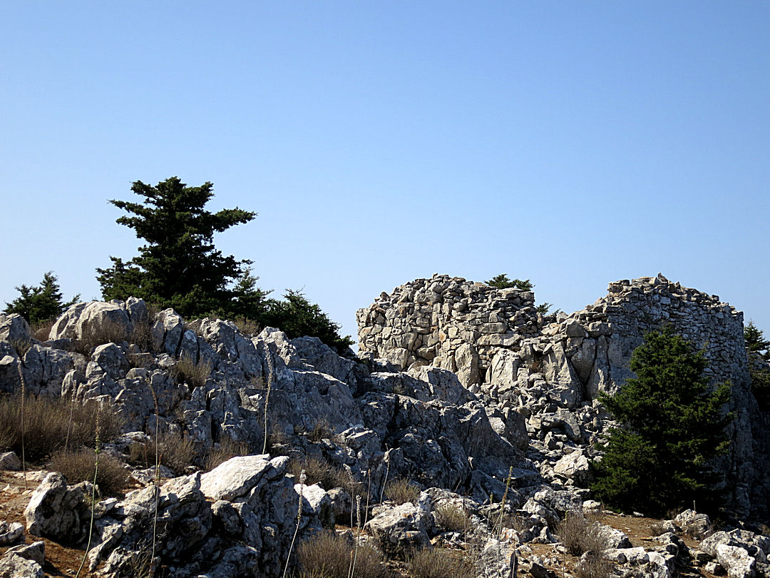
the castle on top of vertical crags
I didn’t linger at the castle. Not shown on the SKAÏ map, nor mentioned in any of the booklets on walks on the island, the path onwards is little trodden now and more difficult to follow. It traces along the crest, sometimes through the top of the tree-line of the cypress woodland which blankets the north side of the ridge, sometimes edging the steep vertical, barren rocky drop to the south.
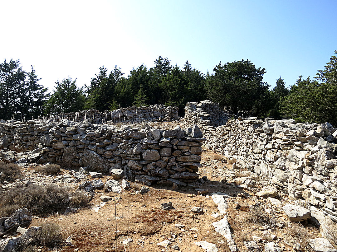
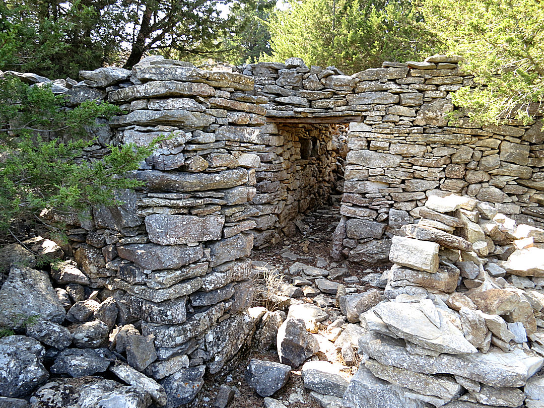
In 15 minutes or so the thin path reaches the stone walls of the enclosure around a long-deserted settlement in small ridge-top col. Like the settlement I found near to the edge of the sea on the east side of the Kokkinochoma Peninsula there were extensive and still largely intact rough-built stone enclosure walls and just a single house. However, my guess was that this settlement had been abandoned considerably earlier as there were no signs of doors or shutters and fewer of the roof timbers survived. The stout wooden lintels bridging the doorway through the nearly metre-thick stone walls were well rotted, encouraging a rapid transit across the threshold, accelerated even more by the swarm of wasps buzzing defensively in the entrance.
The single room of the dwelling was large and would probably have housed a moderate sized group of people. It showed some sophistication in that it had a number of square storage spaces built into it.
Approaching the entrance into the outer enclosure

The entrance to the smaller inner enclosure where the house is situated, marked by large stones, an indicator of prestige
The tiny ‘front garden’ and the door to the house
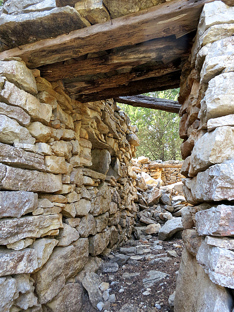
Thick stone walls and stout wooden lintels

Looking towards the far end of the house

…. and looking back towards the entrance
Just beyond the enclosure and slightly higher along the ridge was the remains of a threshing circle, large stones marking its edge though without a hard base like that at Gria. Difficult to spot among the many rocks which cover the small plateau, it was very roughly formed and abandoned long ago.

Looking along the ridge-top towards the threshing circle

…. and just in case it’s not clear I’ve marked it in red

From the ridge above the house looking towards the island monastery of Agios Emilianos

…. and another view of the threshing circle
To this point the direction of the path had been consistently south of west. From the bottom entrance of the enclosure it turns sharply north-eastwards heading directly towards the monastery of Agios Ioannis Theologos, clearly visible, white through the trees. Within a few metres the path reached another broken threshing circle.

The second threshing circle just below the enclosure

Looking north-east to the monastery of Agios Ioannis Theologos, white among the trees
The immediate thought was that to need two threshing circles there must have been extensive cereal growing nearby, a supposition supported by the fact that the path to the monastery drops down a whole series of crumbling terraces which would have once been cropped but are now colonised by thick cypress woodland. Google Earth shows some of the broader terraces lower down the mountainside close to the monastery.
Threshing circles, terraced fields and stone-walled enclosures together indicate that this was a mixed agricultural economy. Animals would have been penned within the enclosures which are too rocky to have been cropped, possibly fed for some of the year on the straw from the cereals after threshing.

Satellite image from Google Earth with the walls of the settlement enclosure bottom centre, the monastery centre top and remains of terraced fields visible to the left of that
Though my main interest on the day had been to visit the old settlement, the trek was not all about crumbling ruins, fascinating as I find them. Like all walks on Symi there was much spectacular scenery and fascinating wildlife.

Even in October the vividly coloured male Red Veined Skimmers still disport themselves on the top of stalks

More and more flowers open as Autumn gets underway

Stunning views on one of the most dramatic kalderimi on the island, and indeed in the whole Aegean,on the way back to Horio

The route plotted on Google Earth
x
