A sunset stroll

The weather forecast for Saturday in Old South Wales was for wall-to-wall sunshine.  A real bonus after days of grey skies.  As I struggled out of bed and the sun slipped over the ridge on the other side of the valley it certainly looked promising.

Seen from the balcony of the house, the sun coming over the ridge opposite

Seen from the balcony of the house, the sunrise over the ridge opposite

........ zooming in

…….. zooming in

For the morning I had pencilled in a trip to a farmers’ market in Cardiff to replenish supplies of ‘block’ butter and eggs.  Since re-homing our hens when I went to Greece for the summer in 2010 I haven’t found any eggs which get anywhere near our own in terms of quality and freshness.  Since then I have bought a total of three 6-packs of apparently ‘free-range’ eggs and enjoyed none of them.  The block butter, 6 inches square and sliced as you want it, is very salty and reminds me of what they made on my uncle’s farm in Carmarthenshire when I was a lad.  I homed in on the Roath Farmers’ Market and Trecastle Eggs after a recommendation by people I met and walked with on Nisyros.  Now I go to restock every couple of weeks and my cholesterol level is taking a beating but I enjoy the food.   Prices are higher than supermarket but then so is quality and there is no marginal cost as I travel on the bus using my Old Fogey’s Bus Pass.

I got back home at 13.05 full of enthusiasm to get out in the mountains.  With the return to GMT from BST it now gets dark between 16.30 and 17.00 so I didn’t have much time to play with but within seconds I hatched a plan.  The late start and the short day meant I could take in the sunset which from a ridge-top was an appealing prospect (pardon the pun).  The obvious choice was to go up the 425-metre Garn Wen, the mountain behind the house.  An hour to the top and another back down.  But I fancied something different.

Earlier in the year I wrote a chapter for a book called Bus Pass Britain Rides Again on service number 30 to Brynmawr, a bus I have used many times. Critically for today it would take me up to the Whistle Inn close to watershed at the top end of the Eastern Valleys with a great walk back over the mountain.  A quick check on bus times on the internet and I had 40 minutes in which to grab something to eat (scrambled eggs with peppered salami on buttered toast in case anyone is interested), change into walking gear and get to the bus stop.  No problem!  Galvanised by the prospect of reaching the high point on the ridge in time for what promised to be a spectacular sunset, I was focused and, with everything achieved, had a couple of minutes in hand.

The Whistle Inn is at the foot of the north scarp of Coity Mountain, the highest ridge of the South Wales coalfield and part of the Blaenavon World Heritage Site, a key location in world history as one of the centres of the Industrial Revolution.  Now the attractions of the area are the echoes of the past and the fact that it fringes the Brecon Beacons National Park from which it is in many ways indistinguishable in landscape terms.

I started walking at 15.10 in deep shade with the low winter sun behind the ridge and the air distinctly cold which, together with enthusiasm and determination to get to the top before the sun sank in the west, propelled me pretty rapidly upwards.

I was not disappointed.  Broaching the top of the scarp I came out of the shadow of the mountain and into the sun, long shadows thrown across the tussocky grass of the high, undulating moorland.  Continuing up to a high point of about 550 metres delayed its setting behind the ridges to the west which receded in a golden glow, fiery sword slashes of cloud across the front of the sun as it sank slowly, sharp in the cold, clear air.

Ridges receding into the golden glow to the west

Ridges receding into the golden glow to the west

Fiery sword slashes of cloud

...... zooming in

…… zooming in

Photography on fiery red grass

Photographer and fiery red grass

Crystal clear in the cold air, flat topped Pen-y-Fan and Corn Du, the core of the Brecon Beacons, 18 miles to the northwest

Crystal clear in the cold air, flat topped Pen-y-Fan and Corn Du, the core of the Brecon Beacons, 18 miles to the Northwest

I dawdled on the top until the sun had finally disappeared from sight and then set off rapidly eastwards and homewards knowing that I needed to get off the mountain before dark.  It’s not a dangerous mountain, no precipitous drops to wander over, but I didn’t fancy floundering around in the deep troughs between the knee-high tussocks, nor wandering into one of the bogs.  As I dropped off the open mountain into the fenced fields I also needed to see where the next stile was so I could take a line towards it and not grope my way in the dark trying to find crossing points.

The final obstacle before reaching a rough track was to find the way to a low footbridge across a small stream running from old colliery workings with uncomfortable boggy bits all around.  As I reached the track, now in darkness, I spotted a sign erected at this end of the path “DANGER!  KEEP OUT’.  Not much help when approaching from the ridge top.

Lone tree silhouetted on the ridge as I dropped off the mountain to the East

Lone tree silhouetted on the ridge as I dropped off the mountain to the East

.......... and zooming in

………. and zooming in

High ISO setting penetrates the near-darkness  to show the final stile and the low footbridge through the pale tussocky grass

High ISO setting penetrates the near-darkness to show the final stile and the low footbridge through the pale tussocky grass

Dark in the valley, last glimmer of sunset beyond the ridge to the West

Dark in the valley, last glimmer of sunset beyond the ridge to the West

Half an hour along the track in near blackness looking down on the town below switching on the lights and I reached civilisation and a bus stop  for the X24 to get me back home.  Total walking time 2½ hours.  Total time from leaving the house to arriving back, 4 hours.

A very productive and enjoyable sunset stroll.

Posted in Autumn, Hiking, History, Landscape, Mountains, Pontypool, Wales | Tagged , , , , , , , , , , , , , , , | 3 Comments

Autumn colour in Grey Britain

Spring and summer were late arriving in Grey Britain this year, the growing season in the garden estimated to be about 3 weeks behind the usual annual pattern.  Similarly Autumn has been late to arrive with trees holding their end-of-summer tired green colour until only recently.  In normal years by now trees would be bare, the ground carpeted in leaves.  A bonus has been that in the Blue House tomatoes which grew to 12 feet high despite total neglect while I was In Greece, entwined in agaves and a palm tree, have continued to ripen fruit into November.

Tomatoes ripening into November

Tomatoes ripening into November

Because I’m at home for a relatively short time before heading off to the Canadian Rockies I’ve been concentrating on getting the garden sorted out and the late arrival of frosts has helped enormously.  But it has meant that I have done little walking other than to the shops and the occasional foray up the mountain.

Not that I have been deprived of Autumn colour.  What I pretentiously call the ‘Acer Glade’ in the garden, the bottom quarter next to the canal which I have been planting up to reduce the maintenance required when I’m old and feeble, is starting to look good with a multicoloured canopy over most of it as trees grow into each other.  Even on grey days the colours are striking, when it’s sunny they are luminous.

Green until a few days before, now gold and mottled

Green until a few days before, now gold and mottled

A deep purple variety of Japanese maple turns bright red even on a grey day

A deep purple variety of Japanese maple turns bright red even on a grey day

Golden throughout the summer, turning more vivid in autumn

Golden throughout the summer, turning more vivid in autumn

Lime Green palmatum dissectum variety turns yellow and gold

Lime Green palmatum dissectum variety turns yellow and gold

At the front of the house a mountain ash is red even under black cloud

At the front of the house a mountain ash is deep red under black cloud

.......... bright gold under blue sky

………. bright gold under blue sky

A newly laid carpet in the Acer Glade

A newly laid carpet in the Acer Glade

Silver birch turns golden brown, exaggerated by the setting sun

Silver birch turns yellow but golden brown in the setting sun

Surrealistic golden glow at the bottom of the garden as the sun rises

Surrealistic golden glow at the bottom of the garden as the sun rises

Carrying a camera all the time when I’m out and about has also paid dividends, particularly walking to the shops through the local park and walking ‘green corridors’ in the densely built up areas of Greater Manchester where my daughter lives.

The bandstand an avenue of ornamental cheery trees in the local park

The bandstand and avenue of ornamental cheery trees in the local park

Bright yellow despite grey skies

Bright yellow despite grey skies

Evening sun on the Trans Pennine Trail

Evening sun on the Trans Pennine Trail

Leaden sky towards the very end of the afternoon bleaches but cannot hide the colour

Leaden sky towards the very end of the afternoon bleaches but cannot hide the colour

 Heaton Mersey Pond in the evening gloom

Heaton Mersey Pond in the evening gloom

Leaves shed on the pond as well as the path

Leaves shed on the pond as well as the path

Setting sun gives a golden glow to everything as it sinks lower on the Trans Pennine Trail

Setting sun gives a golden glow to everything as it sinks lower on the Trans Pennine Trail

x.

Posted in Autumn | Tagged , , , , , , , , , , | 2 Comments

A walk to the pub

“What time do you call this?”  Predictable response, given that I had arranged with friends to meet up for a pub lunch at 12.00 and arrived at 13.45.

The thing is, I had decided to walk.  My ‘local’ is thirty minutes along the towpath of the Monmouthshire and Brecon Canal, very pleasant at any time of year.  But we were meeting in Abergavenny and the walk was via the top of the mountain behind the house, north along the ridge before the steep drop down at the other end.  Along the eastern edge of the Brecon Beacons National Park, the route is altogether about 14 miles and 4 – 4½ hours walking depending on conditions and how often I stop to take photos.

Simple maths: to arrive by 12.00 I would need to leave at 08.00.  However, I find that eight in the morning is an uncomfortably early start for physical exercise especially on this walk as the first hour sees most of the height gain.  Instead, I aimed to set out at nine which would get me to the pub at about 13.00 when the others would have finished their first pint, given up waiting for stragglers, and be ordering food.  Didn’t quite work out.

After early cloud, the forecast was for the sun to break through.  It didn’t.  I knew the route would be very muddy.  It was.

Anticipating deep mud I resorted to wearing gaiters as well as boots, clean when I left the house

Anticipating deep mud I resorted to wearing gaiters as well as boots, clean when I left the house

The first hour sees me reach the ridge path at the 24 metre high Folly Tower, just over 300 metres ASL, and then on to the top of the 425 metre Mynydd Garn Wen, a route I walk often, know well.  The stream at Coed Ithel, in spate a week ago, had subsided.  The beech trees which overhang the path to the open mountain, though succumbing to autumn and carpeting the ground, hold their leaves longer than most, creating a golden brown tunnel.  However, the vibrancy of autumn colouring was muted by the heavily overcast sky.  As I reached the open mountain a buzzard whistled plaintively overhead, out of sight against the dark cloud.  At the top, the views northwest to Pen y Fan and the core area of the Brecon Beacons, northeast to the Malverns, and south across the Bristol Channel were all lost in the greyness.  Ahead to the north the ‘Foxhunter’ telecom masts where I was heading were just visible on the skyline.

The path up to the open mountain

The path up to the open mountain

Looking north from the top of Mynydd Garn Wen, the Foxhunter masts just visible on the centre skyline

Looking north from the top of Mynydd Garn Wen, the Foxhunter masts just visible on the centre skyline

Looking south the Bristol Channel disappears in the greyness, and England doesn't exist

Looking south, Folly tower below on the left, the Bristol Channel disappears in the greyness, and England doesn’t exist

The next hour was gently undulating along the ridge top, mostly on firm if wet ground but in places mired where illegal off-road vehicles have cut through the thin soil and into the peat below.   Ahead to the right, the dramatic and distinctively cusped ridgeback of the Skirrid, easternmost of the mountains in the Brecon Beacons National Park, rises out of the Vale of Usk, hazy in the poor visibility.   The unusually warm but humid weather means that even at this height fungi are plentiful including small but edible waxcaps.  The rough moorland grasses and juncus give a predominantly sepia colour at this time of year.

On the better soils on the ridge, the grass is green and  fungi add colour

On the better soils on the ridge, the grass is green and fungi add colour

The Skirrid, hazy in the murk

The Skirrid, hazy in the murk

Looking across the sepia-coloured grass on the high acid moorland, the Foxhunter masts just visible, the path zigzagging off to the left and then back right to avoid the valley

Looking across the sepia-coloured grass on the high acid moorland, the Foxhunter masts just visible, the path zigzagging off to the left and then back right to avoid the valley

One of the areas where ilegal off-road vehicles have cut though the peat and created mire

One of the areas where illegal off-road vehicles have cut though the peat and created mire

Ten minutes or so after passing the ‘cross-path’ where I sometimes turn east to drop down to the Goose and Cuckoo pub, sole survivor of the zeal of the Temperance campaigning Lady Llanover in the 19th Century, I reach the Llanover Road running from Blaenavon to the eponymous village and the half way stage.  I was now 20 minutes adrift from my timing if I was to arrive in Abergavenny by 13.00.

Which was a shame because crossing the heather moorland to the Foxhunter car park at the edge of the Blorenge is always hard going, the ground very wet and boggy.  I tried to step up the pace but without much success.  The mountain north of the Llanover Road is rounded and the huge telecom masts at the Foxhunter car park are out of sight for much of the tiring pull up to the ridge which here runs east-west.  For many years the path was completely lost in the heather but then it was strimmed and waymarked with wooden posts.  The habitat at this altitude on thin soil over peat is very fragile and unfortunately because of increased use much of the path is now mired.  Recent strimming has cut a wider swathe through the heather, possibly in an attempt to spread the foot traffic over a wider area though maybe as a firebreak because arson-bent vandals set fires in dry summers, competing to get the largest call-out of fire appliances..

Over my boots but in places the mire was half way up my calf

Over my boots but in places the mire was half way up my calf

The level path along the east-west ridge towards the telecom masts

The level path along the east-west ridge towards the telecom masts

Getting closer to the masts

Getting closer to the masts

It was now 12.20 and the aim of reaching Abergavenny by 13.00 unachievable.  I set myself a new target of 13.30, ambitious but possible.  The car park is much used in the summer and the top of the 561 metre Blorenge is only 50 metres higher, a mere kilometre distant.  The path has therefore been surfaced and much improved for those who come by car and want a simple stroll to enjoy the views.  If I see anyone at all on this walk it is normally on this section of path but today I saw no-one.  The good surface meant that I could stride out for a short time at least.

The improved path from the car park to the trig point on The Blorenge

The improved path from the car park to the trig point on The Blorenge

At the top, looking north to The Sugar Loaf, The Skirrid just out of sight

At the top, looking north to The Sugar Loaf, The Skirrid just out of sight

From the trig point on the top the path deteriorates again, first over rocks and then through peaty bog but another 10 minutes and I’m standing on the edge of the north-facing bowl of the mountain, almost 500 metres of tightly packed contours, a near vertical drop, with spectacular views over Abergavenny and to the Sugar Loaf and Skirrid mountains.  This edge is one of the best paragliding and hang gliding sites in Britain and the start of one of my longer paraglider flight – 30 kilometres to the northern outskirts of Cardiff.  The drop is abrupt and stepping off underneath a glider can be daunting but it is easier than walking down the trodden footsteps sunk in the ground, steeper than a ladder, soft, slippery and collapsing after heavy rain.

Standing on the edge of the Blorenge bowl looking north

Standing on the edge of the Blorenge bowl looking north over Abergavenny to the Skirrid

Toes scrunching into the front of my boots, I nostalged about similar mountains in Greece and the comfort of walking everywhere in sandals.  Off the open mountain the descent continues through enclosed fields and then down through ancient beech woodland on an old tramway dating back to the industrial revolution.  It finishes at a wharf on the Monmouthshire and Brecon Canal, at 84 metres ASL, exactly the same height as the bottom of my garden which it borders 12 miles to the South.

Stone sleepers which once carried the rails of the tramway

Stone sleepers which once carried the rails of the tramway

Together with a stream, the path then dives through a tunnel under the canal and the wharf-side house before getting back to civilisation and the final amble along roads to the centre of Abergavenny, a plate of cod and chips, a pint of beer …. and my mocking friends.

The tunnel underneath the house and the canal

The tunnel underneath the house and the canal

x.

Posted in Autumn, Grey Britain, Hiking, Landscape, Monmouthshire, Mountains, Nature, Pontypool, Wales | Tagged , , , , , , , , , , , , , , , | Leave a comment

Writers in Wales in the sunshine

I spent the weekend in North Wales at Ty Newydd, the National Writers’ Centre for Wales near Cricieth on the Llyn Peninsula.  I was there for a re-union of those on a course last year on travel writing.  We gelled as a group in an amazing way, felt that something special had happened and so we kept in touch.

Sunday morning was cloudless so we walked down to the Coast Path and then along the foreshore, chatting and sharing.  It can be a Wild Walk in storm conditions but Sunday it was a very pleasant, easy amble.

Visibility was crystal clear.  A few images from the weekend, mostly taken with my Canon S100 compact.  I wished I had taken my SLR for zooming in.

Sunrise from my bedroom window

Sunrise from my bedroom window

A golden glow promises a good day ahead

A golden glow promises a good day ahead

Not the Mediterranean, North Wales

Not the Mediterranean, North Wales

Tide mark

Tide mark

Oh Bouy! (in Englsih Pronounced 'boy', not 'Boo Ee'

Oh Bouy! (in English Pronounced ‘boy’, not ‘Boo Ee’

Nothing to add

Nothing to add

Cormorant and Criccieth

Cormorant and Criccieth

Closer look

Closer look

Back to the house

Back to the house

x

Posted in Autumn, Grey Britain, Hiking, Landscape, Reflections, Wales, Wildlife | Tagged , , , , , , , , , , | 10 Comments

Independence, risk and narrow escapes.

I was brought up in an area of Salford near Manchester described in a book by Robert Roberts called ‘The Classic Slum’, an appellation coined for it in the mid 19th Century by Friedrich Engels who had interests in cotton mills in the area.  Engels’ concern at the conditions in which people lived and the economic and social inequity which caused and allowed them led to the left wing philosophy for which he is best known.  Being from the slum himself rather than merely observing it as an outsider, Roberts’ book is far more positive than Engels’ ‘The Condition of the Working Class in England’, focusing on qualities of resilience and resourcefulness.

Me?  At the age of 12 I was introduced to the mountains of the Derbyshire Peak District and from then on I escaped there as often as I could, travelling by bus and train from the Classic Slum to the first National Park designated in Britain.  At first I used to go with the local scout group but then I found that wasn’t often enough and soon I was going on my own.  I was beguiled by the mountains and the solitude to be found there.

There was no lack of confidence.  But there was inevitably a lack of imagination about the risks involved.  Accidents happen because adverse circumstances and consequences are unimagined.  Issues of safety never crossed my mind. When something went wrong I learned from it.  That’s what experience is.  It teaches you to be aware of potential dangers, imagine what might happen and take appropriate precautions.  Over the decades that experience built up.  My confidence was not diminished but was better informed, I could more accurately assess the risks and commit or avoid as appropriate.

But there is still the unimagined and I recognise that the unexpected might happen, maybe a complex of adverse coincidences, and bite me in the bum.  Or worse.

Very occasionally something went seriously wrong and, being frank, it has been providential that I survived.

So when I decided to enter a writing competition on the subject of ‘A Narrow Escape’ I had material still relatively close to the forefront of my mind to work from.  One condition of entry was that the incident should be real and not fictional. I wrote about one which happened to me as a young teenager in the Peak District but which resonated with a recent experience in the Canadian Rockies.

It didn’t even make the ‘longlist’ but you might like to read it:  Escapes2

I’m honest enough to attribute my survival to the providence of God and not just my own skill, experience and resolve which at times are not enough.   But when it is my time to go it would be nice if it could be in the mountains.

Posted in Hiking, Mountains, Reflections, Winter | Tagged , , , , , , , , , , , , , , , , , | Leave a comment

A Really Wild Walk.

Saturday and the weather forecast for the end of the afternoon was for winds in this corner of South Wales comparable with those of St Jude Storm last weekend, wind speeds of 25 mph with gusts double that and heavy showers.  So I decided to defer cleaning the loo and other chores I always look forward to, and went back up the mountain.

What a difference to last time!  I live on the east side of the ridge and so with westerly winds the half hour trek to the top in the lee was windy but nothing exceptional.  As soon as I reached the ridge path the change was sudden and dramatic.  Shoulder dipped, body angled into the wind, head down to lessen the stinging of the horizontal rain on the side of my face.

Reaching the ridge-top path a brief respite in the horizontal rain coincided with a brief  gaps in the clouds to the west.

Reaching the ridge-top path a brief respite in the horizontal rain coincided with a fleeting gap in the cloud to the west.

The wind got stronger as I climbed up Little Mountain and then dropped just as dramatically as I dropped into the small valley at Coed Ithel with what is usually a shallow trickle of a stream to cross on flat rocks.

With the heavy rain on already waterlogged ground the stream was many times its normal width and the only way across was to wade.  Thankfully I could pick out a way across which meant it didn’t overtop my boots but by then my feet were wet through anyway so it wouldn’t have mattered.

The path up the other side had become a tributary stream with more water flowing down it than is ordinarily in the brook.  Then onto the open ridge, the eastern edge of the Brecon Beacons National Park, and winds stronger again.  Now I’m walking like a crab with feet braced wide apart at right angles to the wind, upper body bent.

Looking upstream on what is usually a very small brook

Looking upstream on what is usually a very small brook

Looking back across the fording point, normally just two or three flat stepping stones

Looking back across the fording point, normally just two or three flat stepping stones

The onward path, temporarily a stream

The onward path, temporarily a stream

On top I could barely stand.  Air is forced upwards as it blows onto a mountain, a phenomenon used by gliders (paragliders, hang gliders and sailplanes) and known as ‘ridge lift’.  On the leeward side the wind dips down and, as well as creating a problem if you fly too low back over a ridge, can create a gap in the clouds.  I wanted to get a photo of this gap with the trig point in the foreground so I moved towards the short cliff on the western edge, fiddling to take my camera out of my pocket as I did so, but when I turned and put my back to the wind I found myself being blown across the top, running to stay on my feet, unable to stop myself.  I dived behind the trig point, crouching for shelter.

I estimated that the background wind was 50-60 mph with gusts maybe 80 but at such frequent intervals that you could lean on them.  The only way I could even attempt to take photos was to get down on the ground and then the rain was so heavy and persistent that I gave up.  I had intended but forgot to take a plastic bag for just such an eventuality.

Crouching to the ground in driving rain, a poor attempt to photograph the narrow blue gap on the lee side of the mountain

Crouching to the ground in driving rain, a poor attempt to photograph the narrow blue gap on the lee side of the mountain

With the wind continuing to strengthen and from the southwest the walk back was if anything more difficult.  There was no way to avoid the rain lashing ferociously into my face and I had to take of my specs which became opaque. The wind blew the breath back into my mouth if I opened it, tore the air from my nostrils.  Jet-snot landed in the next county.  I spent much of the time legs braced apart, upper body bent in the manner of a front row scrum forward but staggering like a drunk.  In stronger gusts I was pushed backwards like a scratch college rugby team coming up against the Welsh pack.

Past the Folly Tower and onto the lower part of the ridge the thin hedge baffled the wind and I could walk more normally.  Just as well because by now it was dark and I felt I had taken a pummelling, played a full match and extra time. I had in fact been out for just shy of 3 hours on what is normally a 2 hour walk.  I was looking forward to long hot soak in the bath.

A lone beech tree rising above the ridge-top hedge is bent and scuplted by the prevailing wide

A lone beech tree rising above the ridge-top hedge is bent and scuplted by the prevailing wind

I estimated recently that I have walked to the top of Garn Wen, the local mountain, 425 metres ASL, about two thousand times since we moved to the house in 1975.  Some days, like this, are memorable.  Very satisfying!

Posted in Grey Britain, Hiking, Landscape, Mountains, Pontypool, Wales | Tagged , , , , , , , | 1 Comment

Going to extremes

It has been good to look back on my time in Greece during the summer, trekking in the mountains, swimming in the Aegean, warm sunshine ……..  but life can’t be lived in the past. It’s time to refocus.

I like extremes of weather.  My ideal is summer in Greece and winter in the Canadian Rockies, from plus to minus 35oC.  It’s the drabness of Grey Britain which gets me down.  So when on Friday 25 October the Met Office began forecasting an exceptional weather event, it aroused my interest.

The talk was of winds comparable with those of the Great Storm of 1987, known still as the ‘Michael Fish Hurricane’.(1)  The 2013 storm, dubbed the St Jude Storm because it was forecast to occur on the eponymous saint’s day, swept across the UK and northern Europe on 27-28 October.  Unlike the 1987 event, it was predicted with some considerable degree of accuracy and precautionary measures were taken which helped minimise the impact.  Even so, people were killed and in the UK an estimated 625,000 homes lost their electricity supply(2).

The effect in South Wales was less than areas further to the south in England but, with a degree of optimism, I was compelled to go out and walk to the top of the mountain behind the house.   I trekked to the top of Garn Wen at the end of afternoon of Sunday 27th when winds locally were forecast to be at their strongest and again, for a repeat performance, on the morning of Monday 28th.

The cobwebs were certainly blown away but I have known the winds on the mountain considerably stronger.  On a couple of previous occasions, in a col where the venturi effect is greatest, in order to make forward progress I had to dip my shoulder and angle my body into the wind and slide my feet along the ground to avoid being blown over.

In South Wales the St Jude Storm wasn’t that extreme.  It was more severe in southern England and in Denmark apparently gusts were recorded at 120mph.  Good fun though not dramatic, it certainly added the frisson of excitement I was looking for, enhanced and not at all dampened by the horizontal rain from the subtropical showers whizzing across from west to east driven by the wind.

The top of Garn Wen, the next band of cloud and heavy rain scudding across at high speed from the west

Looking north along the ridge at the top of Garn Wen, the next band of cloud and heavy rain scudding across at high speed from the west

A bonus on the way back, a small crop of Clitocybe geotropa soon made into soup

A bonus on the way back down, a small crop of Clitocybe geotropa soon made into soup

Tuesday brought a different focus.  Though the winds had died back, there was a backlog of heavy rain and continuing showers pumping into watercourses which meant that river flows would be high.  With a day of forecast sunshine the obvious target of interest was further west in the Brecon Beacons National Park in Waterfall Country which might well be at its most spectacular, enhanced by autumn colouring.

The waterfalls didn’t disappoint though with mild weather having delayed change in colour and then strong winds and heavy rain having swept leaves off the trees the colours were not as vivid as I had hoped.

13waterfalls11w1201

Autumn in the pools left by water receding from the flat slabs of the river bed

Autumn leaves and water coloured by sediment

Autumn leaves and water coloured by sediment

13Waterfalls13w1193

Looking upstream from one fall to the next

13Waterfalls14w1199

…. getting closer

13Waterfalls15w1218

Water cascades over the edges of cliffs

13Waterfalls16w1206

The volume of water is impressive

13Waterfalls17w1222

Freezing the action: the pattern of rapidly falling water is mesmerising

1  http://en.wikipedia.org/wiki/Great_Storm_of_1987
http://en.wikipedia.org/wiki/St_Jude_storm#Impact

Posted in Autumn, Grey Britain, Hiking, Landscape, Mountains, Wales | Tagged , , , , , , , , , , | 2 Comments

Remembering

Never forgotten.  Always missed

13Pontypool062w3246 13Pontypool063w325013Pontypool061w3265x

Posted in Reflections | 3 Comments

Symi: history and the backbone of the island

Warning: This is a long walk ………. and it’s a long blog.

Long, somewhat strenuous but not technically difficult, is the rewarding trek up to the main ridge on Symi and then along the spine of the island to the mountain-top monastery of Stavros Polemou and beyond that to stone wine presses built in the Byzantine period.  It’s a walk which shows that Symi has much more to offer than just the most attractive and dramatic harbour in Greece.

I tackled it during the final few days of my stay on Symi this year and as ever a willingness to go off the beaten track paid dividends.

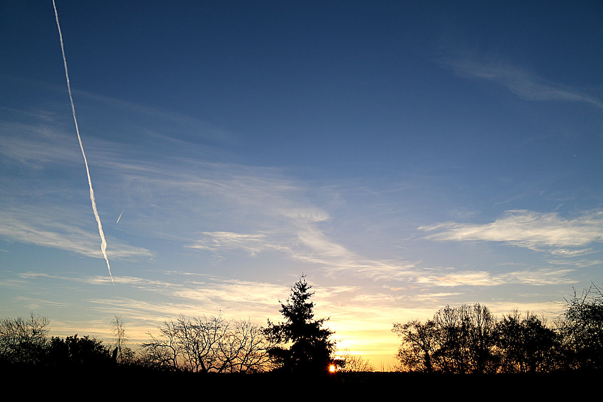
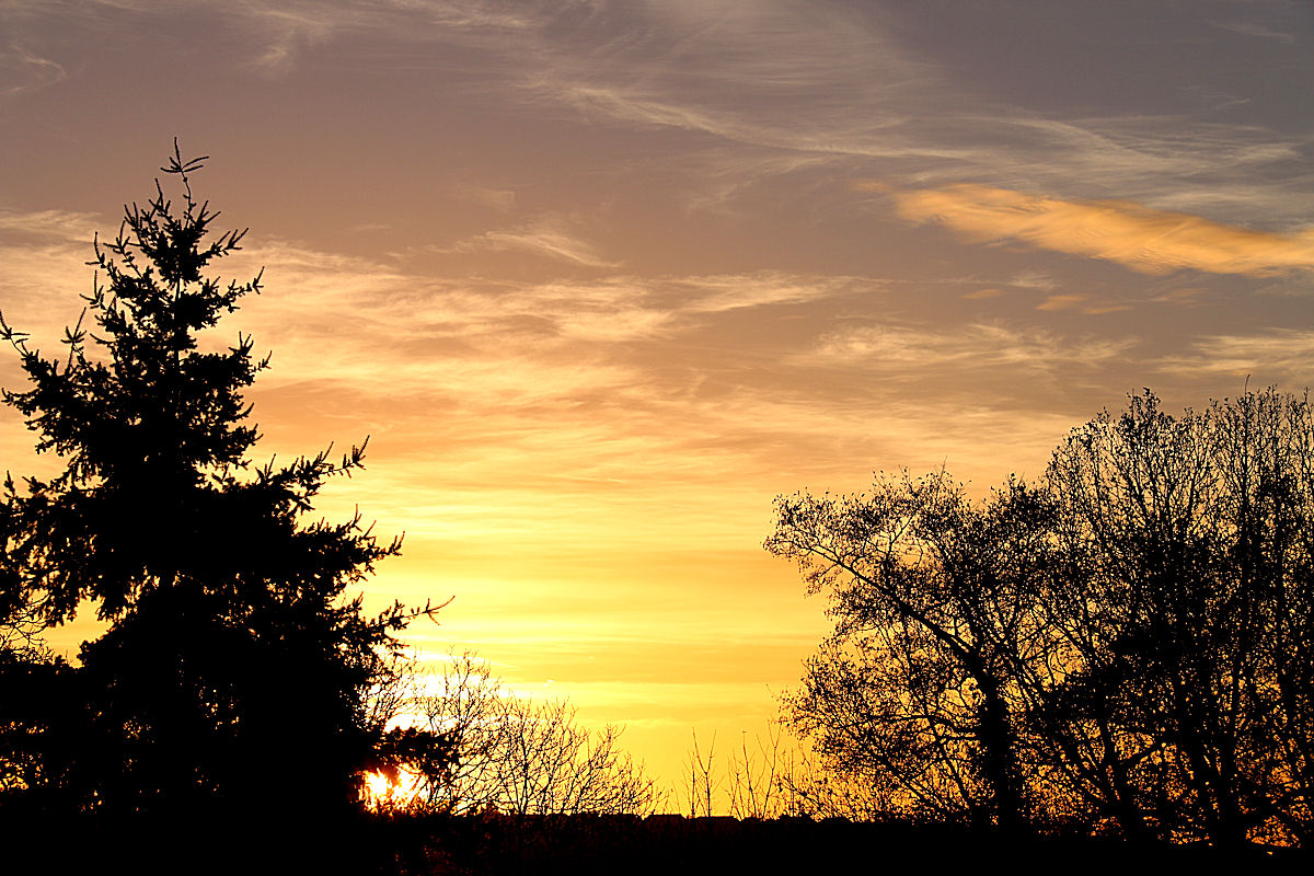
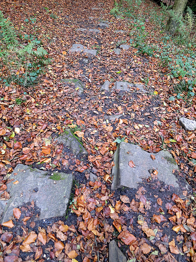
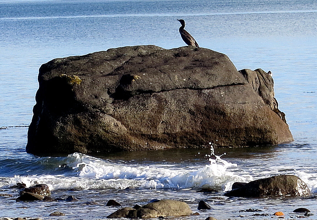
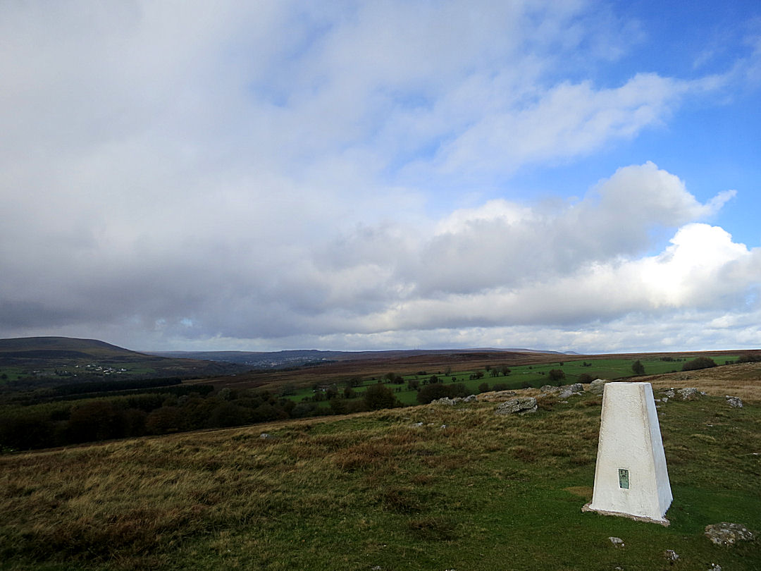
Again the start of the walk is up to the fabulous Viewpoint above Horio but instead of continuing along the well trodden kalderimi polished by centuries of passing feet and hooves I turn left immediately after the gate onto the open mountain and follow a much less used kalderimi zigzagging steeply upwards.  The path is clear enough, edged by stone retaining wall though in places the rough-paved surface is now broken up.  It’s very satisfying both to reflect that this is a routeway used for centuries and to glance backwards to take in the increasingly dramatic view over the harbour with its neo-classical architecture, Nimos Island and the mountainous coastline of Turkey and its gleaming white wind turbines revolving lazily in the shimmering heat.

But then the kalderimi is suddenly interrupted by a bulldozed dirt track going ……… nowhere!  It’s impossible to carry on along the line of the kalderimi because it is further interrupted by rubble pushed over the edge from The Tarmac Road.

Digression here while I vent some spleen.  These ancient routeways are as much part of Greek heritage as is the Parthenon, they are the legacy of the common people over centuries, yet on Symi they have been and still are routinely and thoughtlessly damaged.  European funding is secured for road building projects which then bulldoze through kalderimia with no attempt to secure continuing access to them.  During construction rubble is pushed over the edge onto the pathway below further preventing their use.

I guess my beef is that Symi is an attractive island with a rich history, with very strict regulations to protect the heritage of the neo-classical architecture, and yet offering no protection for ancient routeways which are needlessly damaged and destroyed.  It is common practice to protect old routeways during road construction on other islands, why not here on Symi?  No additional cost need be involved, just a bit of thought, a little planning.

But enough of griping, back to the otherwise very enjoyable walk.  A ten-minute trudge along the road and I’m back on the interrupted kalderimi leading to two small monasteries before joining a narrow path over very broken, rocky ground.

Soon after I start picking my way along this path I’m joined by the young dog which had barked at me from inside the fenced compound of one of the monasteries.  A hunting dog used for retrieving, it had probably been locked there by its master until it was next needed and, desperate for companionship, had leapt the fence having seen me pass. Unlike dogs on some islands, brutalised to provide snarling guard, it showed no aggression, just delight at having company as it raced around me over the rocks with enviable alacrity.  It would disappear bounding over rocks and scrub and then come back having picked up my scent again.  After half an hour or so it shot off down a valley just before the path went into an extensive cypress and pine woodland.  I guess that the smell from the pine needles carpeting the floor masked my scent because it didn’t reappear again.

The path continues through shady woodland, in some places masked by pine needles but you soon learn to look for the line where they are slightly more compacted and thankfully I didn’t take any false trails.

Coming to a dirt track, Stavros Polemou, my first goal, is straight ahead perched on top of a rocky crag rising above the trees.  There is an irony here.  The beginning of the next section of path is difficult to see, indicated only by very faded paint dots on a large rock, but within 100 metres of leaving the track there is more paint marking the route than I have seen on any path anywhere.  Several crosses and daubed lines a foot high in red and blue are in view at any point on the path as it winds between the rocks and trees to reach the base of the crag and then showing the best line up it.

Paint marks the route up the crag

Paint marks the route up the crag

I don’t know for a fact, but suspect that the use of crosses rather than simply dots to mark the path is significant.  ‘Stavros’ is not only a male name but also means ‘cross’ and indeed locals I have met up in the mountains refer to the monastery as ‘The Cross’.  The full name of the monastery, Σταυρός Πολέμου (Stavros Polemou) means ‘The Cross of War’ in recognition of a battle which once took place here probably with the Saracens. It’s certainly in an eminently defensive location.

The courtyard at the top of the monastery at the top of the mountain

The courtyard at the top of the monastery at the top of the mountain

13Symi23w1049

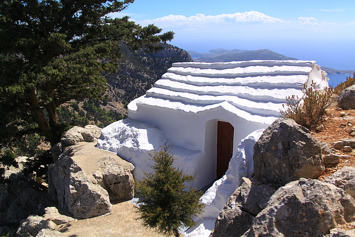
Small chapel at the entrance to the monastery

At a height of over 500 metres the views across the island are expansive if somewhat blurred by heat haze.  Most clearly visible to the Southeast is the Abbey of Magalos Sotiris also perched on top of crags and further away the very large Panormitis Monastery with trip boats the size of toys entering and leaving its sheltered natural anchorage.

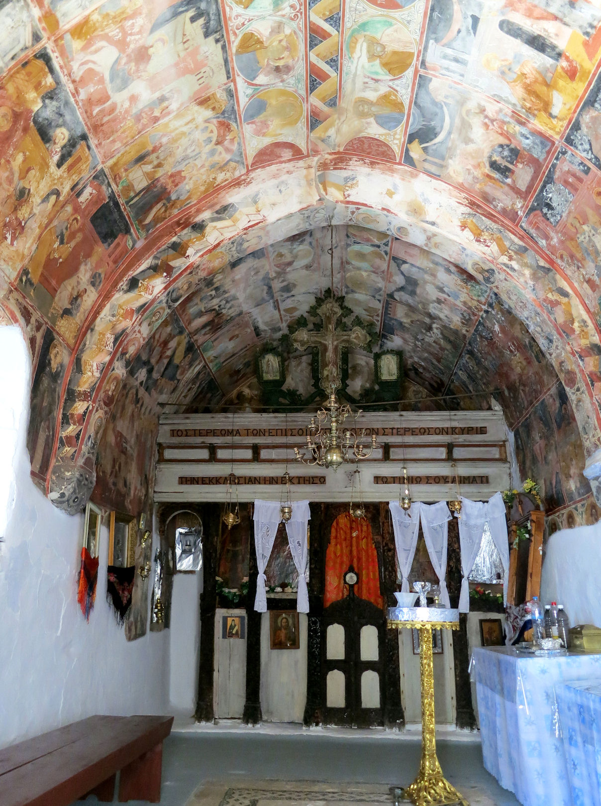
After taking in the view and eating my banana I head back down to the monastery of Panagia Panaidhi at the foot of the crag.  Behind 3-metre high walls the courtyard is very shady and always cool.  The church, built in 1728, has a very fine black-and-white pebbled Hochlakos mosaic floor and the walls and arched ceiling are covered in frescoes painted at that time and depicting stories from the Bible for the edification and instruction of a people those centuries ago who couldn’t read.

Looking back at Panaidhi monastery

Looking back at Panagia Panaidhi monastery

The fresco covered walls and ceilings inside the chapel

The fresco covered walls and ceilings inside the chapel

Part of the Hochlakos pebble-mosaic floor

Part of the Hochlakos pebble-mosaic floor

A cool courtyard

A cool courtyard

Over a rocky outcrop and through more woodland the footpath back to the tarmac road takes little time and then I head for the wine presses, passing first the Heroes War Memorial commemorating the execution of patriots and then the monastery of Agios Dimitrios and a polar bear.

Funky art

Funky art

The path to the wine presses begins opposite the Abbey of Megalos Sotiris and is a very pleasant, level walk along the ridge, broad and well maintained because it leads to the small monastery of Agios Michali Kourkouniotis beyond.

Tour guides stopping at the sponge shops on the harbourside mean that most people know that the island gained great wealth from sponge diving, having the equivalent of the accolade ‘By Appointment to the Ottoman Royal Court, suppliers of Sponges’.  It is also fairly well known that the island had a reputation for ship building at Harani, supplying some of the fastest vessels in the Mediterranean and, ironically, ships which helped secure Greek Independence from the Ottomans in 1821.  What is less well known is that the island also had a reputation for its fine white wines, exporting to neighbouring islands and to Turkey. There is reference to these wines as far back as 1420 but it is probable that the industry was thriving much earlier.  Altogether some 130 stone wine presses have been found and recorded on Symi, with 47 of them in the area between Megalos Sotiris and Kourkouniotis.

Built around large slabs of flat stone surrounded by others on edge mortared in place and topped by thick stone walls, their location was crucially dependant on geology but the fact that they were high on the ridge top meant that they were also free from pirate raids.  Grapes were loaded in and then trodden in traditional fashion, two or three people per press.  In the mid 19th Century viniculture declined substantially because pirate activity in the Aegean made the export trade unviable.  Now 11 of the presses have been restored by researcher/author Kritikos Sarantis1 and make an interesting visit.  I wondered where all the grapes came from to fill them.

Looking across the Byzantine Stone Wine Presses to mountain perch of Stavros Polemou

Looking across the Byzantine Stone Wine Presses to mountain perch of Stavros Polemou

Close-up of one of the restored wine presses

Close-up of one of the restored wine presses

It is now early afternoon and time to head back to Horio, another couple of hours away at a good pace.  It is possible to catch the island bus to and from the Abbey back on the tarmac road but the alternative route back has some pleasures not to be missed and with fitness level honed by 6 weeks of walking in the islands I’m still humming with energy.  Perhaps as well because I make two diversions en route.

The first is at the Abbey, after only a few minutes of the trek back completed.  Looking like a fortification and normally locked, the padlock on the gate to the compound is today hanging open.  Intending simply to go across the compound to photograph the view from its perch on the edge of the crags, I find that the huge iron-studded oak door into the inner courtyard is also open, so I go in.

The iron-studded oak door to the inner courtyard stands open, key in the lock

The iron-studded oak door to the inner courtyard stands open, key in the lock

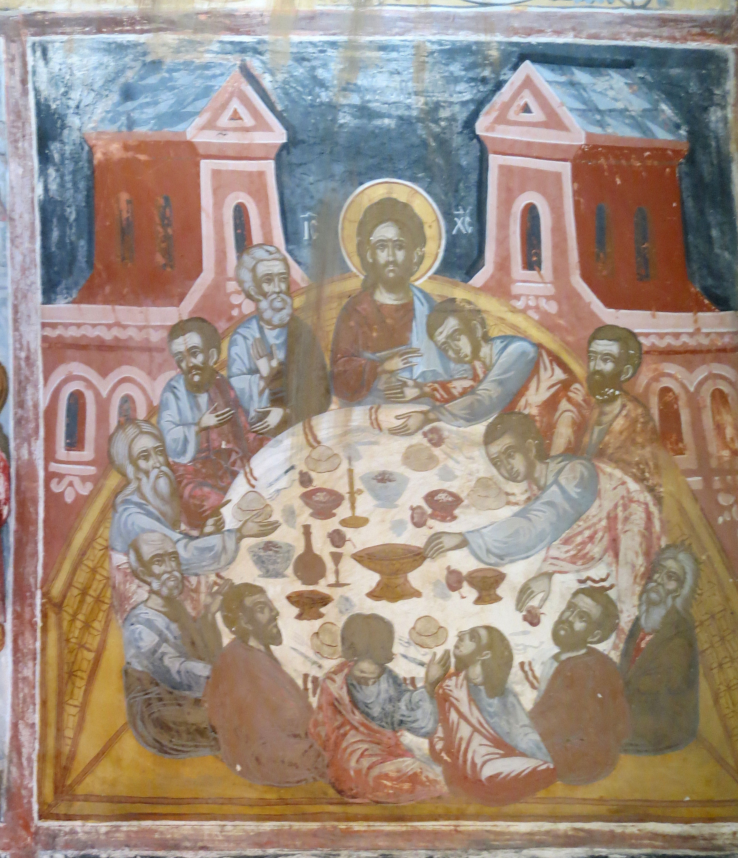
The guy doing maintenance and odd jobs nods in welcome and lets me wander around at will.  Quiet, peaceful, cool, inside the walls embodied the Greek concept of «ησυχία».  The chapel was significantly bigger than any of the others I have seen in the mountains and again walls and arched ceiling were covered in frescoes which, even though painted in 1827, were more vibrant and better preserved than any others I have seen.   I could have stayed much longer but I had a lot of ground to cover and the guy was making a move to lock up and leave.

The arched courtyard at the side of the chapel

The arched courtyard at the side of the chapel

The Last Supper, one of the many very well preserved frescoes

The Last Supper, one of the many very well preserved frescoes

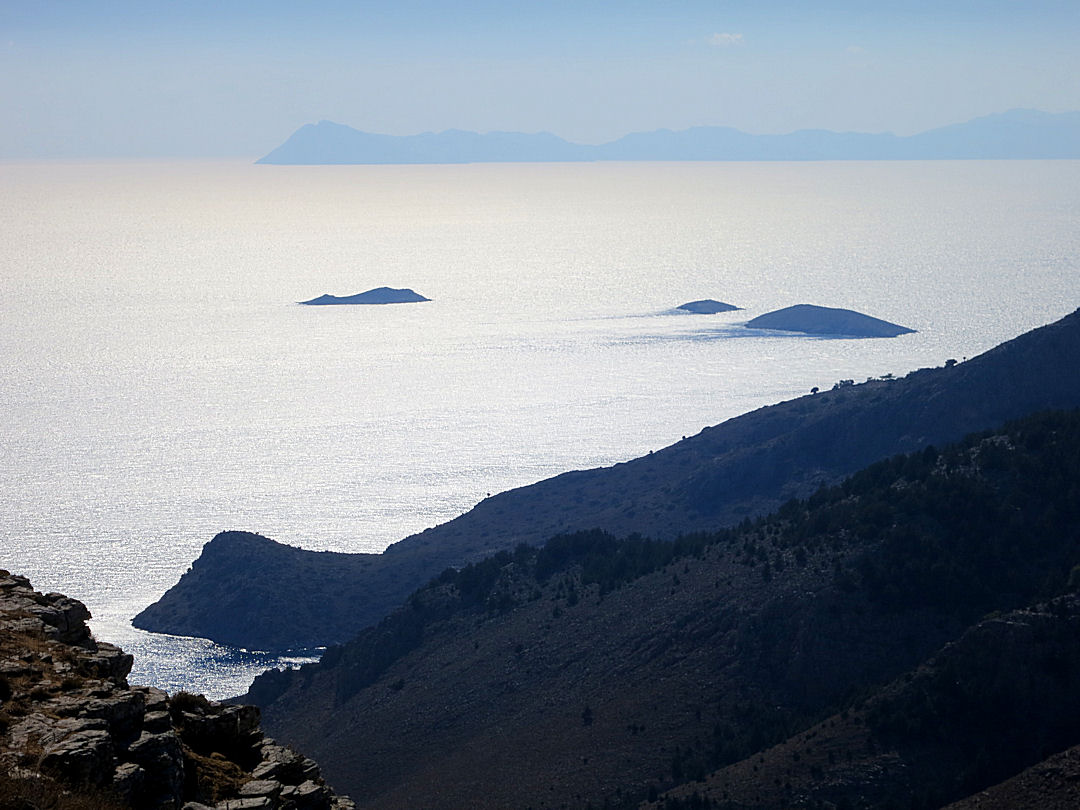
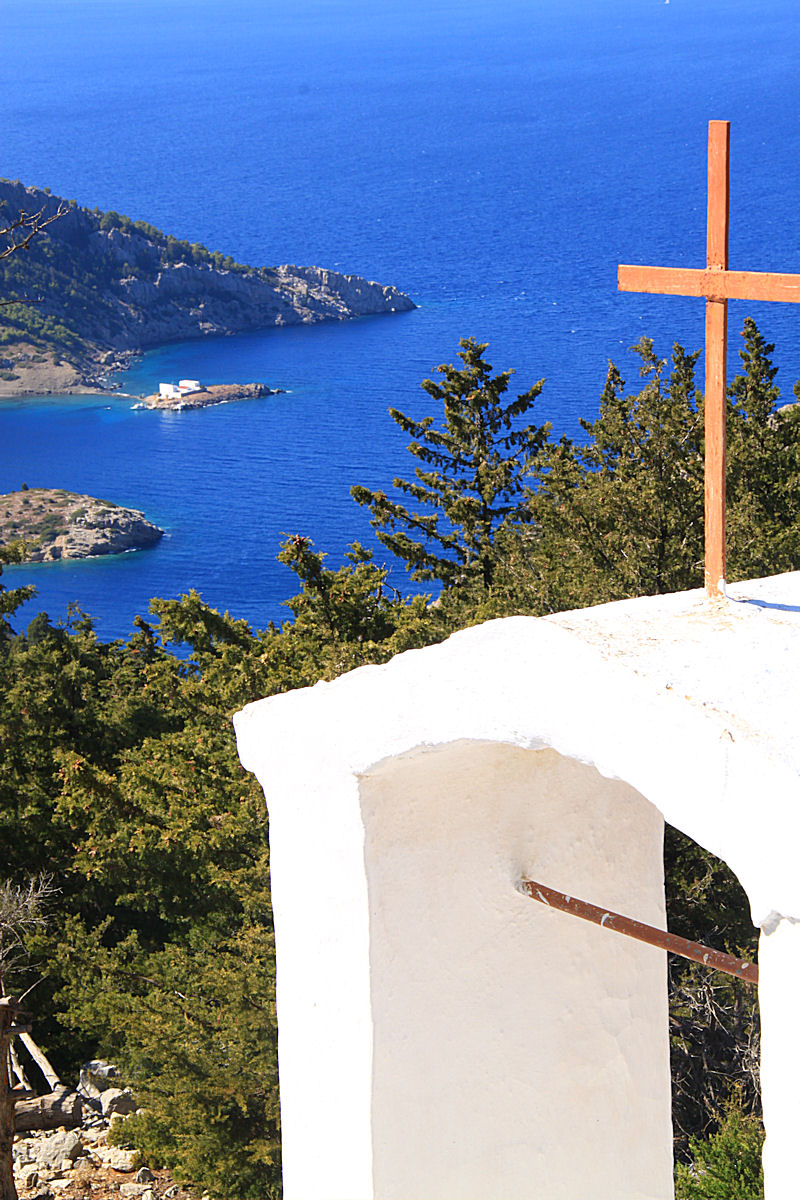
The first thing I do on leaving the Abbey is to climb up the rocky bank at the side of the road on yet another diversion. A few paces and I’m on the edge of a cliff looking down 500 metres to the bays and small islands spread out below with Tilos and Nisyros grey silhouettes on the broad horizon.  Half an hour of clambering on the towering crags and I very reluctantly decide I can’t encompass the whole view in one photo and should really be on my way.  To be honest, the photography was just a pretext for spending time on the edge, picking out possible ways down and ways up, letting the place soak into my brain.  I resolve that next year I will come back specifically to explore further.

Just part of the expansive view from the edge of the cliff at the side of the Abbey

Just part of the expansive view from the edge of the cliff at the side of the Abbey, Stavros Polemou on its perch on the right

Zooming in on Stavros Polemou

Zooming in on Stavros Polemou

Tilos in silhouette on the horizon

Tilos in silhouette on the horizon

The alternative route back necessitates trudging along 3 short sections of tarmac between footpaths but is well worthwhile for the views and the surroundings.  Perhaps most impressive is the long curve of stone-embanked kalderimi, an inside curve on the tarmac road above, with the top of Vigla, the island’s highest mountain, straight ahead.

The long curve of the stone-embanked kalderimi, the wind turbine on top of Vigla on the right

The long curve of the stone-embanked kalderimi, the wind turbine on top of Vigla on the right

I resist the urge to go off-piste yet again and look for a way to the top and instead head back to sit in the kafenion, sip a cold beer, and wallow in the satisfaction of a good walk topped by new experiences.

NOTE: If you want to do the walk the following Walking Guides may be useful.  Preparation of the second of the two is still in progress and so it is incomplete but takes you as far as Stavros Polemou.
Symi walk 1- Viewpoint
Symi walk 4 Ag Stavros Polemou

1.  ‘The stone wine presses of Symi’, a slim book only available on the island but there is a summary of it on the Symi Dream website.

Posted in Art, Greece, Hiking, History, Landscape, Mountains | Tagged , , , , , , , , , , , , , , , , | 1 Comment

Symi: the island experience

I sometimes wonder whether islands which are connected to the ‘mainland’ are truly still islands.  It’s complicated. 

When we went to the Isle of Skye BTB (Before The Bridge) it had an intrinsic separateness even though there was only a narrow channel between it and the mainland.  We crossed on the tiny ferry from Glenelg reached by narrow, one-track road. En route we were stopped by a survey team asking opinions about the proposal to build a bridge across the Kyle of Localsh.  I was emphatic “No!  It will change the place irrevocably”.  Quite irrational, I know, but the bridge has devalued Skye for me. I struggle to think of Anglesey as an island rather than part of ‘mainland’ Wales, connected by the Telford Bridge nearly two centuries ago and soon after by Stephenson’s Britannia Bridge.

It seems I’m not alone in this view.  The Rough Guide to Greece says that Evvia, the second largest of the Greek islands after Crete “often feels more like an extension of the mainland than an entity in its own right”.

There is a slightly different perception if an island is connected by a causeway, especially if it is tidal.  There are 43 tidal islands around Britain, ones which can be reached by foot but only at low water.  Two of the most well known of those are St Michael’s Mount in Cornwall and Lindisfarne in Northumberland.  Because these are accessible on foot for only a short time each day the causeway does not degrade the ‘island experience’ in the same way as a permanent bridge link.  They are ‘true’ islands.

Towards the end of my stay on Symi in September I walked to the island monastery of Agios Emilianos ………. linked to the ‘mainland’ of Symi by a causeway but as the tidal range in the Aegean is only 6 inches it is a permanent link so does not feel like a true island.  Or so I thought.

For the most part the path to Agios Emiliansos is clearly defined and easy to follow.  Like the route to Agios Vasilios the first section is the walk up to the dramatic Viewpoint above Horio and then on past Agia Paraskevi to the tarmac road.  A short trudge along a concrete road and dirt track soon comes to the ridge at 350 metres just below the beautifully well kept monastery complex of Panagia Mirtidhiotissa, The Virgin of the Myrtles. The inside of the small church is particularly impressive, covered in well-preserved frescoes.

From here the path, not shown on the SKAÏ map, picks its way across mountainside covered in grey/white limestone rock before reaching a broad, flat field in a col with a sea of tall, stately gleaming white squill.  Several times we have spotted tortoises here and dubbed it ‘Tortoise Square’.

Part of the boulderfield which the path picks a way through

Part of the boulderfield which the path picks a way through

A sea of squill in Tortoise Square in the col

A sea of squill in Tortoise Square in the col

Changing direction, the path, increasingly clear and level, comes into extensive cypress woodland and for a time takes on the nature of a well kept park.   In the height of summer the air is redolent with the scent of the trees, sap heating up under the intense glare.  When we first walked through these woods in 2000 there were charred remains of fire a few years previously, whether from spontaneous combustion as the sap just reached critical level in temperatures up to 50oC or from a discarded cigarette end or glass bottle I don’t know.  The scent is very pleasant in September temperatures around 30oC but there is still that niggling thought at the back of the mind.

The path reaches the monastery of Agios Ioannis Theologos, St John the Theologian, and an opportunity to sit in the shady courtyard.  The Greek tradition of ‘philoxenia’, friendship to strangers, is often demonstrated in these monasteries by provision of a tin can on a string for drawing water from the sterna (underground water tank) and in some cases provision of coffee-making facilities – gas stove, matches, ‘briki’, (small saucepan for boiling the water), cups, coffee, sugar – but almost without exception the toilets are locked.  I guess they don’t mind sharing what they have, but they don’t want you to leave anything in return.  Still, in the woods that isn’t a problem for us blokes.

The entrance to the monastery of Agios Ioannis Theologos

The entrance to the monastery of Agios Ioannis Theologos

It seems that the saint in question is also known as Metastasi Ioannos Evangelistos1 whose Name Day is 26 September when the monastery is bedecked with flags and bunting, and tables are laid out with food and drink for the celebrations. When I passed on 27 September the clearing up operations were in progress.

From the monastery, with the first glimpse of Agios Emilianos, 300 metres below and 2 kilometres distant across Skoumisa Bay, the path drops down gradually through the trees.  In places it is clearly defined but occasionally distinguishable only by rocks polished or discoloured by the passage of feet and hooves.  It’s still used by donkeys as an alternative to small boats to transport goods to the scattered settlements, evidenced occasionally by hoofprints in the dust.

View from the monastery across Skoumisa Bay to Agios Emilianos

View from the monastery across Skoumisa Bay to Agios Emilianos

Coming out of the cypress wood overlooking the shore the path continues to drop gradually with enticing views of blue in sheltered Skoumisa Bay, normally calmer than the open sea but this time rougher than usual.  One smallholding on a small beach is about as idyllic a place as you could wish for, as long as you forego all the usual amenities.

A great place for piece and quiet.

A great place for piece and quiet.

Finally the path drops down the final metres to sea level and a tiny quay used by the local farmer/fisherman.  This trip there were larger boats pulled up on the beach undergoing repair as well as the fishing boat bobbing at the end of a mooring rope.  On a previous visit local lads came down to catch octopus, a donkey complete with wooden-framed panniers waiting patiently alongside. What a great lifestyle!!!  By contrast, two years ago there were large trip boats from Turkey tied up to rocks on the beach with trippers swimming to the shore in defiance of international maritime law and contrary to immigration controls, destroying the tranquillity of the bay.

Dropping down to the fishing quay and the 'dry dock'

Dropping down to the fishing quay and the ‘dry dock’

13Symi28w1063

Looking across the bay to the island monastery, the sea a little choppier than usual

One of the large Turkish boats moored to the shore

One of the large Turkish boats moored to the shore

The path skirts the bay to reach the monastery causeway and this year something of a surprise.  During the winter storms the causeway had been badly damaged, the concrete slab over the rocks broken up making it necessary to hop across gaps washed by the sea, somewhat choppier than usual.

The causeway breaking up, guarded by hungry goats

The causeway breaking up, guarded by hungry goats

The monastery is rented out to tourists in the summer who come and go by sea, a small boat with outboard motor for ferrying across the bay to visit neighbours, a larger one for going to the shops in the town on the other side of the island.  This year the causeway is still passable, with slightly wet feet.  Another winter of severe storms and the causeway may well get broken up completely.  Unless it is repaired, the island will then offer a true island experience once again.

1  The only definition I can find for ‘metastasi’ or μετάσταση is to refer to the process of cancer cells being transferred from one part of the body to another.  My guess is that it also an old Greek term to refer to St John the (itinerant) Evangelist.

If you fancy doing the walk yourself you might find these Walking guides useful:
Symi walk 1- Viewpoint
Symi walk 3 Ag Emilianos

and try this:

click to get Google Earth Fly to click to fly to the Greek island of Symi and view the route of the walks with Google Earth
Posted in Greece, Hiking, Landscape, Mountains | Tagged , , , , , , , , , , , , , , , | 1 Comment