
Before I turn my attention to Greece, for those who may be interested in following them, below is a summary of some of the walks I did during my recent visit to Banff. They were tracked using the ‘Endomondo’ app on my phone against a Google Earth background. The satellite imagery was taken in the summer months but when I was there it was covered in ice and snow and so uniformly white.
The timings are in no way targets to aim for. They are how long I actually took, mostly from the town centre hotel I stayed in and back to Starbuck’s for a caffeine fix, and so allow for plenty of photo stops. The internet links are to the descriptions and photos on Barry’s Ramblings for that particular trail.
I did other walks which were sections or composites of these six routes.
A very useful map is the 1:35,000 ‘Banff Up-Close’ by Gem Trek Publishing:
http://www.gemtrek.com/banffupclose.html
available on-line or in Banff bookshops and the Parks Canada Office.
Click on the images for a larger view of the track
Cave and Basin and the Marsh Loop
An easy, fairly level walk on broad trails including the Strange World of Ice and Steam and the board walks around the Cave and Basin complex and over the marsh.
4.75 miles, 2 hours

Track for the Cave and Basin and Marsh Loop Trails
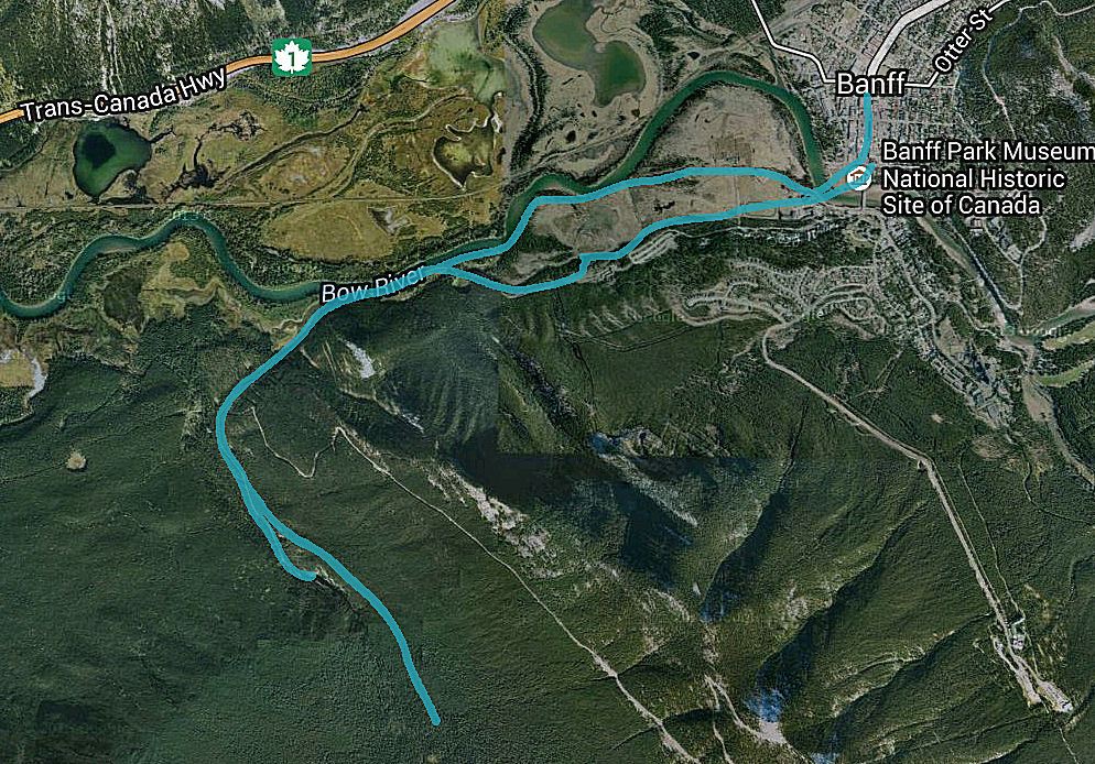
Spray River
An easy walk down to the Bow Falls, ignoring the ‘Trail Closed’ signs at the steps up the side of the crag overlooking the falls or as an alternative diverting away from the river to circumvent them. Then a choice of trails alongside the Spray before climbing up to the higher level Spray Loop for the return. Cleats and trekking poles may be useful especially over the ‘closed’ section of trail.
5.2 miles, 2 hours 30
https://barryh2.wordpress.com/2014/02/09/canadian-rockies-icy-river-twitching-senses/
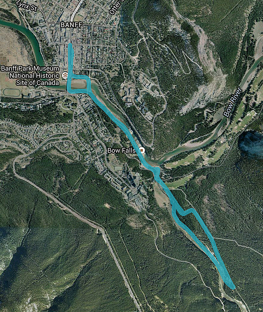
Route on Old Quarry and Spray River Trails
Sulphur Mountain
Down to the Bow Falls again and then a path rising up through the pine forest to reach the Upper Hot Springs and the Gondola. A very good board walk at the summit. Cleats and trekking poles may be useful.
9.2 miles including just over a mile on the gondola, 4 hours 30
https://barryh2.wordpress.com/2014/02/18/canadian-rockies-to-the-top-of-sulphur-mountain/

Trail to the Sulphur Mountain Gondola and on the summit
Sundance Canyon
A broad trail to the canyon then a narrow trail climbing up to Sundance Pass and another climbing more steeply up the side of a frozen waterfall at the head of the canyon. Cleats and trekking poles may be useful.
10.6 miles, 5 hours 30
https://barryh2.wordpress.com/2014/02/21/canadian-rockies-flashback-in-sundance-canyon/
Trail to Sundance Canyon and Sundance Pass
Tunnel Mountain
A great walk straight out of the town, a clear path steeply zigzagging up the mountain from Tunnel Mountain Drive. Well used trail but cleats and trekking poles may be useful.
4 miles, 2 hours 30
https://barryh2.wordpress.com/2014/01/20/canadian-rockies-to-the-top-of-tunnel-mountain/
On Trip Adviser:

Tunnel Mountain Trail
Vermilion Lakes
A very easy level walk with expansive views.
7.8 miles, 3 hours 45
https://barryh2.wordpress.com/2014/02/04/canadian-rockies-the-icy-expanse-of-vermilion-lakes/

Trail to Vermilion Lakes
x

Thanks Barry, these will come in handy when we go there….one day….????
In the meantime – Greece! Renting on Symi sounds fab. I doubt we’ll get back out there this year and anyway, I wilt in the proper Greek heat. But thanks for the offer anyway, you never know? How are the winters there????????
Will keep in touch with your travels via your blog. I was trying to keep my blog focused on ‘Slow Flintshire’ an idea I had about doing local things and encouraging people to explore what’s on offer on their doorstep (maybe with a guide book to follow). But I don’t thing anyone reads it anyway so I might expand it to Greek travels, or perhaps I could open another ‘page’ within the blog? Not sure how I get more readers?
Stay safe on your travels Barry,
Sarah x
Thanks Sarah. I don’t know what winters are like in the islands, the earliest I have been is mid-March to Hydra and the latest I have been is mid-October on Symi. I dare say that I may well find out.