
Apropos nothing in particular, but just a piece of trivia, geographical nomenclature, which weevilled its way into my brain, I don’t know why it is that in the UK the convention for naming rivers is to call them “River Something” – River Wye, River Severn, River Thames ….. etc. In this bit of the Canadian Rockies, and indeed in the rest of Canada, the convention is “Something River” – Bow River, Spray River.
By coincidence, the last of which I decided to follow upstream on another of my days-off skiing. Apparently the water which once flowed out of Sundance Canyon (more of which another time) was diverted by glacial action and now flows in the 64 kilometres-long Spray River, joining the Bow River at the right angle bend just below Bow Falls.
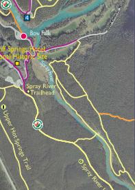
Part of Trails Map showing the Spray and Bow Rivers
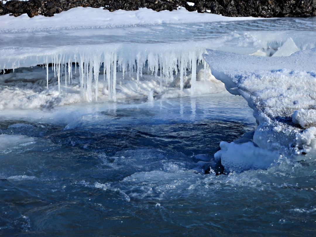
Much of the area at the confluence is snow-covered ice but after the unusually high temperatures when I first arrived the ice over the deepest and fastest flowing part of the river has broke up and is only now beginning to refreeze, about a foot or more below the original 9-12 inches of early-winter ice. Continuing upstream the meandering channel has substantial slabs of ice wedged against the sides, refreezing jaggedly in place.

Thick ice forms over the rocks on the rapids
Water level drops as the ice sheet breaks up
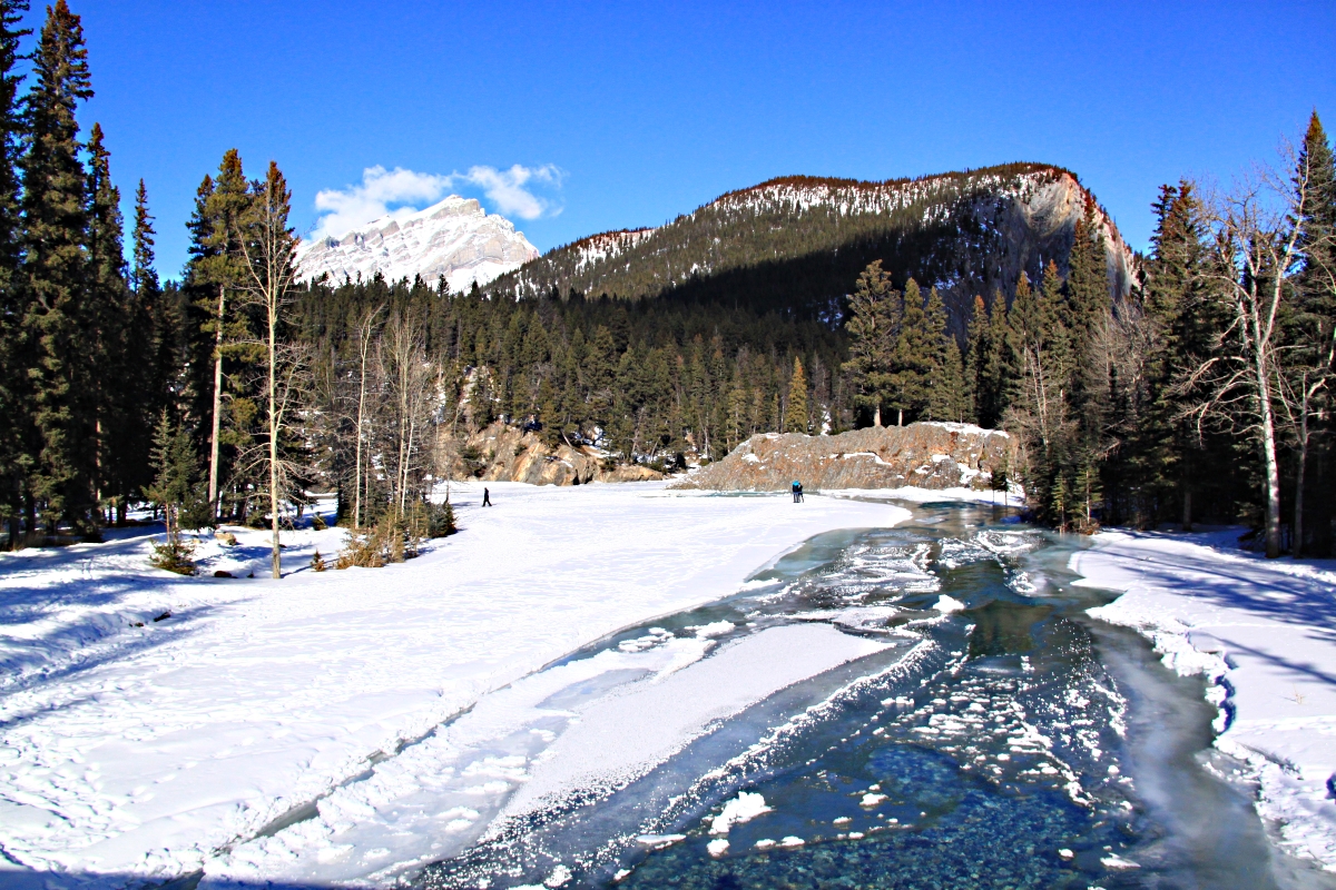
Looking down the Spray towards its confluence with the Bow, Tunnel Mountain behind

Jaggedbroken-up ice refreezes into the edge of the river
First I follow the ‘Old Quarry loop’ but when that crosses a wooden footbridge to return to Bow Falls on the other side of the river, deep in shade from Sulphur Mountain, I continue on a much narrower path along the bank with flat rocky slabs towering above and then strike upwards towards the ‘Spray River Loop’.
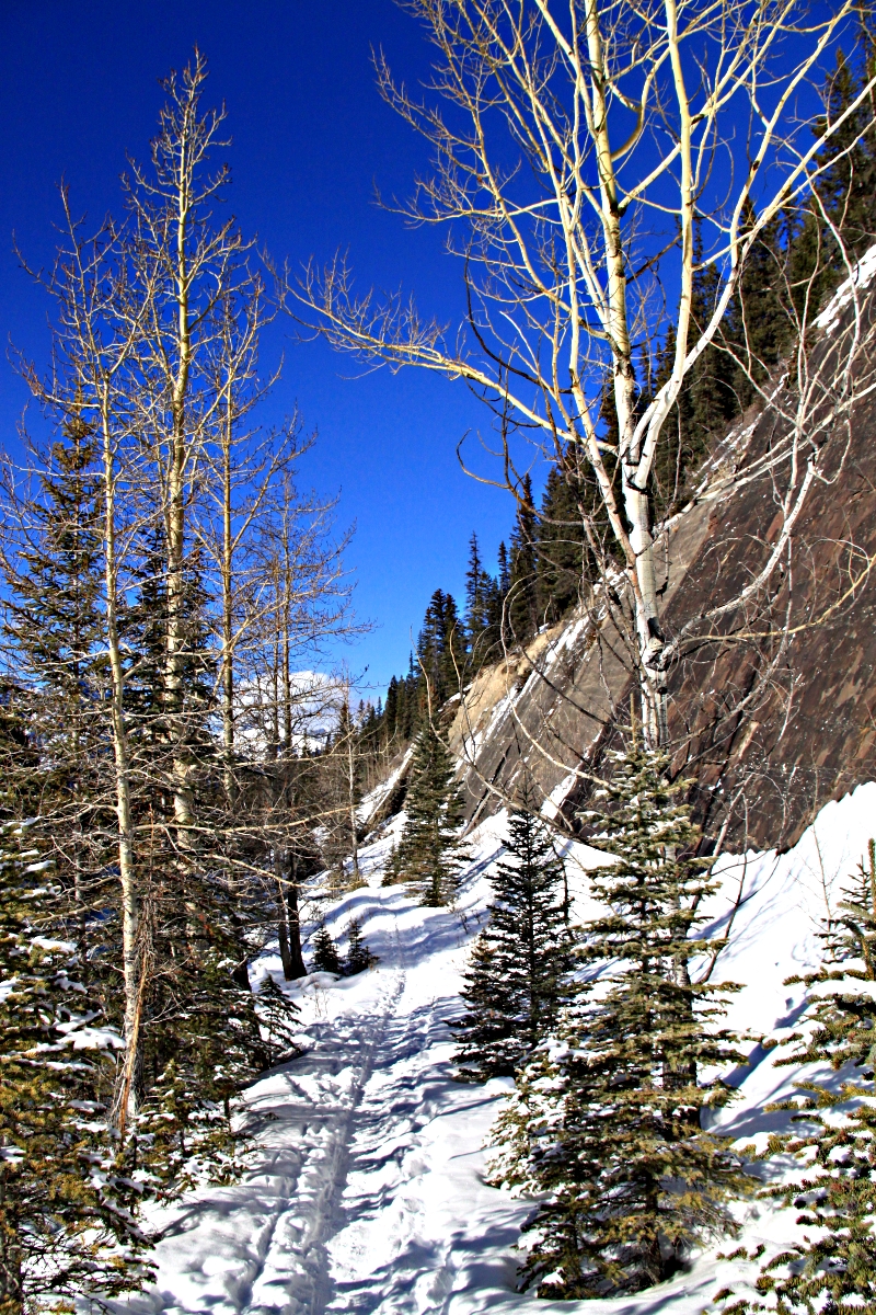
Looking downstream on the narrow river-side path

Path continues

Starting to climb obliquely up to the top of the cliffs
I head back to the falls at a higher level at the top of the cliffs through the forest, lodgepole pines straining straight upwards, each tree desperate to get its canopy into the sunlight.

View from the top of the cliffs
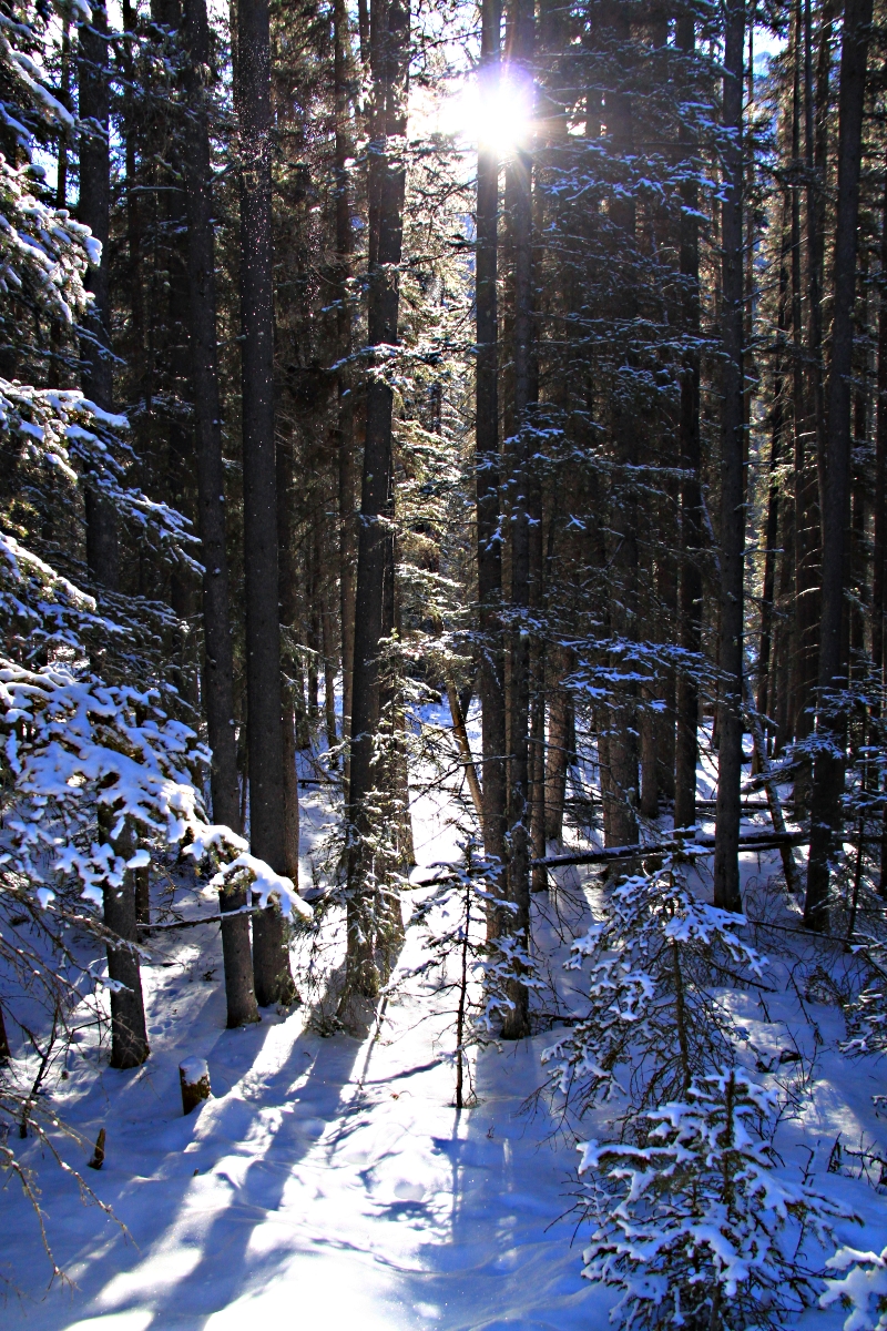
Tall, straight trees filtering the sun
It’s completely silent up there, sound muffled by snow, only a rhythmic squeaking between boot and snow. Alert I strain to listen for any sound. Occasionally, very occasionally, carnivorous predators, coyotes and cougar at this time of year, cause a problem for lone wanderers. I even flare my nostrils to catch any unaccustomed smells. I doubt I would hear or smell anything in the highly improbable event that I were being stalked but I can’t help but make the effort. I take comfort from the fact that there are no deer prints so it is unlikely that predators would be roaming around just on the off-chance of coming across the odd Welsh guy.
Then I hear a faint rustling as something falls through the trees and patters to the ground, Then another. I suspect a squirrel, locate the tree which the sound is coming from, see small pieces of bark fluttering down to join a collection around the base. I squint upwards against the sun and high above spot a woodpecker picking off bits of bark to find insects underneath. My guess is that it’s a Three Toed Woodpecker, but I’ve been wrong before.
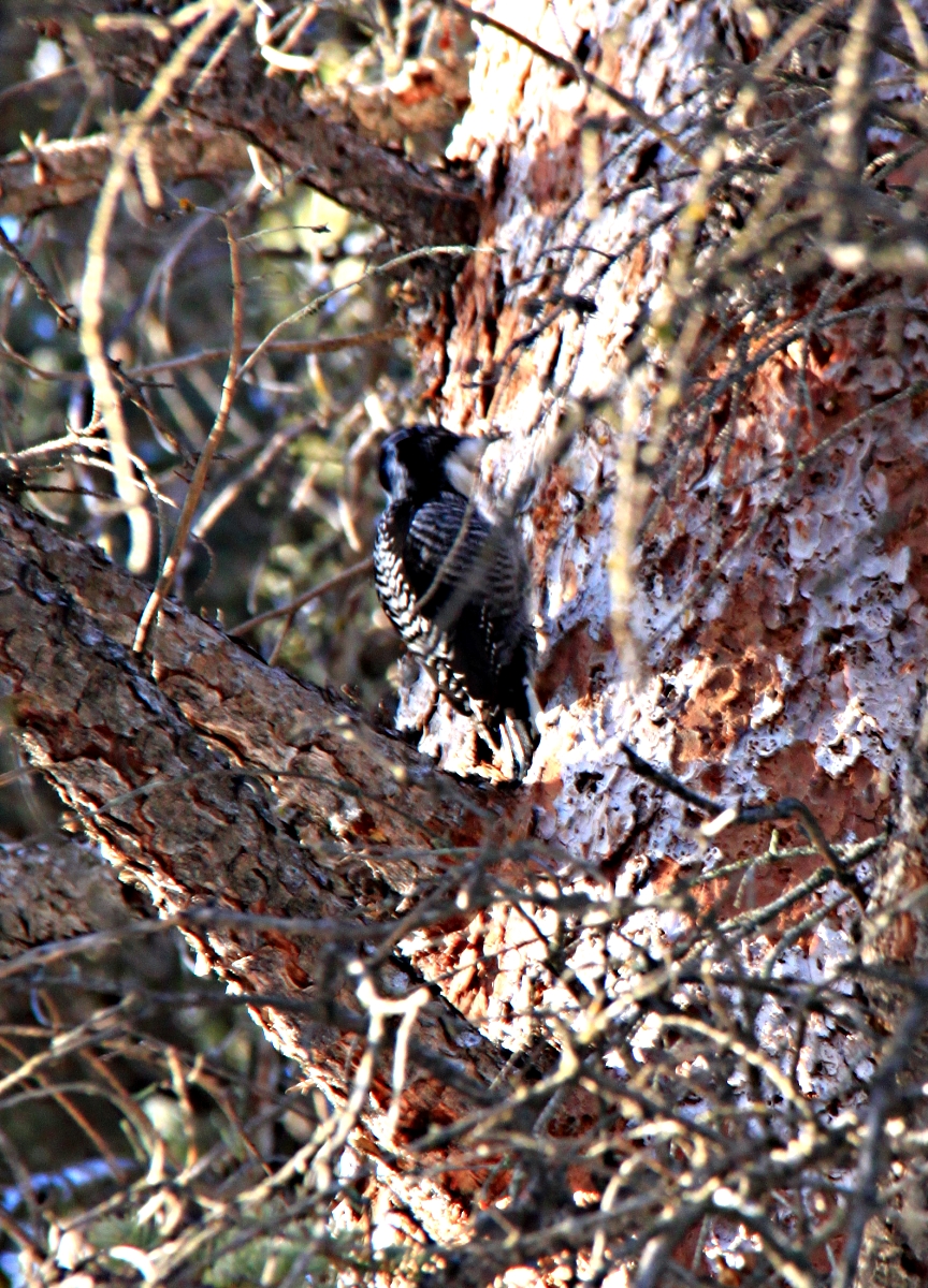
Woodpecker some 30 feet up the tree pecking off the bark

Turning slightly the red patch on its head is just visible as it climbs higher
Only a 2½ hour trek, 5 heavy miles in the snow, but very enjoyable in the afternoon sun.

SUCH A JOY TO SEE THE PHOTO’S and share in your joys and the beauty of creation there thank you so much. Cougers? cyotes? preditors? do be careful and return to base safely. I expect you’ve heard from family here in Pontypool about the weather in Somerset levels [It’s a tradegy. i awoke this morning and a word of scripture was in my mind ‘ The waters abated’ Ido pray for that for them. We have been so fortunate here in Cwmbran ‘only a fence blown down’ Our neighbour built it and used untreated wood, [you pays for short cuts in the end] Acompany is going to build a half concrete one and half timber and has quoted �100 per panel we need 6 panels. Can you send over some of those Canadian pine trees. Pad is making cottage pie with a healthy brown crust. I’ve been helping to hoover the house. We can’t wait for the weather to break so we too can go up to Garnwen. Every blessing in Him. Richard. x
Date: Sun, 9 Feb 2014 06:24:32 +0000 To: the-evanses@hotmail.com
Pingback: Canadian Rockies: Winter trails around Banff. | Barry's Ramblings